

Augsburger Jakobsweg (Memmingen)
120.4 kilometres on the western route of the Augsburger Jakobsweg: from Augsburg past the Fugger castle Wellenburg to Oberschönenfeld Abbey, through the Stauden to the pilgrimage shrine of Maria Vesperbild, to the Fugger castles of Kirchheim and Babenhausen, into the imperial city of the Twelve Articles and via Kronburg to Bad Grönenbach. Six easy stages through Mittelschwaben and the Unterallgäu, where bankers' castles and peasants' demands lie just two days' walk apart.
- 01At a glance
- 02Overview
- 03Other names
- 04Who it's ideal for – and who it isn't
- 05Route & landscape
- 06Stages, terrain & difficulty
- 07Three Fugger castles – and one of them wanted to be the Escorial
- 08Where St James hides on this route
- 09Highlights along the way
- 10How pilgrims get onto this route
- 11Keep walking?
- 12Preparation & practicalities
- 13What the route will cost you
- 14Getting there
At a glance
- Start / Finish: Augsburg, Rathausplatz / Bad Grönenbach (our map currently ends about 1.8 km south-west of the village centre)
- Length: 120.4 km
- Stages: 6 (Camino Ninja division)
- Duration: 6 days
- Elevation gain/loss: ↗ 1,315 m / ↘ 1,125 m
- Highest point: 695 m at Schloss Kronburg (km 114.3); lowest point 479 m in Augsburg
- Character: western route of the Bayerisch-Schwäbischer Jakobsweg between Augsburg and Bad Grönenbach
- Regions: Augsburg, Naturpark Augsburg – Westliche Wälder, Mittelschwaben, Unterallgäu
- Waymarking: yellow scallop shell on a white background, in the Unterallgäu in places the yellow shell symbol on blue
- Connections: in Augsburg and Bad Grönenbach to the eastern route of the Augsburger Jakobsweg
Overview
In Augsburg the Bayerisch-Schwäbischer Jakobsweg splits. The eastern route heads south via Bad Wörishofen and Ottobeuren; this western route takes the wider arc: 120.4 kilometres from the Rathausplatz past the Fugger castle Wellenburg to Oberschönenfeld Abbey, through the forests of the Stauden to the pilgrimage shrine of Maria Vesperbild, to the Fugger castles in Kirchheim and Babenhausen, into the old imperial city of Memmingen and via Schloss Kronburg to Bad Grönenbach, where the two routes meet again. In between lies Swabian hill country without a single metre above 695, six days, and no day with more than 250 metres of ascent.
What carries this route are two sides of the same era. At the front, the Fuggers, the Augsburg merchant house that financed the election of Charles V as emperor in 1519 and whose castles you pass on three of the six days. At the back, Memmingen, where in March 1525 the peasants adopted their Twelve Articles. Rarely do money and rebellion lie so close together along a pilgrim route. To be honest, though, the western route is also a good dozen kilometres longer than the eastern one and has not a single pilgrim hostel beyond Augsburg.
Other names
Officially this route is the western route of the Bayerisch-Schwäbischer Jakobsweg; Wikipedia calls the whole route Bayerisch-Schwäbischer Jakobusweg, the tourism board Bayerisch-Schwaben promotes it with the subtitle "zu drei Fuggerschlössern" (to three Fugger castles), and in the Unterallgäu the section from Kirchheim onwards is simply called Jakobsweg West. With us it is the Augsburger Jakobsweg (Memmingen), to match the main page of the Augsburger Jakobsweg, which follows the eastern route. The stated lengths vary: the association and tourism portals give 128 to 140 kilometres depending on the starting point (Wellenburg, Göggingen); our 120.4 kilometres come from the track on the Camino Ninja map.
Who it's ideal for – and who it isn't
The western route is ideal if you already have a few pilgrim days behind you and are now looking for a quiet route that offers you more churches, monasteries and castles than summits along the way: a Cistercian convent from 1211, a pilgrimage shrine with a grotto and votive tablets, two Fugger castles to admire, an imperial city with its wall intact. Ideal, too, for pilgrims who want to walk the Augsburger Jakobsweg a second time and already know the eastern route. The stages stay between 17.6 and 25.0 kilometres; you won't need mountain fitness.
To be honest, though, it's not for you if you expect a pilgrim bed at a donation price in the evening: after Augsburg you'll sleep six nights in inns, guesthouses or a monastery's guest house, and some stage towns have only a handful of rooms. Not for you either if you like to hop on a train on a whim — Fischach, Maria Vesperbild, Kirchheim and Babenhausen lost their passenger trains in the 1960s, and between Augsburg and Memmingen the bus is usually your only help. And if you only have a few days, the shorter eastern route gets you to Bad Grönenbach faster.
Route & landscape
You share the first six-odd kilometres with the eastern route, then turn west on the southern edge of Augsburg, past the Fugger castle Wellenburg into the forests of the Naturpark Augsburg – Westliche Wälder and down to Oberschönenfeld Abbey (km 17.8). Via Weiherhof, Fischach and Wollmetshofen with its church of St James you walk through the Stauden — stream valleys, spruce slopes, small villages — to the pilgrimage shrine of Maria Vesperbild (km 35.4). Just beyond lies Schloss Seyfriedsberg, today home to a monastery of the Russian Orthodox Church; via Memmenhausen, Haselbach, Aspach and Spöck you reach Kirchheim in Schwaben (km 53.5).
From Kirchheim the country becomes wider and more open: via Hasberg and Loppenhausen to Kirchhaslach with its pilgrimage church (km 71.9) and on to Babenhausen (km 76.9), then via Winterrieden, Boos, Niederrieden and Eisenburg through the Unterallgäu to Memmingen (km 101.9), the only town along the way. On the final stage the terrain rises noticeably: via Fuchsloch up to Kronburg, where the castle stands on the highest point of the route (695 m, km 114.3), and via Oberbinnwang across to Bad Grönenbach. Overall you walk gently uphill from 479 metres in Augsburg into the Alpine foreland.
Stages, terrain & difficulty
We divide the 120.4 kilometres into six stages that end in places with accommodation. The kilometres come from the Camino Ninja map, calibrated exactly to 120.4 km; we calculated the ascents from the map's elevation points. The association and the tourism board divide the route into seven sections with a stop in Niederrieden — if you prefer that, split stage 5 at Niederrieden (km 89.5) into 12.6 and 12.4 kilometres.
- Augsburg → Oberschönenfeld (17.8 km) — ↗ 164 m; leaving the city with the eastern route, Fugger castle Wellenburg, Westliche Wälder, Cistercian abbey.
- Oberschönenfeld → Maria Vesperbild (17.6 km) — ↗ 221 m; Fischach, church of St James in Wollmetshofen, pilgrimage church and grotto.
- Maria Vesperbild → Kirchheim in Schwaben (18.1 km) — ↗ 242 m; Schloss Seyfriedsberg, Haselbach, Spöck, Fugger castle with the Zedernsaal.
- Kirchheim in Schwaben → Babenhausen (23.4 km) — ↗ 248 m; Hasberg, Loppenhausen, pilgrimage church of Kirchhaslach, Fugger castle.
- Babenhausen → Memmingen (25.0 km) — ↗ 225 m; Winterrieden, Boos, Niederrieden, Eisenburg, old town of the imperial city.
- Memmingen → Bad Grönenbach (18.5 km) — ↗ 216 m; Woringen, Fuchsloch, Schloss Kronburg as the highest point, Oberbinnwang.
Difficulty: easy. No day brings more than about 250 metres of ascent, and the terrain alternates between field and forest tracks, minor roads and village streets. Fit pilgrims can do the route in five days if they stay overnight in Fischach (km 25.9) and walk straight through to Kirchheim from there (27.6 km); in that case you should check the accommodation situation in Fischach beforehand. The waymarking is there, as signs at junctions and often as stickers elsewhere — in Augsburg and Memmingen the GPS track helps.
Three Fugger castles – and one of them wanted to be the Escorial
The tourism board sells the western route with a subtitle, and it isn't exaggerating: the route leads to three Fugger castles. The first, Wellenburg on the edge of Augsburg, was bought by Jakob III. Fugger in 1595; his descendants live there to this day, which is why you only see it from the outside. The second stands in Kirchheim: Hans Fugger had it built from 1578 to 1585, modelled on the Escorial near Madrid, and panelled the Zedernsaal with wood from Lebanon — for Wikipedia „das schönste deutsche Schnitzwerk der Renaissance" (the finest German carving of the Renaissance). The third, Babenhausen, was acquired by Anton Fugger in 1538; today the Fuggermuseum there tells the family's story. If you're walking to Santiago, this is where you meet Spain for the first time, on day three — in Mittelschwaben, in Renaissance stone.
Two days' walk further on comes the other side of the ledger. On 20 March 1525, the representatives of the rebellious peasants adopted the Twelve Articles in Memmingen, most likely written by the journeyman furrier Sebastian Lotzer; the meeting place was the Kramerzunft on the Weinmarkt. Within about two months some 25,000 copies were printed, and historians count the Articles among the first written demands for civil liberties in Europe. So you walk past the castles of money for three days and arrive on the fifth evening where the peasants wrote down their rights. A Way of St James that shows both sides of the 16th century without glorifying either.
Where St James hides on this route
Churches of St James are rare on the western route, but they are quirky. In Wollmetshofen, a district of Fischach, stands the church of St. Jakobus maior with a Gothic chancel and a nave from 1860; inside hangs a depiction of the sleeping apostle that, according to Wikipedia, exists only twice. But more pilgrim history than any church is held by the Antoniterhaus in Memmingen: from the early 13th century the Antonine order cared for the sick in the town suffering from St Anthony's fire, an ergot poisoning, and also looked after pilgrims in its houses; Santiago pilgrims carried the cult of St Anthony across Europe. The Memmingen house is considered the best preserved of its kind, and the pigs the order let roam freely through the lanes wearing little bells are the finest footnote to this story.
At the finish a church of St James awaits after all, just for the other James: the Stiftskirche in Bad Grönenbach, first consecrated in 1136 and rebuilt in Gothic style in 1445, is dedicated to Philip and James — by church tradition James the Less, not the apostle of Santiago. You'll get your stamp there anyway. If you're looking for the real St James of the Augsburg route, you'll find him at the start: in Augsburg's Jakobervorstadt, where the only pilgrim hostel on this route sits in the tower of St. Jakob.
Highlights along the way
- Fuggerschloss Wellenburg — bought by Jakob III. Fugger in 1595, still inhabited by the family today; only visible from the outside.
- Kloster Oberschönenfeld — Cistercian convent since 1211, monastery buildings 1718–1721 by Franz Beer, museum in the former stables since 1984, plus monastery shop and beer garden.
- St. Jakobus maior, Wollmetshofen — Gothic chancel, nave from 1860, depiction of the sleeping St James.
- Maria Vesperbild — Pietà since about 1650, pilgrimage church from 1754, Fatima grotto with more than 1,000 votive tablets; 400,000 to 500,000 visitors a year, candlelight procession on 15 August.
- Schloss Seyfriedsberg — seat of an Outer Austrian lordship since 1301, today castle park and Russian Orthodox monastery.
- Fuggerschloss Kirchheim — built 1578–1585 by Hans Fugger on the model of the Escorial, Zedernsaal of Lebanon cedar; his tomb in St. Peter und Paul.
- Wallfahrtskirche Kirchhaslach — miraculous image that, according to legend, returned three times from Babenhausen to the Haseltal; parish church since 1615.
- Fuggerschloss Babenhausen — in Fugger ownership since 1538, today with the Fuggermuseum.
- Kramerzunft, Memmingen — meeting place of the peasants who adopted the Twelve Articles on 20 March 1525.
- Antoniterhaus, Memmingen — best-preserved house of the Antonine order, today the Antoniter- und Strigel-Museum with free admission.
- Siebendächerhaus, Memmingen — built in 1601 for the tanners' guild to dry hides, rescued by citizens after bomb damage in 1945.
- Schloss Kronburg — built 1490–1536 by the lords of Rechberg, highest point of the route, guided tours and concerts since 1986.
- Bad Grönenbach — Hohes Schloss from the 12th century, Stiftskirche with Romanesque crypt, reformed in 1559 and thus an exception in Swabia; Kneipp spa since 1996.
How pilgrims get onto this route
The natural feeder is the Augsburger Jakobsweg itself: its northern route comes in five days from Oettingen via Donauwörth to Augsburg, and in Oettingen it branches off the Way of St. James Nuremberg–Ulm. If you're coming from Franconia, you can turn south in Oettingen and choose between the eastern and western route in Augsburg. The page Augsburger Jakobsweg describes the northern and eastern routes.
The Via Romea Germanica, the Rome route of Abbot Albert of Stade, also runs through Augsburg's old town — for the first few metres at the Rathausplatz you even share the same path. If you travel in directly, start at Augsburg's main station, ten minutes' walk from the Rathausplatz. From the north-east, the Jakobsweg Schrobenhausen – Augsburg also arrives at the Rathausplatz.
Keep walking?
In Bad Grönenbach the eastern and western routes meet; from there the joint route continues as the Augsburger Jakobsweg across the Iller suspension bridge, Altusried and Wiggensbach to Ermengerst, about 23 kilometres. In Ermengerst the Münchner Jakobsweg takes over and leads via Buchenberg, Weitnau and Scheidegg to Lindau on Lake Constance. A note on the map: our track currently ends about 1.5 kilometres west of the eastern route; the last stretch into the village follows the waymarking.
From Augsburg to Lindau it's about 220 kilometres on this route, so a good week and a half. At Lake Constance you then have the choice between the routes through Austria, Switzerland and on to France — from Augsburg, Santiago is still about 2,500 kilometres away.
Preparation & practicalities
You can walk from May to October; in high summer the forest sections of the Westliche Wälder and the Stauden are pleasantly shady. Plan your accommodation in advance: there are no pilgrim hostels after Augsburg, and in places like Maria Vesperbild, Kirchheim or Kirchhaslach the choice is small. The guest house of Oberschönenfeld Abbey also takes individual guests — enquire with the convent —, Babenhausen and Memmingen have hotels and inns, and Bad Grönenbach as a spa town has plenty of rooms. Around 15 August, when thousands come to Maria Vesperbild for the candlelight procession, it gets crowded there. The easiest way to plan your stages and lodgings is in the Camino Ninja app.
The pilgrim hostel in the tower of St. Jakob in Augsburg is your only pilgrim bed: six places, kitchen and shower, open from Easter Monday to the end of October, by prior booking only and with a pilgrim passport. The pilgrim passport is issued by the association along the route, €6.00 plus €1.80 postage (as of September 2026); it also publishes a list of stamping points for the western route. You'll find stamps at the abbey gate in Oberschönenfeld, in the pilgrim office of Maria Vesperbild, at the church in Kirchheim, in a little box next to the church door in Loppenhausen, at the tourist information in Memmingen and at the Stiftskirche in Bad Grönenbach.
As a guidebook, the volume „Bayerisch-Schwäbischer Jakobsweg" by Markus Meier and Janina Rauscher (Conrad Stein Verlag, 3rd edition 2023) describes both routes with accommodation details. Memmingen deserves a long afternoon: the Antoniter- und Strigel-Museum is open Thursday to Sunday from 11 am to 5 pm and charges no admission (as of October 2026) — time your arrival accordingly if that interests you.
What the route will cost you
To be honest, the western route will cost you more than a Spanish Camino because the hostels are missing. In inns and guesthouses reckon with €50 to €80 for a double room, usually more as a solo pilgrim in a single room, at the Oberschönenfeld monastery guest house on request; plus €25 to €35 for food with one stop at a restaurant a day (based on experience, as of October 2026). Solo travellers come to about €85 to €110 a day, so roughly €510 to €660 for six stages excluding travel; two sharing a double room pay considerably less.
Fixed costs: pilgrim passport €6.00 plus postage, guidebook €15.90 (as of September 2026). The culture along the way is remarkably cheap: churches and pilgrimage shrines cost nothing, and neither does the Antoniter- und Strigel-Museum in Memmingen.
Getting there
To the start: Augsburg main station is a long-distance hub with ICE stops on the Munich–Stuttgart line; it's a ten-minute walk to the Rathausplatz. If you want to shorten the city stage, take the train to Gessertshausen on the Augsburg–Ulm line, about three kilometres from Oberschönenfeld Abbey. The Staudenbahn via Fischach currently runs only as an excursion train on summer weekends; a regular timetable is planned from December 2027.
Along the way and at the finish: Maria Vesperbild, Kirchheim and Babenhausen can only be reached by regional bus. Memmingen is the rail hub of the route, with connections to Ulm, Kempten, Munich and Lindau, and has an airport with scheduled flights. Bad Grönenbach has a station on the Illertalbahn in the district of Thal, a good 2.5 kilometres from the centre, with trains to Memmingen and Kempten.
- Rail: bahn.de — Augsburg Hbf, Gessertshausen, Memmingen, Bad Grönenbach
- Bus Unterallgäu: vvm-online.de — Verkehrsverbund Mittelschwaben
- Note: no train to Fischach (apart from excursion services), Maria Vesperbild, Kirchheim and Babenhausen — check bus timetables beforehand
Partners
Partner for Augsburger Jakobsweg (Memmingen)
Camino Ninja is cooperating with official partners. For this camino the partner is:


Get your pilgrim credential and shell
Everything you need for the Augsburger Jakobsweg (Memmingen), shipped to your door.
Visit Camino Shop
Other Caminos
 Ansbacher Jakobsweg
From Weihenzell via Ansbach, Feuchtwangen, Dinkelsbühl, Ellwangen and the Ostalb to Ulm and Oberdischingen: 9 stages, monasteries, imperial cities and the watershed between the Kocher and the Brenz.
Read- Appenzeller Weg
Appenzeller Weg
52.6 km from Rankweil across the Rhine to St. Peterzell: St. James Chapel (1464), 163 Years of the Wedding Trail, connection to the Via Jacobi. Stages, costs, how to get there.
Read 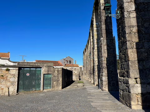
Aqueduct Trail – A path running along the Vila do Conde Aqueduct
From the Coastal Trail to the Camino Central: 12.9 km along the aqueduct from Vila do Conde to São Pedro de Rates. Route, stage, hostels, costs—explained honestly.
Read
