

Camino de El Rocío a Santiago de Compostela
A young Camino from Andalusia: 220.1 kilometres from the Ermita del Rocío in Doñana, through the wine towns of the Condado, the mining landscape of the Río Tinto and the Sierra de Aracena as far as Zafra, where the Vía de la Plata begins.
- 01At a glance
- 02Overview
- 03Other names
- 04Who it suits best – and who it doesn't
- 05Route & landscape
- 06Stages, terrain & difficulty
- 07Rocieros who wanted to ride all the way to Santiago
- 08Three Villages Called "de León"—and None of Them in León
- 09Highlights along the way
- 10How pilgrims get to this route
- 11Keep walking?
- 12Preparation & practicalities
- 13Sleeping and stamping, village by village
- 14What the route costs
- 15Getting there
At a glance
- Start / Finish: Ermita del Rocío (Almonte, Huelva) / Zafra (Badajoz), on the Vía de la Plata
- Length: 220.1 km
- Duration: 13 stages according to the route's Guía, from 3.7 to 34.3 km; combined, about 10 walking days
- Elevation: ↗ 3,349 m / ↘ 2,845 m
- Lowest / highest point: 6 m in El Rocío / 778 m just beyond Fuentes de León
- Landscape: Marshes and sand on the edge of Doñana, vineyards and olive groves of the Condado, the wide Pata del Caballo, open-cast mines and a red river near Nerva, holm oaks and chestnuts of the Sierra de Aracena, finally the dehesas of Extremadura
- Waymarking: Tiles with arrows, yellow towards Santiago, green towards El Rocío; the first tile hangs at the entrance of the Ermita
- Accommodation: in almost every village an Acogida municipal, a municipal lodging for pilgrims on prior request; pilgrim hostels in Puerto Moral, Cañaveral de León, Valencia del Ventoso and Zafra
- Connecting routes: Camino del Sur from Huelva joins at the Embalse de Aracena, and in Zafra the Vía de la Plata
- Stamps: pilgrim office in the Santuario del Rocío, then town halls, parishes and bars, village by village in the Guía
- Best time: October to April; not in the week of the Romería at Pentecost
Overview
Most Caminos end at a pilgrimage site. This one begins at one. The Ermita del Rocío stands in the sand on the edge of the Doñana marshes, and every year at Pentecost around a million people come for the Romería. A few Rocieros wanted more: to ride on, on horseback, all the way to the Apostle. That idea became a route. In 2021 the association Amigos del Camino de El Rocío a Santiago de Compostela was founded, and in December 2022 the first pilgrims of the “I Peregrinación Rociero-Jacobea” passed through Nerva.
Over 220.1 kilometres you climb from 6 metres above sea level to 778 metres. In between lies almost everything the province of Huelva has to offer: the wine towns of the Condado, the lonely Pata del Caballo, the mines on the Río Tinto and the forests of the Sierra de Aracena. Beyond Corteconcepción the route meets the Camino del Sur and follows it into Extremadura, via Fuentes de León and Valencia del Ventoso to Zafra. There the Vía de la Plata begins.
Other names
Camino del Rocío a Santiago, Camino Rociero-Jacobeo, and in the press also Camino de El Rocío. Not to be confused with the many “Caminos del Rocío” on which the Hermandades travel to the Ermita at Pentecost: those lead there, this one leads away.
Who it suits best – and who it doesn't
The route is ideal for pilgrims looking for Spain off the well-known routes who like to walk alone. If you already know the Vía de la Plata or plan to walk it, this is a distinctive prelude with a strong story: from the Virgen del Rocío to the Apostle. It also works on horseback and by bike; that is how it was conceived from the start.
To be honest, though, it is not for you if you expect hostels with fixed opening hours, infrastructure and other pilgrims. The route is young. You mostly sleep in municipal lodgings that you have to phone beforehand, in Tujena there is no shop and no bar, and between Tujena and Berrocal there are 34 kilometres without a village, only the Casa Forestal de Las Contiendas in the first third. In summer it is too hot on the plain.
Route & landscape
The route begins at the portal of the Santuario, beneath the scallop shell, and leads through sand and pines away from the Marisma. After Almonte you walk on the Camino de Los Llanos, the same path on which the Virgen del Rocío is carried to her town every seven years, through strawberry fields, the “red gold” of Huelva, and pine forests parallel to the A-483. Through orchards, grain fields and vineyards it continues to Bollullos Par del Condado, whose parish church is dedicated to the Apostle Santiago, and to Villalba del Alcor, where the church of San Bartolomé stands in a former Almohad ribat and guards the Simpecado of the local Hermandad del Rocío. At the Aldea de Tujena, which belongs to Paterna del Campo, the route leaves the settlements and climbs into the Pata del Caballo, a wide woodland and hunting area within the municipality of Escacena del Campo.
Berrocal, at 305 metres in the western Andévalo between the Sierras de Alabarderos, de Enmedio and de la Picota, is the balcony above the Río Tinto, and here the Cuenca Minera begins. On an old Roman road you descend to the Puente del Cachán bridge, then the route follows the river, whose valley is protected as a Paisaje Protegido, as far as the Estación de Los Frailes. A mountain path leads to Las Delgadas, past Minas de Riotinto, which lies a good kilometre off the path, and over the Monte Sorromero to Nerva. On the way to La Granada de Río-Tinto the association recommends a visit to the source of the Río Tinto and to the Peña del Hierro. After that it gets greener and higher: over the Sierras del Padre Caro, de Enmedio y de la Hoya you come into the dehesas of the Iberian pig, among holm oaks, cork oaks, chestnuts and oaks in the east of the Sierra de Aracena y Picos de Aroche nature park. For a stretch you follow the Río Odiel, then you reach Valdezufre, a district of Aracena with the Ermita de Santa Marina, and Puerto Moral. The area is known for its ham with protected designation of origin. Beyond Corteconcepción, at the Embalse de Aracena, the Camino del Sur from Huelva joins in. Together you go via Cañaveral de León to Fuentes de León, into Extremadura. Shortly after, at 778 metres, you reach the highest point of the route. Then it goes through the dehesas via Segura de León and Valencia del Ventoso to Zafra.
Stages, terrain & difficulty
The stages follow the route's Guía, which the association publishes with the Diputación de Huelva: 13 sections, each with a difficulty level from “Baja” to “Alta”. The kilometres come from the Camino Ninja map and are calibrated exactly to 220.1 km, so they are slightly above the Guía's figures (211 km). The first four days are flat; from Tujena it becomes rolling, from Berrocal mountainous. Three stages are very short, two very long; the Guía itself suggests splitting the 38 kilometres from Cañaveral de León to Valencia del Ventoso at Segura de León.
- El Rocío → Almonte (17.0 km) — Difficulty Baja. From the portal of the Santuario through the village and along the Camino de Los Llanos through strawberry fields and pines, parallel to the A-483. Across the A-474 into the Calle Camino de Los Llanos, past the El Chaparral fairground and the Monumento a Las Yeguas to the Parroquia de la Asunción on the Plaza Virgen del Rocío.
- Almonte → Bollullos Par del Condado (9.0 km) — Difficulty Baja. Behind the parish church along the Calle Antonio Machado to the sports centre and on the Camino de Bollullos between olives, vines and grain, parallel to the main road. The destination is the Parroquia de Santiago Apóstol; the Apostle is the town's patron saint.
- Bollullos Par del Condado → Villalba del Alcor (10.4 km) — Difficulty Baja. Via the Plaza Ocho de Marzo to the Arroyo de la Cerrada and along the Camino de los Vendimiadores, under the A-49 motorway, across the Cañada Traviesa and past the Hacienda La Hincosa. Through the Calles Bollullos, Reliquias and Santa María to the Plaza de la Constitución in front of San Bartolomé.
- Villalba del Alcor → Tujena (13.8 km) — Difficulty Baja. Across the A-472, the Arroyo de los Morantes and the Huelva–Seville railway line onto the Vereda de Niebla, an old drovers' road that you follow for 5.5 kilometres. Tujena is an aldea of Paterna del Campo with the chapel of San Isidro, but without a shop or bar: bring food for two days or shop in Paterna.
- Tujena → Berrocal (34.3 km) — Difficulty Alta. Between olive groves to the Río Corumbel, along the Camino de Los Costales to the main gate of the Pata del Caballo and on the forest track through eucalyptus, pines, cork oaks, holm oaks and strawberry trees. In the first third the Casa Forestal de Las Contiendas, an old forest house, the only resting place. 2.5 kilometres before Berrocal onto the road.
- Berrocal → Nerva (19.6 km) — Difficulty Fácil. From the church of San Juan Bautista along the Calle del Pozo to the viewpoint, down the old Roman road to the Puente del Cachán over the Río Tinto, then uphill on the Vía Verde to the Estación de Los Frailes and along the old mining railway to the ruins of Zarandas. Via the HV-5015 to the tourist railway station, under the A-476 to the town hall of Nerva.
- Nerva → La Granada de Río-Tinto (14.4 km) — Difficulty Media-alta. Along the Avenida de la Reú and the Calle Argentina to Los Huertecillos, where the streams are coloured by minerals, to the road to the source of the Río Tinto and on the HV-5011, today a forest track, over the Sierra del Padre Caro. Steep at the start, with views back to Nerva; then holm oaks and cork oaks to the church of La Granada, the former La Alfilla.
- La Granada de Río-Tinto → Valdezufre (17.4 km) — Difficulty Media-alta. Across the A-461 and almost five kilometres along the Camino de Aracena to the Río Odiel, on the Camino de La Mimbrera through several gates and across the Arroyo de Los Madroñuelos, then across the Odiel and steeply up between the Barrancos de Los Allegaderos and Las Cortecillas. A rest at the Ermita de Santa Marina, then under the N-433 to Valdezufre.
- Valdezufre → Puerto Moral (3.9 km) — Difficulty Baja. Along the Calle Mar and the Calle Vald Real onto the Sendero de La Umbría, 1.5 kilometres to the HU-8130, at the junction with the HV-3105 onto the Sendero de Belén, past the Regina and Tolete watermills in the Barranco de La Madrona to Puerto Moral, one of the “Pueblos Mágicos de España”. The destination is the church of San Pedro y San Pablo.
- Puerto Moral → Corteconcepción (3.7 km) — Difficulty Baja. Along the Calles Rábida and La Seda back onto the path, between dry-stone walls enclosing the pastures of the Ibérico pigs. 350 metres after the HV-3105, right at the fork. Corteconcepción calls itself the pioneer of ham; the destination is the Ermita de San Juan.
- Corteconcepción → Cañaveral de León (20.8 km) — Difficulty Media. From the Ermita de San Juan in the district of Puerto Gil on the HU-3124 around the Embalse de Aracena. After 3.8 kilometres the Camino del Sur from Huelva joins in. Across the bridge over the Rivera de Huelva to the rest area by the reservoir, another 3.8 kilometres to the Camino de Las Ventas on the left, then on the Camino de La Dehesa to Cañaveral, the last village in Andalusia, with a freshly renovated hostel right on the route.
- Cañaveral de León → Valencia del Ventoso (33.5 km) — Difficulty Media-alta. The Guía splits the day at Segura de León. 500 metres beyond Cañaveral you choose the road (9 km) or the mountain path (14 km) to Fuentes de León; the Camino Ninja map follows the mountain path over the highest point, 778 metres. From Fuentes an hour on the main road to Segura de León, past the Ermita de los Remedios to the Charco Hondo, across the Bodonal–Fuente de Cantos road, past the Casa Cantalgallo through a stone-walled lane, over the railway line and along the Llano de Cuchilleros to Valencia.
- Valencia del Ventoso → Zafra (22.3 km) — Difficulty Media. At the Restaurante Fuentenueva onto the Camino del Túnel, at three forks left, right, left, to the Río Bodión, through two gates past a house on the ridge, always following the “Monteviejo” signs, sharp left shortly before the railway line, across the Ribera Atarja to Medina de las Torres. Two kilometres on the road, then on the Camino de la Plata along the Calle Belén into Zafra. In front of the bullring stands the monolith where the route meets the Vía de la Plata from Seville.
Rocieros who wanted to ride all the way to Santiago
At the beginning there was no authority, only a wish. A group of Rocieros wanted to join the pilgrimage to the Virgen del Rocío with the one to the Apostle, and on horseback at that. In July 2021 they founded the association Amigos del Camino de El Rocío a Santiago de Compostela, which within a few months already had over 100 members. The Hermandad Matriz of Almonte supports the route, as do the Diputación de Huelva and the municipalities. As early as February 2020, riders had their pilgrim credentials stamped at the town hall of Berrocal and left a picture of the Virgen del Rocío behind.
In December 2022 the first pilgrims of the “I Peregrinación Rociero-Jacobea” set out, on foot, on horseback and by bike. For the occasion, the first tiles with arrows were hung in Nerva. The association's president said of the mining landscape: “Estos paisajes son una maravilla. Es una recompensa más al tremendo esfuerzo que realizan los peregrinos.” The route is not yet officially recognised. For that, under the rules of the Cathedral Chapter of Santiago and the Spanish federation of Jacobean associations, it needs a definitive route, rest areas, hostels and points of contact.
In its leaflet the association puts the idea into a formula: “Huelva es tierra santiaguista. Huelva es tierra rociera. Y es que Huelva es tierra peregrina.” The route links the Cathedral of Santiago with the Santuario Nacional de Nuestra Señora del Rocío, for the association the two most important pilgrimage sites in Spain. Both are jubilee sites where pilgrims can obtain an indulgence. That is why the route is meant to be walked in both directions: whoever sets out here leaves one pilgrimage site to walk to the next, and whoever comes from Santiago follows the green arrows back to El Rocío.
Three Villages Called "de León"—and None of Them in León
Cañaveral de León, Fuentes de León, Segura de León: reading the stage list, you might think the route takes a detour to northern Spain. But the name refers not to a kingdom but to a province of a military order. The Order of Santiago divided its holdings into a province of Castile and a province of León, and this Sierra belonged to León. In 1247 and 1248 Christian troops took Fuentes de León and handed it to the Order; in 1274 Grand Master Pelay Pérez Correa granted the council of Segura de León its settlement charter. Segura became the seat of the Encomienda Mayor de León, the grand commandery—a rank to which big names were appointed as Comendadores Mayores. The castle the Order built above the town still stands today.
The youngest of the three villages is Cañaveral. King Philip II separated it from Fuentes de León on December 30, 1588, and made it a town in its own right; the census of 1594 lists it in the Order of Santiago's province of León. Then came the administrative reform of 1833, which assigned Cañaveral to the province of Huelva. Ever since, one village called "de León" has been in Andalusia and its neighbor with the same name tag seven kilometers away in Extremadura—and between them you walk across a border the Order never drew.
For the route, this means the traces of St. James on this stretch aren't pilgrim traces but traces of lordship. You'll find the Cross of St. James, the red sword with fleur-de-lis ends, on town coats of arms, above doorways, and on castle walls; in Valencia del Ventoso the Casa de la Encomienda even appears on the municipal coat of arms. In Segura de León, allow an hour for the climb up to the castle and ask at the town hall about opening times; in mid-September the town celebrates the Capeas, with around 150 young bulls running through the streets.
Highlights along the way
- Ermita del Rocío — pilgrimage church of the Virgen del Rocío, the present building begun in 1964, blessed in 1969, completed in 1980; as early as around 1270 Alfonso X had a first hermitage built here.
- The village of El Rocío and Doñana — streets of sand, houses of the Hermandades, the Paseo Marismeño with its bird hides, plus the La Rocina visitor centre and the Palacio del Acebrón on the edge of the national park.
- Almonte — Parroquia de la Asunción, Museo de la Villa, Capilla del Cristo and the Monumento a Las Yeguas, the monument to the mares of the Marisma.
- Condado de Huelva — Bollullos Par del Condado with its Santiago parish church, the wine museum and its bodegas (D.O. Condado de Huelva); Villalba del Alcor with San Bartolomé in the Almohad ribat, the Convento de San Juan Bautista and the Hospital de la Misericordia.
- Paterna del Campo — around the Aldea de Tujena the Ermita de San Isidro, the castle of Alpízar, the Tejada la Nueva excavation and the La Fontanilla spring.
- Pata del Caballo — one of the loneliest stages in Andalusia: 34 kilometres without a village.
- Berrocal — church of San Juan Bautista, the cross chapels Cruz de Arriba and Cruz de Abajo and the “Los Riscos Altos” viewpoint above the Río Tinto.
- Nerva and the Río Tinto — mining town on the red river, the first with waymarking tiles; Museo Vázquez Díaz, the source of the Río Tinto, the Peña del Hierro and the Cerro Colorado open-cast mine. The river valley is protected as a Paisaje Protegido.
- Sierra de Aracena — holm oaks, cork oaks and chestnuts between La Granada and Cañaveral de León; the Ermita de Santa Marina near Valdezufre, whose cult Galician settlers brought with them after the Reconquista; the Tolete and Regina watermills and the Los Nogales botanical garden in Puerto Moral; the washing places of Puerto Gil and La Corte in Corteconcepción; the Laguna of Cañaveral de León.
- Jacobean traces in Extremadura — castles and commanderies of the Order of Santiago in Segura de León, Fuentes de León and Valencia del Ventoso, there the Order's Casa Fuerte, the Iglesia de la Esperanza and the old prison of the Concejo.
- Zafra — finish of the route and gateway to the Vía de la Plata: Palacio de los Duques de Feria, town walls and gates, Plaza Grande and Plaza Chica, Colegiata de la Candelaria, the Museo de la Historia de la Medicina and the Hospital de Santiago of 1437.
How pilgrims get to this route
The Camino de El Rocío a Santiago de Compostela is a starting route: it has no feeder, you travel directly to El Rocío. If you are coming from Huelva, you can alternatively choose the Camino del Sur, which also leads into the Sierra de Aracena via Niebla and Minas de Riotinto. It joins the Camino de El Rocío a Santiago de Compostela 3.8 kilometres beyond Corteconcepción at the Embalse de Aracena.
Keep walking?
In Zafra, at the monolith in front of the bullring, the Vía de la Plata begins for you, which leads via Mérida, Cáceres and Salamanca to Santiago. For the whole route from El Rocío to Santiago, the association reckons with 34 stages and around 1,150 kilometres.
Preparation & practicalities
You need a pilgrim credential (Credencial) as on all Spanish routes. The pilgrim office in the Santuario del Rocío issues it and puts in the first stamp (tel. 620 42 84 25, oficinadelperegrino@hermandadmatrizrocio.org). After that, town halls, parishes, tourist offices and bars stamp; in Nerva the town hall from Monday to Friday, at the weekend the Sociedad Centro Cultural. You only get the Compostela in Santiago, as everywhere from 100 kilometres on foot or on horseback and 200 kilometres by bike.
Waymarking consists of tiles with arrows: yellow towards Santiago, green back towards El Rocío. Because the route is young, signage is not seamless everywhere. Download the Camino Ninja map for offline use. The route's Guía, published by the association with the Diputación de Huelva, describes every stage street by street and lists accommodation, stamping point and sights for every village. For the stage across the Pata del Caballo you need enough water and food for 34 kilometres; there is nothing to buy in Tujena, the nearest shop is in Paterna del Campo.
On this route you mostly sleep in municipal lodgings, the Acogida municipal: almost every town hall provides pilgrims with quarters, but only on prior request. So call the day before. Avoid the week of the Romería at Pentecost. Then El Rocío is full, accommodation is booked out months ahead, and the paths around the village belong to the Hermandades with their horses and carts. The easiest way to plan your stages is directly in the Camino Ninja app, where you can plan suitable accommodation at the same time.
Sleeping and stamping, village by village
According to the route's Guía (as of October 2026). The telephone numbers belong to town halls, parishes and brotherhoods, not to private individuals.
- El Rocío — municipal lodging on request at the Concejalía (959 451 503), plus many hotels; stamp at the pilgrim office of the Santuario and at the Concejalía
- Almonte — municipal lodging; stamp at the town hall, the tourist office and the Hermandad Matriz
- Bollullos Par del Condado — municipal lodging, Casa Vallejo (680 197 660), Hostal El Lirio; stamp at the town hall and the tourist office
- Villalba del Alcor — municipal lodging on request; stamp at the town hall and the parish
- Tujena — Casa Hermandad San Isidro on request (617 666 558), stamp there too
- Berrocal — municipal lodging on request at the town hall (959 577 007); stamp at the town hall and in the shops
- Nerva — municipal lodging on request (959 580 150); stamp at the town hall Monday to Friday, on Saturdays and Sundays at the Sociedad Centro Cultural
- La Granada de Río-Tinto — municipal lodging on request (959 587 008); stamp at the town hall and in the Bar Jara y Encina
- Valdezufre — parish lodging on request (651 010 794); stamp at the Capilla de San José and in the Bar Curro
- Puerto Moral — Albergue municipal on request (959 120 089), country houses; stamp at the town hall, the hostel, the Bar Marry and the Bar Kiosco
- Corteconcepción — municipal lodging on request (959 120 030), plus hotels; stamp at the town hall and the Zona Joven youth centre
- Cañaveral de León — Albergue municipal on request (959 465 860); stamp at the town hall and the Bar Restaurante San Sebastián
- Valencia del Ventoso — Hospedaje Municipal Refugio del Peregrino, Calle San Blas 30; stamp at the town hall (924 562 127)
- Zafra — Albergue Convento de San Francisco and the hostel of the Asociación Amigos del Camino de Santiago de Zafra; stamp at the hostels and the tourist office (924 551 036)
What the route costs
The municipal lodgings make this route cheap; what they cost, the Guía does not say, so ask when you register. Where you prefer a room, say in El Rocío, Bollullos, Corteconcepción or Zafra, reckon with €35 for a single and €60 for a double room in a rural guesthouse (example Fuentes de León, as of October 2026). For about ten walking days that comes to €350 to €600 including food, depending on how often you sleep in municipal lodgings.
Getting there
El Rocío lies in the municipality of Almonte on the road to Matalascañas, about 70 kilometres west of Seville. The nearest airports are Seville and Faro.
From Zafra you can continue by bus and train, or you simply carry on along the Vía de la Plata towards Santiago.
- Bus: from Seville and Huelva to El Rocío (lines towards Matalascañas)
- Train: no train to El Rocío; nearest station in La Palma del Condado
- Flight: Seville, Faro
- Route contact: pilgrim office El Rocío +34 620 428 425, association +34 614 101 167 (asamigosdelcaminorociosantiago@gmail.com)
Partners
Partner for Camino de El Rocío a Santiago de Compostela
Camino Ninja is cooperating with official partners. For this camino the partner is:


Get your pilgrim credential and shell
Everything you need for the Camino de El Rocío a Santiago de Compostela, shipped to your door.
Visit Camino Shop
Other Caminos
 Ansbacher Jakobsweg
From Weihenzell via Ansbach, Feuchtwangen, Dinkelsbühl, Ellwangen and the Ostalb to Ulm and Oberdischingen: 9 stages, monasteries, imperial cities and the watershed between the Kocher and the Brenz.
Read- Appenzeller Weg
Appenzeller Weg
52.6 km from Rankweil across the Rhine to St. Peterzell: St. James Chapel (1464), 163 Years of the Wedding Trail, connection to the Via Jacobi. Stages, costs, how to get there.
Read 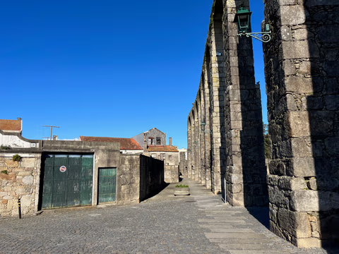
Aqueduct Trail – A path running along the Vila do Conde Aqueduct
From the Coastal Trail to the Camino Central: 12.9 km along the aqueduct from Vila do Conde to São Pedro de Rates. Route, stage, hostels, costs—explained honestly.
Read
