

Oberfränkischer Jakobsweg
The Oberfränkischer Jakobsweg runs 181.1 kilometers from Hof an der Saale to the church of St. Jakob in Nuremberg, by way of Helmbrechts, the pilgrimage basilica of Marienweiher, Marktschorgast, Bayreuth, Creußen, Pegnitz, Betzenstein, Gräfenberg and Kalchreuth. It roughly follows the old imperial highway, the Via Imperii, is waymarked with the European scallop shell and was inaugurated on St. James's Day 2009. Nine stages, 2,260 meters of climbing, and a high point of 694 meters in the Franconian Forest south of Helmbrechts. The route is young; the statues of St. James along it are not.
- 01At a Glance
- 02Overview
- 03Other Names
- 04Who It's Ideal For—and Who It's Not So Ideal For
- 05Route & Landscape
- 06Stages, Terrain, and Difficulty
- 07A Route from 2009, and Eight St. Jameses Who Got There First
- 08Highlights Along the Way
- 09How Pilgrims Find Their Way onto This Path
- 10Continue the pilgrimage?
- 11Preparation & Practical Information
- 12What the journey will cost you
- 13Getting Here
At a Glance
- Start / Finish: Hof, Stadtkirche St. Michaelis / Nuremberg, church of St. Jakob with its pilgrim center
- Length: 181.1 km; the operator gives 183 km
- Duration: 9 stages of 14.1 to 24.2 km, averaging about 20 km; ten days with a rest day in Bayreuth
- Elevation: ↗ 2,260 m / ↘ 2,433 m
- Highest point: 694 m at km 25.5 in the Franconian Forest between Helmbrechts and Rappetenreuth; lowest point 303 m in Nuremberg
- Landscape: Franconian Forest with views of the Fichtelgebirge, the steep drop of the Franconian Line fault, the Red Main valley, the Veldensteiner Forst, the rocks and castles of Franconian Switzerland, cherry orchards, the Sebalder Reichswald
- Waymarking: European scallop-shell symbol
- Traces of St. James: St. Jakobus in Marktschorgast with a 14th-century statue of St. James, stone panels showing St. James from around 1490 in Himmelkron, a St. James statue from around 1440 in Bayreuth's Stadtkirche, St. Jakobus in Creußen, a St. James chapel in Pegnitz, two St. James statues in Kalchreuth, and St. Jakob Nürnberg at the finish
- Accommodation: pilgrim hostel in Hof, pilgrim quarters in parish halls and rectories, Marienweiher friary, private rooms, construction trailers, inns, youth hostels in Bayreuth and Nuremberg
- Connecting routes: in Hof the Sächsischer Jakobsweg and the Via Imperii; at the Kreuzweiher the Jakobsweg Erfurt–Nürnberg; from Nuremberg three routes continue south and west
- Best time: May to October; in spring the cherry orchards around Kalchreuth are in bloom, and in winter the Franconian Forest is often under snow
Overview
The Oberfränkischer Jakobsweg links two networks: in the northeast, the routes from Saxony and the Baltic coast arrive in Hof; in the southwest, the routes toward Lake Constance, Rothenburg and the Altmühl Valley start in Nuremberg. In between lie 181.1 kilometers of Upper Franconia. The route roughly follows the Via Imperii, the imperial highway from Stettin (Szczecin) via Leipzig, Hof, Bayreuth and Nuremberg to Rome, which today is traced more or less by the B 2 federal highway. The route was inaugurated on July 25, 2009, St. James's Day, with an ecumenical pilgrim service in Marktschorgast.
The founders are remarkably honest about it. Asked why the route goes through Helmbrechts rather than the more direct Münchberg, they cite "weniger historischen, sondern sachlichen Gründen: Verwendung vorhandener Wanderwege, Etappenlängen, Einkehrmöglichkeiten, möglichst geradliniger Verlauf" (less historical than practical reasons: existing hiking trails, stage lengths, places to eat, the straightest possible line). In short: the trail dates from 2009, but the St. Jameses along it are up to 700 years older. Start in Hof today and you'll walk through churches dedicated to the apostle long before the first shell marker went up, and arrive at a church that already appears in the records in 1209.
Other Names
For a long time the route was called Jakobsweg Oberfranken; today we call it the Oberfränkischer Jakobsweg. The operator deliberately speaks of the Jakobusweg Hof–Bayreuth–Nürnberg and of "Jakobuswege" rather than "Jakobswege," to put the apostle himself at the center instead of the myth of an ancient route. On maps and in apps you'll also find it as Jakobsweg Hof–Nürnberg; in English it's the Upper Franconian Way of St. James.
Who It's Ideal For—and Who It's Not So Ideal For
It's ideal if you're looking for a well-marked pilgrimage route in Germany where the landscape changes every day: Franconian Forest, the edge of the Fichtelgebirge, the Red Main valley, the Jura. Ideal if churches interest you more than kilometers—across nine stages you'll pass a papal basilica, an altarpiece from 1503 and a margraves' church from 1745. And ideal if you want to stay flexible by train: nearly every stage town has a station or a bus connection.
Honestly, though, it's not for you if you expect Spanish-style albergues: there are pilgrim quarters, but often it's a single room in a parish hall that you have to request from the parish office in advance, and not every night. Not for you if you're looking for company—on this route you're more likely to meet day hikers than pilgrims bound for Santiago. And not for you if pavement on the edge of town bothers you: Hof, Bayreuth and above all Nuremberg each demand a few kilometers between houses.
Route & Landscape
Hof to Bayreuth (km 0–67.4): From Hof the route climbs via Osseck and Föhrenreuth into the Franconian Forest and, just past Helmbrechts at kilometer 25.5, reaches its high point of 694 meters; on a clear day you can see the domes of the Fichtelgebirge. Via Rappetenreuth and Marktleugast you come to Marienweiher (km 35.5) and Marktschorgast (km 44.8). Here the Franconian Line drops away: the railroad needs the Schiefe Ebene (the "inclined plane") to get down this escarpment, 6.8 kilometers with a 157.7-meter height difference, in service since 1848. You descend into the valley to Himmelkron (km 50.5) and walk via Lanzendorf, Ramsenthal and Gemein, passing Bindlach 1.3 kilometers off the route, to Bayreuth (km 67.4).
Bayreuth to Nuremberg (km 67.4–181.1): Beyond the city the route leads via St. Johannis and the park of the Eremitage into rolling hills to Creußen (km 87.8), then past the source of the Red Main to Lindenhardt (km 100.3) and Pegnitz (km 112.0). This is where Franconian Switzerland begins: pine forest in the Veldensteiner Forst, dolomite crags, castles. Via Betzenstein (km 126.1), Stierberg and the Wildenfels castle ruins you reach Hiltpoltstein (km 136.5) and Gräfenberg (km 143.9). After Igensdorf the land grows flatter and more fertile; at the Kreuzweiher the route from Erfurt and Bamberg joins in, and via the cherry village of Kalchreuth (km 163.6) and through the Sebalder Reichswald, passing Heroldsberg 1.7 kilometers off the route, you reach the old town of Nuremberg by way of Buchenbühl.
Stages, Terrain, and Difficulty
We show the route in the same 9 stages the operator describes. The distances come from the Camino Ninja map, calibrated exactly to 181.1 km; the club's figures differ by one or two kilometers per stage.
- Hof → Helmbrechts (21.9 km) — through the Franconian Forest, with the high point just past the finish; places to stop in Föhrenreuth and Edlendorf.
- Helmbrechts → Marktschorgast (22.9 km) — over the heights near Rappetenreuth to the Marienweiher basilica, then on to the St. James church in Marktschorgast.
- Marktschorgast → Bayreuth (22.6 km) — down alongside the Schiefe Ebene to Himmelkron, then through the Red Main valley into the margraves' city.
- Bayreuth → Creußen (20.4 km) — St. Johannis, the Eremitage, then farm tracks and forest to the walled small town.
- Creußen → Pegnitz (24.2 km) — the longest stage: the source of the Red Main, the Grünewald altarpiece in Lindenhardt, lunch at the brewery inn.
- Pegnitz → Betzenstein (14.1 km) — the shortest: about nine kilometers of Veldensteiner Forst, and time for the 92-meter-deep well at the finish.
- Betzenstein → Gräfenberg (17.8 km) — crags, castle ruins and Jura plateau via Stierberg and Hiltpoltstein.
- Gräfenberg → Kalchreuth (19.7 km) — a gentle descent into the foothills, the route from Erfurt joining at the Kreuzweiher, and the terracotta apostles at the finish.
- Kalchreuth → Nuremberg (17.5 km) — the Sebalder Reichswald with a view of the city, then via Buchenbühl and the Marienberg to St. Jakob.
None of it is technically difficult; this is low-mountain country on forest, field and logging tracks. But the climbing isn't evenly spread: the first two days in the Franconian Forest and the stages through Franconian Switzerland have the most constant up and down, and from Gräfenberg on it's mostly downhill. Strong walkers can combine stages into 35 or 40 kilometers, but then won't find a bed in every town in between.
A Route from 2009, and Eight St. Jameses Who Got There First
For a route that owes its existence to "sachlichen Gründen" (practical reasons), the density of St. James is astonishing. The parish church of Marktschorgast is dedicated to him; the town is first mentioned in 1109 as Scoregast and already had a parish church at the time, and inside stand a St. James statue and a Pietà from the 14th century. In the museum of the Stiftskirche Himmelkron, a Cistercian convent founded in 1279 by Count Otto of Orlamünde, lie painted stone panels from around 1490 showing the apostles, St. James the Greater among them. In Bayreuth's Protestant Stadtkirche Heilig Dreifaltigkeit, a weathered St. James from around 1440 stands on a pillar—he survived the Reformation in a Lutheran church.
Farther south comes the church of St. Jakobus in Creußen, with a 15th-century relief on the former portal and a 17th-century St. James statue in the high altar; the church was rebuilt in 1477 after the Hussite Wars and took its present form in 1700. In Pegnitz, the Stadtkirche St. Bartholomäus has a St. James chapel; in Bronn, on the stage to Betzenstein, there's a St. James church with a 13th-century zigzag portal; and in St. Andreas in Kalchreuth, two St. James statues stand beside the famous terracotta apostles. And at the finish waits St. Jakob in Nuremberg, whose small Romanesque predecessor chapel Emperor Otto IV gave to the Teutonic Order in 1209.
If you ask about the pilgrims behind these statues, you'll find them mainly in Nuremberg: in 1494 the physician and humanist Hieronymus Münzer set out with two Nuremberg merchants on a journey through France, Spain and Portugal, wrote it up in his Latin "Itinerarium," and Santiago de Compostela was not to be missed. On the Via Imperii itself it was mostly carters who traveled—and one of them stands at the beginning of the Marienweiher pilgrimage. According to legend, around 1500 a carter from Saxony brought along an image of the Virgin Mary, was attacked by robbers, escaped, and out of gratitude set the image up beside the road. The church there is older, though: as early as 1189 Bishop Otto II of Bamberg handed it over to Langheim Abbey. In practice that means: allow half an hour for the church in Marktschorgast, Bayreuth and Creußen, and ask at the parish office for the key if it's locked.
Highlights Along the Way
- Hof (km 0) — start at the Protestant Stadtkirche St. Michaelis from 1230; also in town, St. Lorenz from 1214, the "Keimzelle" (the town's nucleus) of Hof, and the Marienkirche from 1864 with a new St. James statue.
- Marienweiher Basilica (km 35.5) — Rococo pilgrimage church built from 1740 to 1750 with a miraculous image from around 1500; Franciscans since the 17th century, Basilica minor since 1993, pilgrim office and lodging in the friary.
- Schiefe Ebene near Marktschorgast (km 44.8) — railroad incline from 1848 with gradients of up to 25 per mille; an educational trail accompanies the route down to Himmelkron.
- Himmelkron (km 50.5) — 13th-century collegiate church, convent from 1279, later a hunting lodge of the Bayreuth margraves; plus the Autobahnkirche St. Christophorus, a highway church from 1998 with a replica of the Chartres labyrinth.
- Bayreuth (km 67.4) — margraves' city with its Stadtkirche and St. James statue; pilgrim stamps also at the Catholic Schlosskirche.
- St. Johannis and the Eremitage (km 73.1–74.2) — a margraves' church from 1745 with Gothic murals and a baptismal angel holding a shell-shaped basin, then the Eremitage park with its Temple of the Sun.
- Creußen (km 87.8) — first mentioned in 1003 as "urbs crusni," a town since 1358, town walls from 1358 to 1361, and the Krügemuseum for Creußen stoneware.
- Lindenhardt (km 100.3) — winged altarpiece from 1503 whose panels have been attributed to Matthias Grünewald since 1915; it originally stood in Bindlach and came here after a church fire in 1685.
- Betzenstein (km 126.1) — first mentioned in 1187, town charter in 1359, the 92-meter Tiefer Brunnen (deep well) dug from 1543 to 1549, the Baroque church from 1748.
- Kalchreuth (km 163.6) — first recorded in 1298, a cherry village above the Reichswald; St. Andreas with twelve late-medieval terracotta apostles, the only complete set preserved anywhere.
- St. Jakob Nürnberg (km 181.1) — the finish, first recorded in 1209, with a pilgrim center, pilgrim stamp and pilgrim passports.
How Pilgrims Find Their Way onto This Path
The route begins where two routes from the east end. In Hof the Sächsischer Jakobsweg arrives, following the old imperial highway through Saxony and the Vogtland. The Via Imperii also ends in Hof, waymarked as a Way of St. James since 2015 from Stettin via Berlin, Leipzig and Zwickau. If you come that way, you simply switch shells in Hof.
From the northwest, the Jakobsweg Erfurt–Nürnberg joins at the Kreuzweiher before Kalchreuth, coming via Coburg, Lichtenfels and Bamberg. Both routes share the last kilometers to St. Jakob; from here, according to the operator, you follow the shell markers of the route from Lichtenfels.
Continue the pilgrimage?
In Nuremberg the route ends at St. Jakob—and three others start from the very same church:
- Mittelfränkischer Jakobsweg — 99.3 km west via Heilsbronn to Rothenburg ob der Tauber, with a connection there toward Rottenburg am Neckar
- Jakobsweg Nürnberg–Ulm — south through Franconia and over the Swabian Jura to Ulm Minster and on toward Lake Constance
- Jakobsweg Nürnberg–Eichstätt — south into the Altmühl Valley to the bishop's city of Eichstätt
If you're headed all the way to Santiago, you'll usually pick one of the first two: via Rothenburg into the French network of routes, or via Ulm and Lake Constance into Switzerland. At the pilgrim center in Nuremberg you'll get the stamp that completes this route and the information for the next one.
Preparation & Practical Information
Pilgrim passport and app. As on every Way of St. James, you need a pilgrim passport (credencial) to stay in pilgrim quarters and to receive the Compostela in Santiago at the end; the pilgrim hostel in Hof explicitly requires one. It's best to order it online ahead of time so it reaches you before your trip begins; the St. Jakob pilgrim center in Nuremberg also issues pilgrim passports. You'll find stamps in almost every church along the way—in Hof alone, in four. The easiest way to plan the route is right in the Camino Ninja App, where you put your stages together and plan suitable accommodation as you go.
Lodging and waymarking. Every year the operator publishes an address list of pilgrim quarters on jakobus-oberfranken.de: the Diakonie Hochfranken pilgrim hostel in Hof with 4 beds and key pickup until 8 p.m., parish halls in Helmbrechts, Pegnitz and Gräfenberg, a pilgrim room in the Lindenhardt rectory, the Marienweiher friary, private quarters in Marktleugast, Creußen and Kalchreuth, and construction trailers in Gräfenberg and Kalchreuth. Almost everything goes through the phone and the parish office—call two or three days ahead. The waymarking changes with each club's territory but is good throughout; in the Veldensteiner Forst it pays to have the track on your phone.
Walking together. Between Easter and November, Pastor Michael Thein invites people to Saturday pilgrim walks on sections of the route, with no registration and no fee; in 2026, for example, on July 25, St. James's Day, from Kalchreuth to Nuremberg.
What the journey will cost you
The pilgrim room in the private lodging in Kalchreuth costs 18 € a night according to the address list; parish halls and rectories usually don't name a fixed price but ask for a donation (as of October 2026). Inns and guesthouses in Helmbrechts, Creußen, Pegnitz, Betzenstein and Gräfenberg run roughly 45 to 75 € for a single room with breakfast, more in Bayreuth and Nuremberg; the youth hostels in Bayreuth and at Nuremberg's Kaiserburg castle are the cheaper city option (as of October 2026).
Budget 60 to 90 € a day if you sleep and eat at inns, and 35 to 50 € if you use the pilgrim quarters and cook for yourself. A real money-saver is the Deutschland-Ticket at 63 € a month (as of October 2026): it covers getting there and back on regional trains, plus any early exit or stage skip along the way.
Getting Here
To the start. You can reach Hof Hauptbahnhof by regional train from Nuremberg, Bamberg, Regensburg, Leipzig and Dresden; the Deutschland-Ticket covers the trip on regional services. From the station it's a few minutes' walk to the Stadtkirche St. Michaelis.
Along the way and from the finish. Helmbrechts, Marktschorgast, Bayreuth, Creußen, Pegnitz and Gräfenberg have train stations; Creußen and Pegnitz are on the Nuremberg–Bayreuth line, the Gräfenbergbahn runs from Gräfenberg to Nürnberg-Nordost, and Betzenstein is connected to Pegnitz by bus. From St. Jakob it's a ten-minute walk to Nuremberg Hauptbahnhof, with ICE connections in every direction.
- Rail: bahn.de — connections to Hof and from Nürnberg Hbf
- Route and lodging: jakobus-oberfranken.de — stage descriptions, address list, Saturday pilgrim walks
Partners
Partner for Oberfränkischer Jakobsweg
Camino Ninja is cooperating with official partners. For this camino the partner is:
Route guide for the Oberfränkischer Jakobsweg
Stage-by-stage guide with the best places to stay.
Printable PDF · free with a Camino Ninja account
Popular towns on the Oberfränkischer Jakobsweg
Picked by our team, in walking order.

Get your pilgrim credential and shell
Everything you need for the Oberfränkischer Jakobsweg, shipped to your door.
Visit Camino Shop
Other Caminos
 Ansbacher Jakobsweg
From Weihenzell via Ansbach, Feuchtwangen, Dinkelsbühl, Ellwangen and the Ostalb to Ulm and Oberdischingen: 9 stages, monasteries, imperial cities and the watershed between the Kocher and the Brenz.
Read- Appenzeller Weg
Appenzeller Weg
52.6 km from Rankweil across the Rhine to St. Peterzell: St. James Chapel (1464), 163 Years of the Wedding Trail, connection to the Via Jacobi. Stages, costs, how to get there.
Read 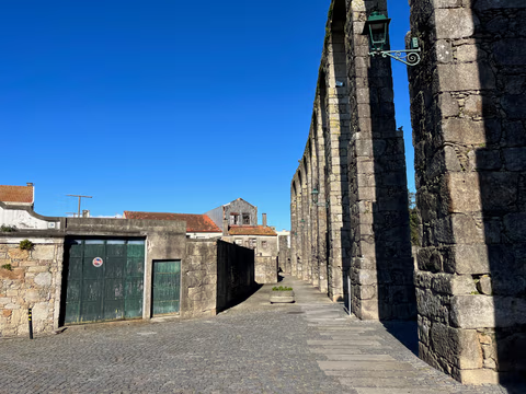
Aqueduct Trail – A path running along the Vila do Conde Aqueduct
From the Coastal Trail to the Camino Central: 12.9 km along the aqueduct from Vila do Conde to São Pedro de Rates. Route, stage, hostels, costs—explained honestly.
Read
