


Partner
Jakobsweg Schweiz - Compostelle Suisse
The Swiss St James association: since 2026 a merger of jakobsweg.ch and the Amis du Chemin de Saint-Jacques. It looks after the Via Jacobi and ten feeder routes – from Lake Constance and Basel to Geneva and over the Gotthard.
The Caminos on the map
Caminos of this partner
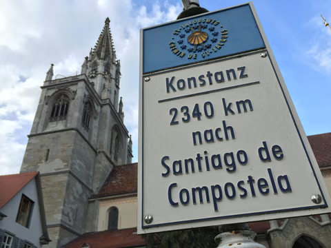 Via JacobiThe Via Jacobi runs 447.3 kilometers from Konstanz on Lake Constance right across Switzerland to Geneva, where the French routes to Santiago begin. As the Schwabenweg it crosses Thurgau and the Töss valley to Rapperswil and climbs over the Etzel to Einsiedeln Abbey, then tops out on the Haggenegg at 1,414 meters before dropping to Lake Lucerne and reaching the Bernese Oberland via Flüeli-Ranft and the Brünig Pass. By way of Lake Thun, Rüeggisberg, Fribourg, Romont and Lausanne it ends on the Rhône after 21 stages and 11,518 meters of ascent.Explore this Camino
 Via Jacobi BregenzThe Via Jacobi Bregenz runs 106.8 kilometers from the Austrian shore of Lake Constance in Bregenz to Rapperswil-Jona on Lake Zurich, where it joins the Via Jacobi toward Geneva. For the first 30 kilometers it crosses the flat Rhine Delta, switching countries three times along the way; from Rorschach on it follows Swiss national hiking route 4 ViaJacobi through St. Gallen and its UNESCO-listed Abbey District. After that it's up and down through the Appenzell backcountry and the Toggenburg, topping out at 1,084 meters near Schwellbrunn. Five stages, 2,744 meters of climbing, and at the end a pilgrim hostel right in the heart of Rapperswil's old town.Explore this Camino
 BaslerwegThe Baslerweg stretches 112.8 kilometers from Basel via the Passwang to Bern—with an elevation gain of 3,492 meters, it offers significantly more of the Jura Mountains than the map suggests. At kilometer 2, the battlefield from 1444 lies next to a St. James chapel; at kilometer 72, there is a hermitage that has been inhabited continuously since 1442.Explore this Camino
- Rhein-Reuss-RhônewegThe Rhein-Reuss-Rhôneweg runs 242.8 kilometers from the Benedictine abbey of Disentis in the Surselva to the Abbey of Saint-Maurice in Lower Valais, which has existed without interruption since 515. It crosses the Oberalp Pass at the source of the Rhine and the Furka, where our map measures the highest point at 2,462 meters, and then follows the young Rhône through the Goms, via Brig, Leuk, Sion, and Martigny. Three languages, two passes, 7,014 meters of climbing—and a route you can only walk end to end between summer and fall. In Saint-Maurice, the Via Francigena is waiting.Explore this Camino
- Tessiner Anschlussweg172.8 kilometers and 5,213 meters of elevation gain from the Madonna del Sasso pilgrimage church via Locarno through the Magadino Plain, the Riviera and the Leventina, over the Passo del San Gottardo at 2,106 meters, down to Lake Uri and on to Emmetten—the only route in our network that crosses the main Alpine ridge via the Gotthard. It does not have its own trail markers, but it does have a historical record that hardly any other Way of St. James can boast: in 1559, the nuns of the Claro Convent traveled this exact route by papal decree to revive the Seedorf Abbey. In Emmetten, the trail joins the Via Jacobi.Explore this Camino
- Drei-Seen-WegThe Drei-Seen-Weg (Three Lakes Way) runs 188.3 kilometers from Basel past the cliff monastery of Mariastein, across the Jura and through the Seeland lake district to the abbey church of Payerne. Along the way you cross the high point on the Raimeux at 1,288 meters, walk through the Roman rock gate of Pierre Pertuis, follow the vineyards along Lake Biel and pass through Murten and ancient Aventicum. Eight stages, 5,158 meters of climbing, eight cantons and a language border you cross more than once.Explore this Camino
- Appenzeller Weg52.6 kilometers from Rankweil in Vorarlberg across the Rhine into the Appenzell region to St. Peterzell: the short stretch that connects the Jakobsweg Österreich to the Via Jacobi—featuring a pilgrimage church full of arrowslits at the start, a St. James Chapel dating from 1464 along the route, and 163 years of wedding records in the church registers.Explore this Camino
- LuzernerwegThe Luzernerweg runs 124.2 kilometers from Lucerne on Lake Lucerne past the pilgrimage monastery of Werthenstein, through Willisau, Huttwil and Burgdorf to Bern, then climbs on to Rüeggisberg. There, at the ruins of the first Cluniac monastery in the German-speaking world, it joins the Via Jacobi toward Fribourg and Geneva. Seven stages, 3,857 meters of ascent, high point 980 meters just before the finish. Along the way you cross from the Catholic Lucerne hinterland into the Protestant Emmental—walking, in reverse, the route a statue of the Virgin took in 1528.Explore this Camino
- Thurgauer Klosterweg79.5 kilometers from Blumberg over the Randen to the Rhine and through Thurgau: six monasteries founded between 1049 and 1331, including the Ittingen Charterhouse and St. Katharinental—and at the end of the route, a commandery of the Order of St. John that served as a pilgrims’ hostel for 581 years and as a prison for 162 years.Explore this Camino
- Schaffhauser-Zürcher-WegThe Schaffhauser-Zürcher-Weg covers 111.6 kilometers from Blumberg in the Schwarzwald-Baar district over the Randen into Switzerland, through Schaffhausen, past the Rhine Falls to the monastery island of Rheinau, through Winterthur and the Zürcher Oberland to Rapperswil-Jona on Lake Zurich. There it joins the Via Jacobi toward Einsiedeln. Five stages, 2,079 meters of ascent, and the highest point at 919 meters on the Randen shortly after the start. Along the way: the Allerheiligen minster of 1049, a monastery on a Rhine island, and the Ritterhaus Bubikon, the best-preserved commandery of the Knights Hospitaller in Europe.Explore this Camino
- Verbindungsweg Mariastein – WillisauThe Mariastein Trail – Willisau stretches 87.7 kilometers in four stages from Switzerland’s second-most important pilgrimage site across the Basel-Landschaft Jura to the Luzernerweg—with an elevation gain of 3,019 meters, it is steeper per kilometer than the Baslerweg over the Passwang. It doesn’t connect two places; it connects two trails.Explore this Camino
Who stands behind the route
The roots lie in the Bernese Oberland: from 1997 a project group there worked to revive the Way of St James in Switzerland, initially backed by the regional economic association Volkswirtschaft Berner Oberland. In 2008 the association jakobsweg.ch took over. On 28 March 2026 the general assembly approved the merger with the Amis du Chemin de Saint-Jacques from French-speaking Switzerland – since then the association has been called Jakobsweg Schweiz – Compostelle Suisse, bilingual like the country its routes cross.
The association wants pilgrims to experience Switzerland with all their senses, encounters and friendships to grow across borders along the way, and the spiritual meaning of the Way of St James to find a contemporary form. It works with partner associations in Bavaria, Austria, South Tyrol, Poland and the Czech Republic and is part of the Camino Europe network and the IG Swiss Camino. Its website carries a sentence we are happy to quote: „Die Schweiz ist das erste Land, welches komplett in der Camino Ninja APP aufgenommen wurde.“ – Switzerland is the first country fully included in the Camino Ninja app.
The association's routes
The backbone is the Via Jacobi from Lake Constance to Geneva. Ten further routes lead towards it from Germany, Austria, Basel, Central Switzerland, Graubünden and Ticino:
- Via Jacobi – 447.3 km, Constance → Geneva
- Via Jacobi Bregenz – 106.8 km, Bregenz → Rapperswil-Jona
- Appenzeller Weg – 52.6 km, Rankweil → St. Peterzell
- Schaffhauser-Zürcher-Weg – 111.6 km, Blumberg → Rapperswil-Jona
- Thurgauer Klosterweg – 79.5 km, Blumberg → Tobel-Tägerschen
- Baslerweg – 112.8 km, Basel → Bern
- Drei-Seen-Weg – 188.3 km, Basel → Payerne
- Verbindungsweg Mariastein – Willisau – 87.7 km, Mariastein → Willisau
- Luzernerweg – 124.2 km, Lucerne → Rüeggisberg
- Rhein-Reuss-Rhôneweg – 242.8 km, Disentis → Saint-Maurice
- Tessiner Anschlussweg – 172.8 km, Locarno → Emmetten
What the association does for pilgrims
The association's shop sells the pilgrim passport with protective sleeve for CHF 12 (approx. €13) – currently sold out, though – plus route booklets and books, French guides, pilgrim stamps, the scallop shell and “Pilgrims welcome” signs for hosts (as of October 2026). For the Compostela the association reminds you of the rule: document at least the last 100 km on foot or 200 km by bike without gaps, two stamps a day.
Trained pilgrim companions lead pilgrim days and special events, and regional groups – called “Stämme” (tribes) in the association – meet to share experience and answer questions before you set off. Accommodation is listed via the Camino Europe platform; there is also a newsletter, an events calendar and pilgrim stories on the blog.
Contact and getting involved
Website: jakobswegschweiz-compostellesuisse.ch with shop, events and newsletter · Email: web@jakobsweg.ch. Anyone who has walked, still wants to walk or simply wants to support pilgrimage can become a member; donations are welcome too.