

Ansbacher Jakobsweg
211.9 km from Weihenzell via Ansbach to Oberdischingen: through two former imperial cities, over the Ostalb between the springs of the Kocher and the Brenz, past monasteries to Ulm Minster – the "Nordroute" (northern route) of the Schwäbische Jakobusgesellschaft.
- 01At a glance
- 02Overview
- 03Other names
- 04Who it's ideal for – and who it isn't
- 05Route & landscape
- 06Stages, terrain & difficulty
- 07Between the Kocher and the Brenz: where the water makes up its mind
- 08Highlights along the way
- 09How pilgrims get onto this route
- 10Keep walking?
- 11Preparation & practicalities
- 12What the route will cost you
- 13Getting there
At a glance
- Start / Finish: Jakobskirche Weihenzell on the Mittelfränkischer Jakobsweg / Jakobusbrunnen (St James's fountain) at Haus St. Jakobus in Oberdischingen near Ulm
- Length: 211.9 km
- Stages: 9, between 13.4 and 30.0 km (the organisation's stage plan, with the first stage extended from Weihenzell; distances from the Camino Ninja map)
- Duration: 9 to 11 days
- Elevation gain/loss: ↗ 2,383 m / ↘ 2,269 m
- Highest point: 676 m at km 121.1 between Unterkochen and Königsbronn, on the watershed between the Kocher and the Brenz; lowest point 386 m in Weihenzell
- Regions: Middle Franconia (Bavaria) and East Württemberg (Baden-Württemberg) – Frankenhöhe, Wörnitzgrund, Virngrund, Ostalb, Brenz valley, Donauried, Hochsträß
- Waymarking: yellow scallop shell on a blue background, plus yellow arrows
- Origins: researched from 2006, waymarked and blessed in 2018
- Pilgrim passport / stamps: credential from Haus St. Jakobus; stamps in Weihenzell, Ansbach, Leutershausen, Feuchtwangen, Dinkelsbühl, Ellwangen, Schnaitheim, Elchingen and Ulm Minster, among others
- Onward connection: Oberschwäbischer Jakobsweg to Konstanz and Ulm – Pfullendorf
Overview
This route has several names and a clear purpose. The Schwäbische Jakobusgesellschaft calls it its "Nordroute" (northern route) or Ansbacher Jakobsweg, and on the map it links two landscapes that rarely share a sentence: Protestant Middle Franconia and Catholic East Württemberg. In between lie 211.9 km, two former imperial cities, a Romanesque basilica, five monasteries and a watershed.
What's new about the route isn't its line but its composition. It follows old connecting paths, monastery trails and places of pilgrimage that were researched from 2006, described in a pilgrim guide in 2015, and waymarked and ecumenically blessed in 2018. It starts at a Jakobskirche and ends at a fountain: at the Jakobusbrunnen in Oberdischingen the northern route stops and the southern route to Konstanz begins.
Other names
Mittelfränkisch-Schwäbischer Jakobsweg (as on the organisation's route page), Jakobsweg Weihenzell – Ansbach – Ulm (in the accommodation list), Jakobusweg Ansbach – Ulm (as used by Aalen tourism and Pilgern in Bayern), Jakobusweg Ansbach – Ulm / Oberdischingen „Zwischen Städten und Klöstern" ("Between Towns and Monasteries", after the pilgrim guide), Nordroute of the Schwäbische Jakobusgesellschaft. Cycling pilgrims have their own version, the Ansbacher Jakobusradpilgerweg.
Who it's ideal for – and who it isn't
The route is ideal if you'd rather combine pilgrimage with churches, old towns and inns than with hostel romance, and want to walk a continuous stretch of southern Germany in nine to eleven days. It's technically easy, crosses the Jura through valleys rather than over summits, and has railway stations on the route in Ansbach, Ellwangen, Unterkochen, Königsbronn, Heidenheim, Langenau and Ulm. If you want to continue to Konstanz or Lake Constance, Oberdischingen connects you seamlessly.
To be honest, though, it's not for you if you're looking for a dense network of pilgrim hostels and a pilgrim community. There are hardly any real pilgrim hostels; you'll spend most nights in inns, guesthouses and private rooms, and many churches along the way are closed on weekdays. The first stage from Weihenzell is almost 27 kilometres, the seventh 30, and between Dinkelsbühl and Ellwangen you'll be on your own for a long time.
Route & landscape
From the Jakobskirche in Weihenzell, where the route branches off the Mittelfränkischer Jakobsweg, you head to Ansbach to St. Gumbertus and St. Johannis, then out onto the Frankenhöhe, via Leutershausen on the Altmühl to the former imperial city of Feuchtwangen and through the Frickinger Wald to Dinkelsbühl on the Wörnitz. Beyond it the borderland begins: forest tracks and hamlets in the Virngrund until you reach Württemberg near Haselbach, and the route descends via Eigenzell to Ellwangen with its basilica and the pilgrimage hill of Schönenberg.
Then comes the Jura. Via Schrezheim, Hüttlingen and Oberalfingen the route runs into the Kocher valley to Unterkochen, where the Kocher rises, climbs to 676 m on the watershed and drops down to Königsbronn, where the Brenz emerges from the Brenztopf spring. It follows the Brenz via Itzelberg, Schnaitheim and Heidenheim below Schloss Hellenstein to Anhausen, crosses the plateau via Bissingen ob Lontal and Lindenau to Langenau, through the Donauried to Elchingen Abbey and into the Danube valley to Ulm. The last stage runs over the Hochsträß to Grimmelfingen, Erbach and Donaurieden and on to Oberdischingen. Ulm Minster lies 340 m off the track, the centre of Aalen 2.5 km – the route leaves the town to the east.
Stages, terrain & difficulty
We show the route in the organisation's stage plan with nine stages; its first stage begins in Ansbach, but we start it in Weihenzell. The distances come from the Camino Ninja map and are calibrated exactly to 211.9 km, and we calculated the elevation figures from the route's elevation points. Technically the route is easy: farm tracks, forest paths, cycle paths and plenty of tarmac on the edges of towns. The only real climb leads from Unterkochen up to the watershed; the route is rideable by bike almost everywhere, except between Unterkochen and Königsbronn.
- Weihenzell → Leutershausen (26.7 km) — ↗ 275 m / ↘ 233 m. To Ansbach (km 10.3, station at km 9.8 – many pilgrims join here), out onto the Frankenhöhe, with the Gumbertusbrunnen in the forest near Hinterholz; the organisation calls this day „Im Zeichen der Eyb'schen Muschel" (Under the sign of the Eyb shell).
- Leutershausen → Feuchtwangen (24.1 km) — ↗ 213 m / ↘ 195 m. On old paths via Erlbach, Röttenbach and Weinberg into the imperial city with its collegiate church and Johanniskirche.
- Feuchtwangen → Dinkelsbühl (13.4 km) — ↗ 120 m / ↘ 119 m. The short stage: via Zehdorf and through the Frickinger Wald, take care on the B 25 at the Unsinnige Mühle, then over the Wörnitz into the old town.
- Dinkelsbühl → Ellwangen (26.6 km) — ↗ 296 m / ↘ 302 m. „Einsamkeit pur im Grenzland" (Pure solitude in the borderland): mills, hamlets and forest, across the state border near Haselbach and via Eigenzell to Ellwangen.
- Ellwangen → Unterkochen (26.6 km) — ↗ 380 m / ↘ 355 m. Via Schrezheim, Hüttlingen and Oberalfingen into the Kocher valley; Aalen stays off to the west.
- Unterkochen → Heidenheim (24.1 km) — ↗ 272 m / ↘ 230 m. From the source of the Kocher up to the watershed (676 m), down to the Brenztopf in Königsbronn and on down the Brenz valley.
- Heidenheim → Langenau (30.0 km) — ↗ 340 m / ↘ 389 m. „Der Klösterliche" (The monastic one): via Bolheim, Anhausen and Falkenstein, through the Lontal and via Lindenau to Langenau – the longest stage.
- Langenau → Ulm (19.5 km) — ↗ 166 m / ↘ 159 m. Through the Donauried via Göttingen to Elchingen Abbey, then with the Nuremberg route into Ulm to the Minster.
- Ulm → Oberdischingen (20.9 km) — ↗ 318 m / ↘ 285 m. „Auf dem Hochsträß" (On the Hochsträß): via Grimmelfingen with its Jakobuskirche, Erbach and Donaurieden to the Jakobusbrunnen.
Between the Kocher and the Brenz: where the water makes up its mind
On the sixth stage you reach the highest point of the route, and it isn't on a summit but on a boundary. Just past Unterkochen, where the Kocher emerges from the hillside, the route climbs at km 121.1 to 676 m – and beyond it all the water flows the other way. The Kocher runs to the Neckar and with the Rhine into the North Sea; the Brenz, which wells up from the Brenztopf in Königsbronn just under eight kilometres further on, runs to the Danube and into the Black Sea. One pilgrim day, two springs, two seas.
Königsbronn tells a second story too. Georg Elser went to school here and worked as a carpenter before detonating his bomb against Hitler in Munich's Bürgerbräukeller on 8 November 1939 – 13 minutes too late. The memorial in the village is worth a stop, and it suits a pilgrim route: Elser was one person who followed his conscience when almost everyone else went along.
And then there's Lindenau near Langenau. Above the door of the inn it says 1274; the pilgrim guide calls the house a medieval pilgrim hostel that belonged to a monastery. The monastery was dissolved in 1803 and its Madonna moved to Elchingen – where you meet her again the next day as the "Mother of the Seven Sorrows". The route lost a figure and found it again a day later.
Highlights along the way
- Jakobskirche Weihenzell — start and first stamp, on the Mittelfränkischer Jakobsweg
- St. Johannis and St. Gumbertus, Ansbach — pilgrim blessing, the "Pilgereck" (pilgrim corner) and a stamp; the parish of St. Johannis was first mentioned in 1139
- Gumbertusbrunnen near Hinterholz — an enclosed spring in the forest where, according to legend, Abbot Gumbertus baptised
- Stiftskirche and Johanniskirche, Feuchtwangen — the collegiate foundation is recorded in 819, the Johanniskirche in 1257; together they form a medieval courtyard like a film set
- Münster St. Georg, Dinkelsbühl — built 1448 to 1499, with St James on the organ gallery; a St James figure on the "Goldener Hirsch" inn
- Basilika St. Vitus, Ellwangen — 1182 to 1233, one of the most important Romanesque churches in Swabia; above it the Schönenberg with its pilgrimage church of 1729
- Source of the Kocher in Unterkochen and the Brenztopf in Königsbronn — two springs, one watershed, plus Königsbronn Abbey (1303) and the Georg Elser memorial
- Schloss Hellenstein, Heidenheim — the castle above the town on the Brenz
- Anhausen Abbey and Lindenau — monastic country in the Brenz and Lone valleys, and the Lindenau inn with the date 1274
- Abbey church of Oberelchingen — Baroque Marian pilgrimage church with the Madonna from Lindenau, stamp at the literature stand
- Ulm Minster — 161.53 m tower, 768 steps, choir stalls by Jörg Syrlin the Elder; stamp at the tower ticket desk
- Jakobuskirche Grimmelfingen — consecrated in 1463, with a pilgrim stamp
- Haus St. Jakobus, Oberdischingen — built in 1794 next to the Holy Trinity chapel, under St James's patronage since 1986; pilgrim centre with the Jakobusbrunnen
How pilgrims get onto this route
The route starts in Weihenzell at the Jakobskirche, and there it lies on the Mittelfränkischer Jakobsweg from Nuremberg to Rothenburg (at its km 51.5). If you're coming from Nuremberg, you turn south in Weihenzell instead of carrying on to Rothenburg. If you arrive by train, you'll usually join at Ansbach station at km 9.8.
There are further entry points along the way: near Lindenau the route touches the Jakobsweg Nürnberg–Ulm, and from Elchingen Abbey the two run together as far as Ulm Minster. The Fränkisch-Schwäbischer Jakobsweg from Würzburg also ends there. Between Unterkochen and Königsbronn the route crosses the Neresheim – Neckartailfingen section.
Keep walking?
In Oberdischingen you're not at the end but at a junction. The last stage from Ulm Minster was already the first section of the Oberschwäbischer Jakobsweg; it continues via Biberach, Bad Waldsee and Weingarten to Konstanz Minster on Lake Constance. Alternatively, the Ulm – Pfullendorf route to Pfullendorf starts in Oberdischingen.
Preparation & practicalities
You can get your pilgrim passport from Haus St. Jakobus in Oberdischingen, which also publishes an up-to-date accommodation list for the route (as of August 2026). It lists around 80 addresses from Weihenzell to Ulm, only a few of them specifically for pilgrims: the Alte Mühle pilgrim hostel in Burgberg, pilgrim accommodation in Feuchtwangen and at the Catholic parish office in Schnaitheim. The rest are inns, guesthouses, private rooms and youth hostels in Dinkelsbühl and Ulm. Book ahead, especially for private rooms and on the inns' rest days.
The scallop-shell waymarking is good but not seamless, and from Elchingen onwards several shell variants from different routes appear side by side. Take the track in the app with you. Not every church has a stamp; reliable places are the Jakobskirche Weihenzell, the parish offices and tourist information centres in the towns, Elchingen and Ulm Minster. Haus St. Jakobus sends out the pilgrim guide „Der Jakobusweg zwischen Städten und Klöstern" (The Jakobusweg between towns and monasteries) for €6.80 plus postage (as of October 2026).
What the route will cost you
Expect inn and guesthouse prices: usually €50 to €90 per night for a single room, less in private rooms, and €15 to €25 for dinner at an inn (as of October 2026). For nine to eleven days that comes to roughly €700 to €1,100, excluding travel to the start. Pilgrim accommodation and the hostel in Burgberg are cheaper; Haus St. Jakobus in Oberdischingen has pilgrim beds.
Getting there
Ansbach is on the Nuremberg–Stuttgart railway line and can be reached from Nuremberg in about 40 minutes; Weihenzell, about 10 km to the north-east, can be reached by bus. Along the way there are stations in Ellwangen, Unterkochen, Königsbronn, Heidenheim and Langenau; Feuchtwangen and Dinkelsbühl can only be reached by bus.
From the finish in Oberdischingen, buses run to Ulm and Ehingen; the nearest station is Erbach on the Ulm–Friedrichshafen line. Ulm Hbf has ICE connections to Stuttgart, Munich and Frankfurt.
- Ansbach station — regional and long-distance trains Nuremberg–Stuttgart, bus to Weihenzell; joining point at km 9.8
- Ellwangen, Unterkochen, Königsbronn, Heidenheim, Langenau — joining and leaving points along the way
- Ulm Hbf — ICE hub, also an exit point after stage 8
- Erbach (Donau) — nearest station to the finish in Oberdischingen
Partners
Partner for Ansbacher Jakobsweg
Camino Ninja is cooperating with official partners. For this camino the partner is:


Get your pilgrim credential and shell
Everything you need for the Ansbacher Jakobsweg, shipped to your door.
Visit Camino Shop
Other Caminos
 Appenzeller Weg
52.6 km from Rankweil across the Rhine to St. Peterzell: St. James Chapel (1464), 163 Years of the Wedding Trail, connection to the Via Jacobi. Stages, costs, how to get there.
Read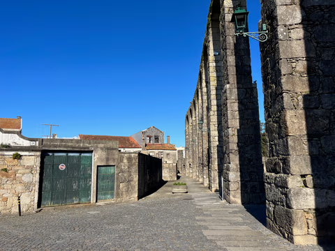
Aqueduct Trail – A path running along the Vila do Conde Aqueduct
From the Coastal Trail to the Camino Central: 12.9 km along the aqueduct from Vila do Conde to São Pedro de Rates. Route, stage, hostels, costs—explained honestly.
Read- Augsburger Jakobsweg (Memmingen)
Augsburger Jakobsweg (Memmingen)
The western route of the Augsburger Jakobsweg: 120.4 km in 6 stages via Oberschönenfeld Abbey, Maria Vesperbild, the Fugger castles of Kirchheim and Babenhausen and Memmingen to Bad Grönenbach. Stages, accommodation, costs.
Read
