

Jakobsweg Rheinhessen
Over 69.5 kilometers, the Jakobsweg Rheinhessen links two towns that made history: Bingen, where Hildegard founded her convent, and Worms, where Luther stood before the Imperial Diet in 1521. In between lie the rolling Rhenish Hesse hills, with vineyards, church spires and views stretching all the way to the Taunus. The route was reconstructed from old records starting in 2005 and completed in 2009. Three relaxed days, easy to reach by train, ideal as a first pilgrimage.
- 01At a Glance
- 02Overview
- 03Other Names
- 04Who It's Ideal For—and Who It's Not So Ideal For
- 05Route & Landscape
- 06Stages, Terrain, and Difficulty
- 07The Old Pilgrims Walked Here—Just the Other Way
- 08Highlights Along the Way
- 09How Pilgrims Find Their Way onto This Path
- 10Continue the pilgrimage?
- 11Preparation & Practical Information
- 12What the journey will cost you
- 13Getting Here
At a Glance
- Start / Finish: Bingen am Rhein, Burg Klopp / Worms-Herrnsheim; from there it's about 5 km more to the cathedral on the Jakobsweg Mainz–Speyer
- Length: 69.5 km
- Duration: 3 stages, 4 at a leisurely pace
- Elevation: ↗ 846 m / ↘ 855 m
- Highest point: 284 m at km 50.9 between Framersheim and Dittelsheim-Heßloch, on the slopes of the Kloppberg
- Operator / Waymarking: yellow scallop shell on a blue background, plus yellow arrows
- Traces of St. James: Kloster Jakobsberg near Ockenheim, the Church of St. Philip and St. James in Sulzheim, St. Jakobus in Heßloch, a scallop-shell stone at Worms Cathedral
- Accommodation: guest rooms at wineries, guesthouses, a youth hostel in Worms; no pilgrim hostels
- Connecting routes: in Bingen Linksrheinischer Jakobsweg, Way of St. James Fulda – Bingen, Hunsrücker Jakobsweg, Nahe-Glan-Camino (Süd-Route); in Worms Jakobsweg Mainz–Speyer and Klosterroute Worms
- Best time: April to October; on the first Sunday in May, the villages along the route celebrate their pilgrim trail festival
- Associations along the way: whole route: St. Jakobus-Gesellschaft Rheinland-Pfalz-Saarland e.V.
Overview
The Jakobsweg Rheinhessen is a short route with a long reach. It begins in Bingen, where the Rhine and the Nahe meet and where, around 1150, Hildegard founded her own convent on the Rupertsberg, and it ends in Worms, the city of the cathedral, the Nibelungs and the Imperial Diet of 1521. In between, you walk through the Rhenish Hesse hill country: vineyards to the horizon, villages with Baroque churches, hilltops crowned with lookout towers.
There were pilgrim roads here as far back as the Middle Ages; a pilgrims' path through the Wormsgau is mentioned in 1392. From 2005 onward, the Rheinhessen regional group traced today's line using old descriptions and opened it section by section; on May 3, 2009, it closed the last gap. And here's the twist: the historical pilgrims documented in this area walked the other way. So you're following in their footsteps—just in reverse.
Other Names
On Wikipedia the route is called Rheinhessischer Jakobsweg, at the pilgrim festival Rheinhessischer Pilgerweg, and on signposts and in hiking guides often simply Jakobsweg Bingen–Worms. In English it's the Rheinhessen Way of St. James.
Who It's Ideal For—and Who It's Not So Ideal For
This route is ideal if you want to try pilgrimage for the first time: three days, well marked, train stations within reach, hardly a steep meter. It also suits you if you're coming down the Rhine from the north and want to carry on to Speyer or the Palatinate, because it bridges the gap between Bingen and Worms through the hinterland rather than along the riverbank. And if you like wine, you'll find a winery with a tasting room in almost every village.
Honestly, though, it's not for you if you're looking for hostels and a pilgrim community: you'll sleep in guesthouses and winegrowers' farms, and in the evening you'll usually be eating alone. Shade is scarce, and in high summer the paths between the rows of vines feel long. And the map line doesn't end at the cathedral but in Herrnsheim on the outskirts of Worms; you walk the last kilometers to the cathedral on the route to Speyer.
Route & Landscape
Bingen to Wolfsheim (km 0–23.2): From Burg Klopp you climb straight up the Rochusberg with its pilgrimage chapel and cross vine-covered slopes to Ockenheim. Beyond it rises the Jakobsberg with its monastery, and shortly after, the Laurenziberg near Gau-Algesheim, both a good half kilometer off the trail. Via Appenheim you head up onto the plateau near Ober-Hilbersheim, where at over 260 meters you can see far across Rhenish Hesse, and on over to Wolfsheim.
Wolfsheim to Worms (km 23.2–69.5): Via Vendersheim, the Hagelkuppe and Sulzheim, the trail passes the western edge of Wörrstadt; the town center lies just under a kilometer off the route. Next come Spiesheim, Biebelnheim and Framersheim, a steady up and down between stream valleys and vine-clad hilltops. On the Kloppberg near Dittelsheim-Heßloch you reach the highest point, after which the trail slowly descends to the Rhine plain. Via Abenheim you arrive at the western edge of Worms-Herrnsheim; the palace and park lie a good kilometer farther on. Here the route merges into the Jakobsweg Mainz–Speyer; you already share the last three-plus kilometers to the end of the map line with it.
Stages, Terrain, and Difficulty
We show the route in 3 stages. Kilometers come from the Camino Ninja map, calibrated exactly to 69.5 km. If you prefer shorter days, add an overnight stop in Biebelnheim (km 41.1).
- Bingen → Wolfsheim (23.2 km) — the hilliest day: Rochusberg, Jakobsberg, the plateau near Ober-Hilbersheim.
- Wolfsheim → Framersheim (23.8 km) — through Sulzheim and past Wörrstadt, with good places to stop in the wine villages.
- Framersheim → Worms-Herrnsheim (22.5 km) — over the Kloppberg and down into the Rhine plain; add about 5 km to reach the cathedral.
Technically the route is easy: field paths and farm tracks, short stretches of asphalt, no real climbs. What makes it tiring is the sun and wind on the exposed heights. Carry enough water, since there are hardly any fountains between villages, and you'll only reliably find shops in Bingen, Wörrstadt and Worms. Besides the main route there are signed alternatives, for example via Saulheim, Gabsheim and the Petersberg to Framersheim; the map shows the main line.
The Old Pilgrims Walked Here—Just the Other Way
Whether pilgrims to Santiago ever walked exactly this line, no one knows. What is documented, though, is a very similar route: the Aachen pilgrimage, which ran from Worms to Bingen and touched 22 places, including Westhofen, Bechtheim, Wörrstadt and Büdesheim. Raftsmen and towing crews also cut across here on foot to avoid the long bend the Rhine makes at Mainz. In 1932 the folklorist Wilhelm Hoffmann described a "Pilgerpfad" (pilgrims' path) from Worms to Bingen. And at the winery in Biebelnheim now called Landhaus Pilgerhof, they'll tell you that in the 17th century pilgrims bound for Rome crossed Rhenish Hesse overland to avoid the Rhine, passing right by the farm.
The traces of St. James along the way are correspondingly quirky. The Jakobsberg near Ockenheim became a pilgrimage site for the Fourteen Holy Helpers from 1720; Trappists moved in in 1921, followed in 1961 by Missionary Benedictines from St. Ottilien, who left in 2023. The Baroque church in Sulzheim, from 1715, is dedicated to Philip and James—that's James the Less, not the one from Santiago. On the other hand, Sulzheim is the only village on the route with the scallop shell in its coat of arms. That's this route in a nutshell: the pilgrims are real, the direction is reversed, and the James in the church is the wrong one. Still, it all comes together in the end, because in Worms the cathedral awaits, where a scallop-shell stone of the cross-border Sternenweg has been set since fall 2012.
Highlights Along the Way
- Burg Klopp and Rochusberg, Bingen (km 0–2.3) — the castle is documented as "Clopp" since 1277, was destroyed in 1689 and rebuilt in Gothic Revival style from 1875 to 1879; the Rochus Chapel goes back to a plague vow of 1666, and Goethe described the St. Rochus festival in 1814.
- Rupertsberg, Bingen — Hildegard's convent, consecrated in 1152 and destroyed by Swedish troops in 1632; the last remains of the church had to make way for the Nahe Valley Railway in 1857, and five arcade arches have been open to visitors again since 2023.
- Kloster Jakobsberg (a good 0.5 km off the trail at km 7.9) — pilgrimage church built from 1857 to 1862, with Nazarene-style paintings.
- Sulzheim (km 29.1) — first mentioned in 766; Baroque church, and on the Schildberg a lookout tower from 2013.
- Wörrstadt (km 30.9) — the Neunröhrenbrunnen (Nine-Spout Fountain) is a popular rest stop; the town center lies just under 1 km off the trail.
- Dittelsheim-Heßloch (km 53.4) — the Romanesque "Heidenturm" of the Dittelsheim church has been tree-ring dated to around 1080; up on the Kloppberg there's a tower with a beer garden.
- Schloss Herrnsheim, Worms (a good 1 km past the end) — the old pilgrims' path runs through the palace park; at the edge of the village stands a Baroque wayside shrine with a Pietà from 1749.
- Worms Cathedral (about 5 km past the end) — consecrated on May 2, 1181; in front of its north portal, Kriemhild and Brünhild quarrel in the Nibelungenlied over who may enter first.
How Pilgrims Find Their Way onto This Path
Bingen is a hub: several routes end and begin here, and many pilgrims use the Jakobsweg Rheinhessen as a bridge heading south.
- Linksrheinischer Jakobsweg — comes down the Rhine from the north and ends at the Basilica of St. Martin
- Way of St. James Fulda – Bingen — from eastern Hesse to the Rhine
- Rhein-Camino — ends opposite in Rüdesheim; the ferry takes you across to Bingen
- Hunsrücker Jakobsweg — over the Hunsrück to the Rhine
- Nahe-Glan-Camino (Süd-Route) — starts in Bingen and heads west into the Saarland
Continue the pilgrimage?
In Herrnsheim you're already on the Jakobsweg Mainz–Speyer. It takes you first to Worms Cathedral and then across the Rhine plain via Frankenthal and Schifferstadt to Speyer. If you'd rather head west, take the Klosterroute Worms in Worms, which runs through the northern Palatinate toward the Pfälzer Jakobsweg. Sooner or later, both directions lead into the routes to France.
Preparation & Practical Information
Pilgrim passport and app. As on all Ways of St. James in Germany, a pilgrim passport (credencial) is worth having, although the Compostela is only awarded for the last 100 kilometers to Santiago. It's best to order it online in advance so it reaches you in time for the start of your trip; the association issues an international and a regional passport for a donation of 5 € each, and the route guide booklet costs 3 € (as of October 2026). Since there are no pilgrim hostels, the easiest way to plan is directly in the Camino Ninja App, where you put together your stages and work suitable accommodation into your plan right away.
Season and accommodation. The route is at its loveliest in spring, when the vines start to sprout, and in fall during the grape harvest; in July and August the heights are hot and shadeless. On the first Sunday in May, municipalities, churches and the association celebrate their pilgrim trail festival under the motto "Pilgern verbindet" (pilgrimage connects). Book your rooms ahead, especially in Wolfsheim and Framersheim, where the choice is small.
What the journey will cost you
Budget 60 to 100 € a day (as of October 2026), depending on whether you sleep at a winegrower's farm or in a guesthouse. The Worms youth hostel right by the cathedral costs 33.30 € in a dorm and 42.70 € in a twin room per person, breakfast included, with a 5 € surcharge for a single night (as of October 2026). Guest rooms at wineries and guesthouses usually run 50 to 90 € (as of October 2026).
Getting Here
There and back. You can reach Bingen by regional train from Mainz and Koblenz; from Bingen Stadt station it's just a few minutes to Burg Klopp. From Worms Hbf, trains run to Mainz, Mannheim and Frankfurt. There are stations along the way in Ockenheim and Wörrstadt, so you can shorten the route or take a day off.
Partners
Partner for Jakobsweg Rheinhessen
Camino Ninja is cooperating with official partners. For this camino the partner is:


Get your pilgrim credential and shell
Everything you need for the Jakobsweg Rheinhessen, shipped to your door.
Visit Camino Shop
Other Caminos
 Ansbacher Jakobsweg
From Weihenzell via Ansbach, Feuchtwangen, Dinkelsbühl, Ellwangen and the Ostalb to Ulm and Oberdischingen: 9 stages, monasteries, imperial cities and the watershed between the Kocher and the Brenz.
Read- Appenzeller Weg
Appenzeller Weg
52.6 km from Rankweil across the Rhine to St. Peterzell: St. James Chapel (1464), 163 Years of the Wedding Trail, connection to the Via Jacobi. Stages, costs, how to get there.
Read 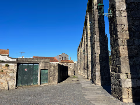
Aqueduct Trail – A path running along the Vila do Conde Aqueduct
From the Coastal Trail to the Camino Central: 12.9 km along the aqueduct from Vila do Conde to São Pedro de Rates. Route, stage, hostels, costs—explained honestly.
Read
