

Nahe-Glan-Camino (Süd-Route)
The Nahe-Glan-Camino covers 152.6 kilometers, from the Rhine-Nahe confluence in Bingen via Bad Kreuznach, Hildegard of Bingen's Disibodenberg, the Glan valley with Meisenheim and Lauterecken, Kusel and St. Wendel to Tholey Abbey. The route has carried its name since 2025. Along the way you pass one of the longest castle ruins in Germany and the tomb of St. Wendelin; at the finish stands a monastery considered the oldest on German soil. From Tholey a separate route continues to Saarbrücken and on toward Metz.
- 01At a Glance
- 02Overview
- 03Other Names
- 04Who It's Ideal For—and Who It's Not So Ideal For
- 05Route & Landscape
- 06Stages, Terrain, and Difficulty
- 07The Little Santiago Is in Saarland
- 08Where Two Rivers Meet: Hildegard at the Disibodenberg
- 09Highlights Along the Way
- 10How Pilgrims Find Their Way onto This Path
- 11Continue the pilgrimage?
- 12Preparation & Practical Information
- 13What the journey will cost you
- 14Getting Here
At a Glance
- Start / Finish: Rhine-Nahe confluence (Rhein-Nahe-Eck) in Bingen am Rhein / Abbey of St. Mauritius in Tholey
- Length: 152.6 km
- Duration: 8 stages
- Elevation: ↗ 2,225 m / ↘ 1,933 m
- Highest point: 438 m at km 129.1, between Oberkirchen and Hoof in northern Saarland
- Landscape: vineyards on the lower Nahe, crags at Bad Münster, the quiet Glan valley, the Kusel uplands, meadows and forests around St. Wendel, and finally the Schaumberg above Tholey
- Waymarking: continuous between Bingen and the Disibodenberg and between the Remigiusberg and Tholey; in the Glan valley between the Disibodenberg and the Remigiusberg still patchy at the end of 2024, so walk with a GPS track
- Traces of St. James: a scallop stone at Lichtenberg Castle (2017); otherwise a route of the local saints Disibod, Hildegard and Wendelin
- Accommodation: no pilgrim hostel network; inns, guesthouses, winegrowers' rooms, youth hostels in Bingen, at Lichtenberg Castle and in Tholey
- Connecting routes: Nahe-Glan-Camino (Nord-Variante) from Odernheim, Hunsrücker Jakobsweg, Linksrheinischer Jakobsweg and Way of St. James Fulda – Bingen in Bingen, Jakobsweg Saarbrücken from Tholey toward Saarbrücken and Metz; from Bingen also the Jakobsweg Rheinhessen to Worms
- Best time: April to October; in fall the grape harvest on the Nahe, and in October the Wendelinus pilgrimage week in St. Wendel
- Associations along the way: whole route: St. Jakobus-Gesellschaft Rheinland-Pfalz-Saarland e.V.
Overview
This Camino is older than its name. It follows the Celtic-Roman link from the legionary camp at Mainz via Tholey to Metz, which later connected the bishops' seats of Mainz and Metz; as a pilgrim route it is documented since the Middle Ages. It has only had its name since 2025: Nahe-Glan-Camino. At the Disibodenberg near Odernheim it splits into one route through the Glan valley and one through the upper Nahe valley. The Glan route, the subject of this page, runs via Meisenheim, Kusel and St. Wendel to Tholey, where the Abbey of St. Mauritius is regarded as the route's "little Santiago."
Tholey is where the route ends, and that's deliberate: the abbey is its goal, just as the cathedral is the goal of the Camino Francés. Before you get there lie vineyards, a monastery of Hildegard of Bingen, a castle where Zwingli stopped in 1529, and the tomb of St. Wendelin. If you'd rather not stop, a separate connecting route leads on from Tholey to the Saar and toward Metz. Cees Nooteboom wrote the fitting line for it: "Umwege nach Santiago de Compostela beschenken zumeist!" (Detours to Santiago de Compostela are mostly a gift!)
Other Names
Until 2024 the project was simply called the Pilgerweg von Bingen nach Tholey (pilgrim route from Bingen to Tholey); its two branches went by Glan-Camino (southern route) and Nahe-Camino (northern route). Since 2025 the shared name has been Nahe-Glan-Camino. On the Camino Ninja map the Glan route is set up as the main route and the Nahe route as a variant, so the two don't overlap:
- Nahe-Glan-Camino (Süd-Route) — Bingen via the Glan valley, Kusel and St. Wendel to Tholey, the subject of this page
- Nahe-Glan-Camino (Nord-Variante) — from Odernheim via Bad Sobernheim, Idar-Oberstein and Birkenfeld; rejoins shortly before Tholey
Along the way you'll come across older names: between St. Wendel and Tholey the route is called the Wendelinus-Pilgerweg, from St. Wendel also the Saarland-Camino. St. Wendel is also the start of the Jakobsweg St. Wendel–Saarbrücken, opened in 2010 and conceived as part of a Mainz–Metz axis; on Camino Ninja its section beyond Tholey is a route of its own. As far as the Disibodenberg the route uses the Rhein-Nahe-Weinwanderweg wine trail and the Hildegard-von-Bingen-Pilgerwanderweg, and between Theisbergstegen and Oberkirchen cycle paths such as the Glan-Blies-Radweg and the Fritz-Wunderlich-Radweg.
Who It's Ideal For—and Who It's Not So Ideal For
This route is ideal if you're looking for a German Camino without crowds, with daily stages of around 20 kilometers and a railway line almost always within reach. It suits you if monasteries, ruins and local saints interest you more than statues of St. James, and if you've already finished the Linksrheinischer Jakobsweg or the Fulda route in Bingen and simply want to keep going. The climbing is moderate, and the Glan valley is almost flat.
Honestly, though, it's not for you if you expect pilgrim hostels and a pilgrim community: there's no hostel network, you sleep in inns and guesthouses, and you're more likely to meet cyclists than pilgrims on the way. Not for you if you want to rely on seamless waymarking; in the Glan valley it still wasn't fully coordinated as of late 2024. And not for you if you shy away from asphalt: the cycle paths in the Glan valley and between Theisbergstegen and Oberkirchen are hard underfoot.
Route & Landscape
Bingen to the Disibodenberg (km 0–59.9): You set off at the Rhein-Nahe-Eck; the first 3.2 kilometers are shared with the Hunsrücker Jakobsweg. Then the route turns into the Lower Nahe hill country, through vineyards via Münster-Sarmsheim, Laubenheim and Guldental. Beyond Hargesheim comes Bad Kreuznach, whose town center lies just under a kilometer off the trail, and at Bad Münster am Stein-Ebernburg the Nahe valley turns narrow and rocky. Via Norheim, Niederhausen and the vineyards of Duchroth you reach Odernheim and the Disibodenberg, where the Glan and the Nahe meet.
Glan valley to Tholey (km 59.9–152.6): From here the route heads up the Glan, flat and quiet, via Meisenheim with its old town, Lauterecken, Ulmet and Altenglan to Theisbergstegen. At the Remigiusberg the Kusel uplands begin: via Kusel to Lichtenberg Castle near Thallichtenberg, via Pfeffelbach and Schwarzerden to Oberkirchen and across the heights to the highest point. Via Hoof and the Wendelinushof you come to St. Wendel, then via Winterbach and Alsweiler to Tholey below the Schaumberg, where the route ends at the abbey.
Stages, Terrain, and Difficulty
We show the route in 8 stages. Kilometers come from the Camino Ninja map, calibrated exactly to 152.6 km. The stage towns are chosen for beds, not sights; if you prefer shorter days, split at Bad Kreuznach, Meisenheim or Kusel, for example.
- Bingen → Guldental (18.9 km) — Rhine-Nahe confluence, then vineyards via Münster-Sarmsheim and Laubenheim.
- Guldental → Bad Münster am Stein-Ebernburg (20.2 km) — via Hargesheim, past Bad Kreuznach and into the narrow rocky valley.
- Bad Münster am Stein-Ebernburg → Odernheim (20.8 km) — loops of the Nahe, the vineyards of Duchroth, finishing at the Disibodenberg.
- Odernheim → Lauterecken (21.0 km) — up the Glan valley, via Meisenheim.
- Lauterecken → Altenglan (20.3 km) — almost flat along the river, lots of cycle path.
- Altenglan → Oberkirchen (23.6 km) — via the Remigiusberg, Kusel and Lichtenberg Castle; the day with the most climbing.
- Oberkirchen → St. Wendel (14.9 km) — over the highest point (438 m) and Hoof to Wendelin's tomb.
- St. Wendel → Tholey (12.9 km) — the Wendelinus-Pilgerweg via Winterbach and Alsweiler to the abbey, your goal.
Nothing is technically difficult. What's tiring are the short, steep climbs out of the valleys, for example up the Remigiusberg and to Lichtenberg Castle, and the longest stage, Altenglan to Oberkirchen at 23.6 kilometers. The last stage, by contrast, is short at 12.9 kilometers, so you'll have time at the abbey.
The Little Santiago Is in Saarland
On December 30, 634, the Frankish nobleman and deacon Adalgisel Grimo dictated his will, and in it a monastery in Tholey appears. Ever since, the Abbey of St. Mauritius has been regarded as the oldest monastery on German soil. For pilgrims on the Nahe and the Glan it is what the cathedral is for the Galicians: the goal. This is where the Nahe-Glan-Camino ends. The Jakobusgesellschaft calls it the "little Santiago" of the Nahe-Glan-Camino.
It wasn't an unbroken story. In 1793 French revolutionary troops occupied the monastery, looted it and dissolved it. Only on December 8, 1949 was it re-established, and on April 23, 1950 monks from St. Matthias in Trier moved in. The twist for pilgrims: St. Matthias is the destination of the Hunsrücker Jakobsweg, with which you walked the first kilometers out of Bingen. Two routes part at the Rhine-Nahe confluence, and at the end stand two monasteries that belong together.
Today many people come for the windows. The abbey church, whose early Gothic building began under Abbot Hugo between 1264 and 1280, was restored from 2018 to 2021; since 2020 three windows by Gerhard Richter have glowed in the choir, more than nine meters tall, deep red and blue on the outside, gold in the middle. The other 34 windows were created by Mahbuba Maqsoodi, with saints and biblical scenes. You've walked 152.6 kilometers, and at the end contemporary art awaits you in a monastery from the Merovingian era.
Thirteen kilometers earlier lies the second pole: St. Wendel. According to legend, Wendelin was a Scottish king's son who turned down the crown, worked as a shepherd and was elected abbot of Tholey; tradition has him dying in 617. A town grew up around his tomb in the 14th century, and the stage between the basilica and the abbey is still the Wendelinus-Pilgerweg today.
Where Two Rivers Meet: Hildegard at the Disibodenberg
Around 640 the Irish monk Disibod came to the Nahe and settled "wo sich zwei Flüsse vereinigen" (where two rivers unite), at the mouth of the Glan. Almost 1,400 years later, your route splits into two at exactly that spot. On November 1, 1112, the young Hildegard entered the women's anchorhold at the Benedictine monastery on the hill with her teacher Jutta von Sponheim; in 1136 she took over as its head, and from 1141 she wrote her visionary work Scivias here. In 1150 she moved with twenty nuns to the Rupertsberg near Bingen, the very place where you started. Pilgrim from Bingen to the mouth of the Glan and you're walking her path in reverse.
Of the monastery, two gables and long stretches of wall remain on about 2.5 hectares. In 1259 the Cistercians took over, in 1559 the last abbot ceded the monastery to Palatinate-Zweibrücken, and after that it served as a quarry. Since 1989 the Scivias Foundation has looked after the ruin. Hildegard died on September 17, 1179; she was canonized and named a Doctor of the Church only in 2012.
Highlights Along the Way
- Bingen (km 0) — Rhine-Nahe confluence and the Basilica of St. Martin, end point of the Linksrheinischer Jakobsweg; Hildegard's Rupertsberg monastery stood in Bingerbrück. Ausonius crossed the Nahe here around 371: "Transieram celerem nebuloso flumine Navam" – I had crossed the swift Nahe with its misty stream.
- Bad Kreuznach (km 31.7, just under 1 km off the route) — the Old Nahe Bridge, built around 1300, with bridge houses from 1582; a cannonball from the Swedish attack of 1632 is lodged in the house from 1609.
- Bad Münster am Stein-Ebernburg (km 39.1) — crags above the Nahe, graduation towers and the Ebernburg, where Franz von Sickingen was born in 1481.
- Disibodenberg near Odernheim (km 59.9) — monastery ruins with a Hildegard museum; the North Variant branches off here.
- Meisenheim (km 70.5) — the Schlosskirche, begun in 1479 and consecrated in 1504, with a princely crypt and the Stumm organ of 1767, considered the best-preserved of its kind from the 18th century.
- Remigiusberg near Haschbach (km 108.4) — church of a provostry founded around 1127 by Saint-Remi in Reims and dissolved in 1526, next to the ruins of the Michelsburg.
- Lichtenberg Castle near Thallichtenberg (km 116.0) — 425 meters long, one of the longest castle ruins in Germany; in 1529 Zwingli and Oecolampadius stopped here on their way to the Marburg Colloquy. The lower castle has been a youth hostel since 1922, and a scallop stone has stood there since 2017.
- St. Wendel (km 139.7) — the Wendalinus Basilica, built from 1332, with the saint's raised tomb from 1506 and the pulpit donated by Nicholas of Cusa in 1462; a basilica minor since 1960.
- Tholey (km 152.6) — the goal of the route: the Abbey of St. Mauritius, the oldest monastery on German soil, with the Richter windows in the choir.
How Pilgrims Find Their Way onto This Path
Most pilgrims start in Bingen, which is easy to reach by train; if you only want to walk a section, join at Bad Kreuznach, Kusel or St. Wendel, all three with rail connections. Bingen is a hub of the Rhineland Caminos, and if you arrive on one of them, you can simply keep walking:
- Linksrheinischer Jakobsweg — from Cologne along the left bank of the Rhine to the Basilica of St. Martin in Bingen
- Way of St. James Fulda – Bingen — from the tomb of St. Boniface via Frankfurt and Mainz to the mouth of the Nahe
- Rhein-Camino — ends opposite, at the Church of St. James in Rüdesheim; the ferry takes you across the Rhine to Bingen
- Hunsrücker Jakobsweg — also starts in Bingen; the first 3.2 kilometers are identical, then it heads across the Hunsrück to Trier
Continue the pilgrimage?
Tholey is where the Nahe-Glan-Camino ends, but the way west goes on. From the abbey, the Jakobsweg Saarbrücken runs 45.7 kilometers via Marpingen, Illingen and Holz to the Saar and on to the Ludwigskirche in Saarbrücken. It is part of the Jakobsweg St. Wendel–Saarbrücken, opened in October 2010 with a three-day pilgrim walk, and the final stretch of the old Mainz–Metz axis. In Saarbrücken the route to Metz connects: our Jakobsweg Hornbach – Metz follows the southern route through Sarreguemines; the northern route of the same Way crosses the border from Saarbrücken and meets the southern route at the Hérapel near Cocheren, from where it's another 72 kilometers to Metz Cathedral. In Metz the long-distance route toward Le Puy and the Via Podiensis begins.
Preparation & Practical Information
Pilgrim passport and app. As on all Caminos, a pilgrim passport (credencial) is recommended; you can get stamps at parish offices, monasteries and many inns. It's best to order it online in advance so it reaches you in time for the start of your journey. There's no Compostela for this route; that only counts the last 100 kilometers before Santiago, so the stamps here are your keepsake and your record on the way there. The easiest way to plan is directly in the Camino Ninja App, where you put together your stages and plan suitable accommodation right along with them.
Accommodation and waymarking. There's no hostel network. Plan on inns, guesthouses, winegrowers' rooms and vacation apartments, and book ahead in the Glan valley and in northern Saarland around Oberkirchen, because the choice there is small. There are youth hostels in Bingen, at Lichtenberg Castle and in Tholey; you can also inquire at the Tholey Abbey guesthouse. As of late 2024 the waymarking was complete between Bingen and the Disibodenberg and between the Remigiusberg and Tholey, but still patchy in between. Download the GPS track.
Season. The route is at its best from April to October. In September and October it's grape harvest on the Nahe, and around October 20 St. Wendel celebrates its Wendelinus pilgrimage week. In winter many small inns are closed.
What the journey will cost you
Budget 70 to 100 € a day (as of October 2026), because without pilgrim hostels you'll almost always sleep in rooms. The youth hostels are cheapest: in Tholey a night with breakfast costs 33.80 to 42.20 € (as of October 2026); Bingen and Lichtenberg Castle are in a similar range. Inns and guesthouses in the Glan valley and Saarland mostly charge 55 to 80 € for a single room with breakfast, hotels in Bad Kreuznach and St. Wendel more (as of October 2026).
Churches, the basilica in St. Wendel and Tholey's abbey church are free to enter. At the Disibodenberg, access to the chapel and grounds is free during Sunday services.
Getting Here
To the start (Bingen): Bingen (Rhein) Hauptbahnhof and Bingen Stadt are on the left-bank Rhine line, with regional trains from Mainz and Koblenz; from Frankfurt you travel via Mainz. Coming from the Rhein-Camino, take the ferry in Rüdesheim.
Along the way: Bad Kreuznach and St. Wendel are on the Nahe Valley Railway between Mainz and Saarbrücken, and Kusel and Lauterecken have regional trains to Kaiserslautern. Between Staudernheim and Altenglan no trains run on the disused Glan Valley Railway anymore; instead there's a 40-kilometer rail-bike (draisine) line.
From the finish (Tholey): Tholey has no train station. Take a bus to the nearest rail station, for example St. Wendel; from there the Nahe Valley Railway takes you back via Bad Kreuznach toward Bingen and Mainz.
- German rail: bahn.de — Bingen, Bad Kreuznach, Kusel, St. Wendel
- Bingen–Rüdesheim ferry: bingen-ruedesheimer.com
Partners
Partner for Nahe-Glan-Camino (Süd-Route)
Camino Ninja is cooperating with official partners. For this camino the partner is:


Get your pilgrim credential and shell
Everything you need for the Nahe-Glan-Camino (Süd-Route), shipped to your door.
Visit Camino Shop
Other Caminos
 Ansbacher Jakobsweg
From Weihenzell via Ansbach, Feuchtwangen, Dinkelsbühl, Ellwangen and the Ostalb to Ulm and Oberdischingen: 9 stages, monasteries, imperial cities and the watershed between the Kocher and the Brenz.
Read- Appenzeller Weg
Appenzeller Weg
52.6 km from Rankweil across the Rhine to St. Peterzell: St. James Chapel (1464), 163 Years of the Wedding Trail, connection to the Via Jacobi. Stages, costs, how to get there.
Read 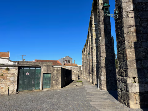
Aqueduct Trail – A path running along the Vila do Conde Aqueduct
From the Coastal Trail to the Camino Central: 12.9 km along the aqueduct from Vila do Conde to São Pedro de Rates. Route, stage, hostels, costs—explained honestly.
Read
