

Jakobsweg Saarbrücken
The Jakobsweg Saarbrücken extends the Nahe-Glan-Camino from Tholey Abbey to the Saar River: 45.7 kilometers via Marpingen, Illingen and Göttelborn, then down through the Saarkohlenwald forest to the Saar and over the Old Bridge to the Ludwigskirche. It is the final leg of the St. Wendel–Saarbrücken Way of St. James, opened in 2010 and conceived as the last piece of a Mainz–Metz pilgrim axis. Along the way you pass the oldest documented monastery on German soil, the "German Lourdes" and a headframe whose shaft was used for just six years. Two days are enough.
- 01At a Glance
- 02Overview
- 03Other Names
- 04Who It's Ideal For—and Who It's Not So Ideal For
- 05Route & Landscape
- 06Stages, Terrain, and Difficulty
- 07The Count Who Swapped His Santiago Vow for an Altar
- 08Highlights Along the Way
- 09How Pilgrims Find Their Way onto This Path
- 10Continue the pilgrimage?
- 11Preparation & Practical Information
- 12What the journey will cost you
- 13Getting Here
At a Glance
- Start / Finish: Edge of Tholey, arrival point of the Nahe-Glan-Camino / Ludwigskirche on Ludwigsplatz in Alt-Saarbrücken
- Length: 45.7 km
- Duration: 2 stages
- Elevation: ↗ 630 m / ↘ 821 m
- Highest point: 424 m at km 26.4, between Göttelborn and Holz
- Landscape: Schaumberg country, beech forests, old mining villages, the Saarkohlenwald
- Operator / Waymarking: Laid out in 2010 on the initiative of the St. James Society; the route uses existing hiking trails such as the Naheweg with its blue N
- Traces of St. James: The parish church of St. Jakob in Alt-Saarbrücken, heir to a St. James altar from 1356
- Accommodation: Youth hostels in Tholey and Saarbrücken, otherwise inns and hotels
- Connecting routes: Nahe-Glan-Camino (Süd-Route) and Nahe-Glan-Camino (Nord-Variante) in Tholey; toward Metz, the Jakobsweg Hornbach – Metz
- Best time: April to October
- Associations along the way: whole route: St. Jakobus-Gesellschaft Rheinland-Pfalz-Saarland e.V.
Overview
Both branches of the Nahe-Glan-Camino end in Tholey, at the abbey the St. James Society calls the "little Santiago" of the Nahe-Glan-Camino. This route picks you up there and takes you to the Saar in two days. It is the final leg of the St. Wendel–Saarbrücken Way of St. James, which pilgrims opened from October 22 to 24, 2010, with a three-day relay walk under the motto "Wendelinus und Jakobus machen sich auf den Weg …" ("Wendelin and James set out on the road …").
Over 46 kilometers, Saarland changes its face three times: first monastery country, then Marian pilgrimage in Marpingen, then coal country around Illingen and Göttelborn, and finally a forest that is being allowed to go wild again at the gates of the state capital. At the end you stand before the Baroque Ludwigskirche. A monastery from the year 634 at the start, a headframe from 1994 in the middle: 1,360 years lie between them, and not even 25 kilometers.
Other Names
At its opening, the route was called the Jakobsweg St. Wendel–Saarbrücken; the St. James Society describes it as the final section of the Mainz–Metz Way of St. James. Because the stretch up to Tholey now belongs to the Nahe-Glan-Camino, the Camino Ninja map lists the rest as a route of its own: Jakobsweg Saarbrücken. Along the way you follow sections of older hiking trails, such as the Schaumberg-Wanderweg and the Naheweg.
Who It's Ideal For—and Who It's Not So Ideal For
This route is ideal if you don't want the Nahe-Glan-Camino to end in Tholey but at a station with ICE and TGV trains. It's perfect for a pilgrimage weekend, for beginners, and for anyone who finds industrial heritage as fascinating as churches.
Honestly, though, it's not for you if you're looking for unbroken silence: between Illingen and Saarbrücken you cross the A 8, walk a stretch alongside the A 1 and often hear traffic in the Saarkohlenwald. It's not for you if you expect pilgrim hostels; there are none. And it's not for you if you want to arrive in the countryside: the last kilometers from Malstatt run through the city.
Route & Landscape
Tholey to Illingen (km 0–17.4): From the Abbey of St. Mauritius, the route crosses the Kupferberg to Marpingen, passes the Church of the Assumption and climbs into the Härtelwald to the spring chapel. Through beech forest and past ancient graves it reaches the heights near Urexweiler, which stays about a kilometer off the route. On a paved ridge road, a former Roman road, you reach Hüttigweiler and Illingen with its baroque parish church of St. Stephan.
Illingen to Saarbrücken (km 17.4–45.7): Up to the Bergkapelle, through the Merchtal valley to Merchweiler, under the A 8 to Göttelborn with its headframe. Just before Holz comes the highest point. Then the route plunges into the Saarkohlenwald, through the Steinbachtal valley, past the Neuhaus forester's lodge and the Kirschheck Naturfreunde hut, to the Rastpfuhl. Alongside Lebacher Straße you descend through Malstatt to the Saar, follow the north bank to the Old Bridge, cross the river and walk through Alt-Saarbrücken to the Ludwigskirche on Ludwigsplatz.
Stages, Terrain, and Difficulty
Two stages are enough. Distances from the Camino Ninja map, calibrated exactly to 45.7 km:
- Tholey → Illingen (17.4 km) — Marpingen, the Härtelwald and the Roman road along the heights.
- Illingen → Saarbrücken (Ludwigskirche) (28.3 km) — Göttelborn, highest point at km 26.4, then a long descent through the Saarkohlenwald, through Malstatt to the Saar and over the Old Bridge to the Ludwigskirche.
Nothing is technically difficult. The second stage drags on, though: between Holz and Malstatt lie a good 15 kilometers of forest with no village and nowhere to stop, so bring water and food.
The Count Who Swapped His Santiago Vow for an Altar
In 1356, Count John II of Saarbrücken was in a bind. He had vowed to make the pilgrimage to Santiago de Compostela and had never set off. Pope Innocent VI allowed him to commute the vow: instead of making the journey, the count endowed an altar to the Apostle James the Greater in his castle chapel.
The chapel was torn down in 1466, the new one took over the dedication to St. James two years later, and from there it passed on to today's parish church of St. Jakob in Alt-Saarbrücken, built from 1885 to 1887. That is also where the opening walk of this route ended in 2010. So the city's St. James church owes its name to a pilgrim who never left. You do it the other way around: you set off, and the altar is already waiting.
Highlights Along the Way
- Tholey Abbey (km 1.3) — mentioned in the will of Adalgisel Grimo dated December 30, 634; since 2020, three windows by Gerhard Richter have glowed in the choir.
- Marpingen (km 5.8) — on July 3, 1876, three eight-year-old girls saw an apparition of the Virgin Mary in the Härtelwald. During the Kulturkampf, Prussia sent in soldiers, and around 60 people were injured. In 1889, Margaretha Kunz, one of the three, wrote that it had been "eine einzige große Lüge" ("one single big lie"); the pilgrims kept coming anyway.
- Göttelborn — coal has been documented here since 1446. The 90-meter headframe was completed in 1994 and was considered the tallest in the world when it was built; the mine closed in 2000.
- Saarkohlenwald — since 1997, 1,011 hectares here have been allowed to grow wild again as a "Urwald vor den Toren der Stadt" ("primeval forest at the gates of the city").
- Old Bridge and Ludwigskirche — the bridge, built from 1546 to 1549 after Emperor Charles V was stuck for days, unable to cross the flooded Saar, now takes you across the river on foot. Beyond it waits the finish: the Ludwigskirche, built by Friedrich Joachim Stengel from 1762 to 1775 as a Baroque church on Ludwigsplatz.
How Pilgrims Find Their Way onto This Path
Almost everyone arrives on foot, via one of the two branches of the Nahe-Glan-Camino from Bingen am Rhein:
- Nahe-Glan-Camino (Süd-Route) — through the Glan valley via Kusel and St. Wendel to Tholey
- Nahe-Glan-Camino (Nord-Variante) — from Odernheim via Idar-Oberstein and Birkenfeld to Tholey
If you only want to walk this stretch, start at Tholey Abbey.
Continue the pilgrimage?
In Saarbrücken, the map ends, not the way. Back in 2010 it was meant to meet the Speyer–Metz Way of St. James at the Old Bridge, and our map now crosses that very bridge. This is where that route's northern branch begins; it crosses the border and joins the southern branch at Cocheren on the Hérapel; from there it's another 72 kilometers to Metz Cathedral. Our Jakobsweg Hornbach – Metz, however, traces the southern branch via Sarreguemines, and its line never comes closer than about eight kilometers to this route. So you'll need to plan the northern branch from Saarbrücken to the Hérapel yourself.
Preparation & Practical Information
Pilgrim passport and app. As on every Way of St. James, a pilgrim passport (credencial) is recommended; you can get stamps at parish offices, at the abbey and at many inns. It's best to order it online in advance so it reaches you in time for the start of your trip. There is no Compostela for this route; only the last 100 kilometers before Santiago count for that. The easiest way to plan is right in the Camino Ninja App, where you can put together your stages and plan suitable accommodation at the same time.
Waymarking and accommodation. The signage dates from 2010 and partly follows existing hiking trails, so download the track. Tholey has a youth hostel and the abbey guesthouse, Illingen has inns and hotels, and Saarbrücken has the Europa youth hostel and plenty of hotels.
What the journey will cost you
Budget 60 to 90 € a day (as of October 2026). The youth hostels in Tholey and Saarbrücken charge per person per night, breakfast included, 33.80 € in a dorm and 42.20 € in a double room, or 57.20 € for a room to yourself; if you stay only one night, add 5 € (as of October 2026). Inns and hotels usually charge 60 to 90 € for a single room with breakfast (as of October 2026). The abbey, the churches and the Saarkohlenwald are free to visit.
Getting Here
To the start (Tholey): Tholey has no train station. The nearest is St. Wendel on the Nahe Valley Railway between Mainz and Saarbrücken; from there it's a good ten kilometers to Tholey by bus or taxi.
Along the way: Illingen has a train station, handy if you want to split the route or walk just one stage.
From the finish (Ludwigskirche): It's about 1.5 kilometers on foot to the main station; Saarbahn trams and buses serve the city center. From there, ICE and TGV trains run to Frankfurt, Mannheim and Paris, and regional trains to Metz.
Partners
Partner for Jakobsweg Saarbrücken
Camino Ninja is cooperating with official partners. For this camino the partner is:


Get your pilgrim credential and shell
Everything you need for the Jakobsweg Saarbrücken, shipped to your door.
Visit Camino Shop
Other Caminos
 Ansbacher Jakobsweg
From Weihenzell via Ansbach, Feuchtwangen, Dinkelsbühl, Ellwangen and the Ostalb to Ulm and Oberdischingen: 9 stages, monasteries, imperial cities and the watershed between the Kocher and the Brenz.
Read- Appenzeller Weg
Appenzeller Weg
52.6 km from Rankweil across the Rhine to St. Peterzell: St. James Chapel (1464), 163 Years of the Wedding Trail, connection to the Via Jacobi. Stages, costs, how to get there.
Read 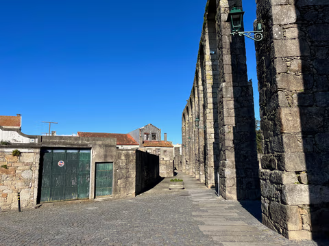
Aqueduct Trail – A path running along the Vila do Conde Aqueduct
From the Coastal Trail to the Camino Central: 12.9 km along the aqueduct from Vila do Conde to São Pedro de Rates. Route, stage, hostels, costs—explained honestly.
Read
