

Town on the Camino
O Porto do Barqueiro
Spain
- places to stay
- 4
- Camino
- 1
- Elevation
- 64 m
O Porto do Barqueiro has the ferryman in its name: until 1901 a barqueiro carried people across the ría. Today you cross the iron bridge, have a coffee at the harbour under colourful houses and look over to the Bares peninsula, the northernmost tip of Iberia.
Right now in O Porto do Barqueiro (as of September 2026)
In September 2026 pilgrims reported that the path over the Bares peninsula is overgrown in places and hard to find. The road as an alternative has a lot of traffic and no hard shoulder. The detour is not part of the official route.
How long to stay?
A break is enough. According to Camino Ninja, O Porto do Barqueiro is only 4.1 kilometres beyond O Vicedo, so for most people it is a morning stop. A coffee at the harbour, a look at the boats and the houses on the slope, then on towards Loiba. If you have time for Estaca de Bares, better plan a day of its own for it.
O Porto do Barqueiro in Ninja numbers
- 124.5 kilometres lie between Ribadeo and O Porto do Barqueiro, according to Camino Ninja, and there are still 147.5 to Ferrol.
- In 1895 the harbour was declared a port of refuge and got a 116-metre-long mole.
- Since 1930 the village has had its own station on the narrow-gauge railway.
- In 2007 only 15 shellfish gatherers were left, after the peak in the 1970s to 1990s.
Arriving: over the iron bridge
From O Vicedo you cross the old iron bridge at the end of the ría, which replaced the ferry in 1901. Here the Sor is the border between the provinces of Lugo and A Coruña: with your last step on the bridge you are in the municipality of Mañón. The village lies deep in the Ría do Barqueiro, on the southern edge of the Bares peninsula.
In brief: a village that lived from crossing
The place began as the anchorage of the ferry that carried people and goods across to O Vicedo. In the 18th century it was almost as busy as Bares and lived from sardine fishing; in 1847 the parish counted three sardine works, mills and two taverns. The canned fish disappeared, later salt, coal, timber and kaolin were loaded here. Today people live from tourism, fishing and shellfish gathering.
At the harbour: what to see
The village is small, you see everything on your way through.
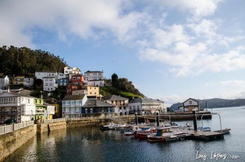
- Harbour and houses: Low, colourful houses climb the slope above the harbour and stretch along the waterfront promenade. Fishing boats lie in the harbour and go out almost every day, among other things for hake, clams and cockles. The mole of 1895 still protects them.
- The iron bridge: The three wrought-iron spans have been open only to pedestrians since the 1980s. Next to it you see the railway bridge from the 1960s and the road bridge from the 1980s, three generations of crossings side by side.
- Estaca de Bares: The northernmost point of the Iberian Peninsula lies north of the village. The imaginary border between the Atlantic and the Cantabrian Sea runs here, and in late summer and early autumn millions of migratory birds pass by. The way there is an outing of its own, not a detour at the edge of the stage.
Honestly
- No pilgrim bed. According to Camino Ninja, the nearest pilgrim hostel is 25.2 kilometres back in Viveiro, and as far as we know there is none towards Ferrol. In the village there are hostales and a hotel.
- The Bares detour is tiresome. In September 2026 pilgrims found the path overgrown and the road dangerous. Some took a taxi to the harbour of Bares.
- It gets expensive at the harbour of Bares. One pilgrim found two beach shacks there with proud prices for seafood.
Ninja tips
- Buy supplies here. In September 2026 one pilgrim stocked up for the day at the village supermarket. Until Ortigueira, supplies are thin.
- Take the train if you have to stop. Barqueiro station is on the narrow-gauge railway, and in September 2026 pilgrims went back from here by train.
- Sit on the bench in Loiba. At kilometre 131, right on the way, stands the bench that is said to be the most beautiful in the world, with a view from Estaca de Bares to Cabo Ortegal. Early in the morning you are more likely to have it to yourself.
Onward: to the cliffs of Loiba
It is 20.7 kilometres to Ortigueira, according to Camino Ninja. On the way lie the cliffs of Loiba with their famous bench and Espasante with its lookout post above the harbour. Beyond Ladrido the waymarking of the Camino Natural del Cantábrico ends, and the last stretch leads through villages in the hinterland. The Camino del Mar then reaches the wide ría of Ortigueira.
Where to stay in O Porto do Barqueiro
Places to stay in O Porto do Barqueiro.
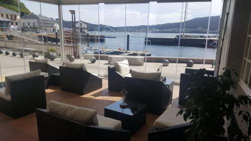 OpenReservations accepted
Hostal O Forno
 OpenReservations accepted
Hostal La Marina
 OpenReservations accepted
Hotel Porto do Barqueiro
Town 10 of 17