

Caminho dos Candeeiros
The Caminho dos Candeeiros is the youngest and most mountainous approach to the Sanctuary of Fátima: 63.3 kilometers from the salt pans of Rio Maior straight through the Serras de Aire e Candeeiros Natural Park. It is not a Way of St. James but one of the Caminhos de Fátima, certified by the Centro Nacional de Cultura in 2024 and walkable in three days. Along the way you pass a dolmen inside a village church, the rock cirque of the Fórnea, the karst villages of Arrimal, Mendiga and Alvados, and finally the high plateau of São Mamede. In Alvados it meets the Caminho da Nazaré, and over the last kilometers the Caminho do Tejo.
- 01At a Glance
- 02Overview
- 03Other Names
- 04Who It's Ideal For—and Who It's Not So Ideal For
- 05Route & Landscape
- 06Stages, Terrain, and Difficulty
- 07A May 13, 770 Years Before Fátima
- 08Highlights Along the Way
- 09How Pilgrims Find Their Way onto This Path
- 10Continue the pilgrimage?
- 11Preparation & Practical Information
- 12What the journey will cost you
- 13Getting Here
At a Glance
- Start / Finish: Rio Maior (city park on the Rio Maior) / Sanctuary of Fátima
- Length: 63.3 km
- Duration: 3 stages as divided by the operator, 4 at a relaxed pace
- Elevation: ↗ 1,332 m / ↘ 1,054 m
- Highest point: 525 m at km 38.7, between Lugar da Feteira and Fradilhão in the Serra dos Candeeiros
- Landscape: limestone massif with dry-stone walls, sinkholes and holm oaks; salt pans at the start, high plateau at the finish
- Waymarking: Caminhos de Fátima signs, blue arrows where they are missing; laid out by the municipalities of Rio Maior and Porto de Mós
- Traces of Fátima: the church of Nossa Senhora da Consolação in Alvados, the Marian shrine of Fetal as a side trip, and at the finish the Capelinha das Aparições; there are no traces of St. James
- Accommodation: hotels in Rio Maior and Fátima, holiday homes around Casais Monizes and Mendiga, a youth hostel in Alvados; no classic pilgrim hostels
- Connecting routes: Caminho da Nazaré (shared from Alvados), Caminho do Tejo (the last 2.3 km)
- Best time: March to June and September to October; avoid the Fátima pilgrimage days around May 13 and October 13 or book well in advance
- Pilgrim passport / certificate: Credencial of the Caminhos de Fátima, with its own certificate since 2026; no Compostela
Overview
Most routes to Fátima avoid the mountains; the Caminho dos Candeeiros goes looking for them. From Rio Maior it climbs into the Serras de Aire e Candeeiros Natural Park, protected since 1979, and stays in the limestone for two days: dry-stone walls, threshing floors, holm oaks and rosemary. Villages like Casais Monizes, Arrimal and Mendiga lie far apart, and the water disappears into the rock.
You start at a well whose brine is seven times saltier than the sea, and you end at the place where three shepherd children were tending sheep in 1917. In between lie 63.3 kilometers and more climbing than the distance suggests. The route is young: Rio Maior announced it in January 2021, and the Centro Nacional de Cultura added it as a certified Caminho de Fátima in the fall of 2024. To be upfront: it is not a Way of St. James, and there is no Compostela at the end. Camino Ninja includes it because many Santiago pilgrims in Portugal plan a detour to Fátima.
Other Names
In Portuguese the route is called Caminho dos Candeeiros; the operator's English name is Candeeiros Route. It belongs to the network of the Caminhos de Fátima, whose trademark is owned by the Centro Nacional de Cultura. The name comes from the mountains, not from lanterns along the way: the Serra dos Candeeiros is the ridge between Ribatejo and Oeste that you cross on the first and second days. Don't confuse it with the Caminho da Nazaré, which crosses the same limestone massif farther north and shares the same track from Alvados.
Who It's Ideal For—and Who It's Not So Ideal For
The route is ideal if you want mountains rather than asphalt on your way to Fátima: three days of nature, views all the way to the sea, hardly any other pilgrims. It suits anyone coming from Lisbon or the west coast who wants to reach Fátima on foot without sharing the national roads.
Honestly, though, it's not for you if you expect easygoing pilgrim days with a hostel and a café every few kilometers. The second day is almost 30 kilometers long, and the operator rates it "very hard." There are no pilgrim hostels, water is often only available in the villages, and shade is scarce on the limestone plateaus. Porto de Mós councilor Eduardo Amaral said it openly at the 2024 launch: „Não é um caminho para o peregrino ‚normal‘“ – not a route for the "normal" pilgrim.
Route & Landscape
Rio Maior to Casais Monizes (km 0–18.0): From the city park by the river, after a good four kilometers you pass the salt pans, then continue via Vale da Laranja and Portela de Teira into the natural park from the south. In Alcobertas (km 13.5) the dolmen stands inside the church, and by the stream rises the Olho de Água, one of the few year-round springs in the limestone massif. Then the route climbs hard to Casais Monizes (km 18.0) at around 360 meters.
Casais Monizes to Fátima (km 18.0–63.3): Via Casal de Vale de Ventos up to over 460 meters, then down to the lagoons of Arrimal (km 26.7), where you cross into the municipality of Porto de Mós, and on via Bemposta to Mendiga (km 32.1). Then comes the heart of the route: up to the highest point (525 m, km 38.7), through the rock cirque of the Fórnea and steeply down to Alvados (km 47.6) at just over 250 meters. From here you walk with the Caminho da Nazaré via Barrenta, Bouceiros and Pia de Urso (km 57.2) onto the São Mamede plateau. For the last 2.3 kilometers the Caminho do Tejo joins in before you reach the Sanctuary of Fátima.
Stages, Terrain, and Difficulty
We show the route in the operator's three stages. Distances come from the Camino Ninja map, calibrated exactly to 63.3 km. If you want to split the long second day, stay overnight in or near Mendiga (km 32.1) and walk four days of 14 to 18 kilometers each.
- Rio Maior → Casais Monizes (18.0 km) — salt pans, Alcobertas with its dolmen chapel, then the first stiff climb into the Serra dos Candeeiros.
- Casais Monizes → Alvados (29.6 km) — the queen stage via Arrimal and Mendiga to the highest point (525 m) and down through the Fórnea; rated "very hard" by the operator.
- Alvados → Fátima (15.7 km) — climb into the Serra de Aire, then gently via Pia de Urso and the São Mamede plateau to the sanctuary.
Nothing is technically difficult, but the surface alternates between dirt tracks, limestone gravel and asphalt, the climbs are short and steep, and most of the 1,332 meters of ascent come on the first two days.
A May 13, 770 Years Before Fátima
Just over one and a half kilometers off the route, on a hilltop near Arrimal, a stone triumphal arch stands in the middle of nowhere: the Arco da Memória, about five meters high and six meters wide. It marks the boundary of the lands of the Alcobaça monastery. King Afonso Henriques is said to have vowed here, on his way to Santarém, to give the Cistercians of St. Bernard everything „tudo quanto via com os olhos dali até ao mar“ – everything he could see from here to the sea – if his conquest succeeded. In 1153 the monks received their land, and Alcobaça became one of the largest monasteries in Europe.
The Latin inscription, composed by the monk and chronicler Bernardo de Brito in the early 17th century, dates the vow to May 13, 1147. The only snag: Santarém had already fallen on March 15, 1147. The vow is dated, just unfortunately two months after the victory it was made for. Historians therefore consider it a monastic legend. After the revolution of 1820 the arch was torn down; its west side has read ever since: „REEDIFICADO POR MANDADO DO MVITO ALTO E PODEROZO REI O SENHOR D. MIGVEL PRIMEIRO NO ANNO DE 1830.“
For Fátima pilgrims, the arch carries a quiet punchline: here a king makes a vow on May 13, 770 years before the first apparition in the Cova da Iria on May 13, 1917. And the Centro Nacional de Cultura, which runs the Caminhos de Fátima today, was founded on May 13, 1945. You'll have to plan the side trip to the arch yourself; according to the map it lies about 1.7 km off the route at km 24.9.
Highlights Along the Way
- Rio Maior salt pans (near km 4) — salt gardens far inland: a well just under nine meters deep brings up brine seven times saltier than seawater; 470 pans, and wooden huts with wooden locks, because salt eats iron. As early as 1177, Pêro Baragão and Sancha Soares sold a share of the well to the Templars.
- Roman villa of Rio Maior — discovered in 1983, with mosaics from the 2nd or 3rd century.
- Anta-Capela of Alcobertas (km 13.5) — a dolmen from around 3000 BC, converted in the 17th century into a side chapel of the church of Santa Maria Madalena, protected since 1957.
- Casais Monizes (km 18.0) — threshing floors and dry-stone architecture at one of the highest points in the municipality.
- Lagoons of Arrimal (km 26.7) — rainwater collected in limestone hollows, rare open water in the karst.
- Fórnea (around km 42.6) — a rock cirque about 500 meters across and 250 meters deep; after heavy rain a waterfall plunges down here.
- Grutas de Alvados and Grutas de Santo António — two show caves near Alvados, discovered by quarry workers in 1964 and 1955.
- Pia do Urso (km 57.2) — a stone village restored in 2016, home to Portugal's first sensory park for blind visitors; the name recalls rock basins bears are said to have drunk from.
- Sanctuary of Fátima (km 63.3) — the Capelinha das Aparições on the site of the 1917 apparitions; Francisco and Jacinta Marto were canonized on May 13, 2017.
How Pilgrims Find Their Way onto This Path
Rio Maior lies on no waymarked feeder route and on no Way of St. James. Most people arrive by bus from Lisbon. The municipality planned the town as a meeting point for Fátima pilgrims from the Oeste and greater Lisbon, who until then had walked along country roads.
If you're on the Central Portuguese Way, the closest point to Rio Maior is Santarém, about 24 km away as the crow flies, but with no waymarked connection; the best way to bridge the gap is by bus. If you want to walk from Lisbon to Fátima, the Caminho do Tejo is a dedicated, continuous Fátima route that follows the Central as far as Santarém.
Continue the pilgrimage?
The route ends in Fátima, not in Santiago. Five other Fátima routes converge here, and two share kilometers with the Candeeiros:
- Caminho da Nazaré — from the Atlantic coast; shared from Alvados to Fátima
- Caminho do Tejo — from Lisbon along the Tagus; the last 2.3 kilometers shared
- Rota de Tomar — from the Templar town of Tomar on the Central Portuguese Way
- Rota da Sertã — from the pine country northeast of Tomar via Ourém
- Rota de Abrantes — from the Tagus at Abrantes via Torres Novas
- Caminho do Norte (Valença – Fátima) — from the Spanish border, following the Central as far as Venda do Negro
To get to Santiago, two sensible routes lead from Fátima back to the Central Portuguese Way. Either walk the Rota de Tomar in reverse, 30.8 km to Tomar, and follow the yellow arrows from there; from Tomar it's still about 465 km to Santiago on the Central. Or walk the Caminho do Norte against its direction via Ourém and Freixianda, 57 km to Venda do Negro, where it meets the Central, leaving you about 426 km to go. Both run against the Fátima waymarking – take the track with you.
Preparation & Practical Information
Pilgrim passport and app. Instead of the Santiago credencial, you need the Credencial of the Caminhos de Fátima. It costs a voluntary donation of 2 € and is available from the Centro Nacional de Cultura in Lisbon, by mail, in Camino hostels, in the cathedrals of Lisbon and Porto and in tourist offices. It's best to order it in advance so it reaches you in time for the start; you get a stamp at every stop. Since March 2026 the Centro Nacional de Cultura has issued its own certificate for a donation of 7 €, provided the start and finish stamps are clearly visible. Since October 13, 2026, the sanctuary itself has also been selling its own credencial, "Via Pacis," for 2 € (in its shops and online); the matching certificate will be available from November 29, 2026, and requires at least 13 kilometers on foot. There is no Compostela. The easiest way to plan is right in the Camino Ninja App, where you put your stages together and plan suitable accommodation at the same time.
Season and accommodation. The route is at its most beautiful in spring, when the limestone blooms green and yellow, and in the fall. In summer the plateaus are hot and shadeless; in winter it often rains. Around May 12 and 13 and October 12 and 13, Fátima hosts its great annual pilgrimages – rooms are scarce and expensive then, and the sanctuary puts up walking pilgrims for free in tents and halls. There are no pilgrim hostels on the route: in Alvados a 48-bed youth hostel explicitly welcomes pilgrims, and around Casais Monizes and Mendiga there are country houses you book ahead. In Fátima, walking pilgrims with a credencial and at least two stamps, one of them from outside the municipality of Ourém, get a bed at the Casa de Retiros Nossa Senhora das Dores; showers are free.
What the journey will cost you
Budget 50 to 80 € a day (as of October 2026), since there are no pilgrim hostels. In Rio Maior a double room costs about 55 to 65 €, at the Alvados youth hostel prices start at 16 €, and country houses in Alvados run 85 € and up. In Fátima you'll find simple rooms from about 21 to 35 €, and a bed at the sanctuary's Casa de Retiros costs 10 € a night (as of October 2026).
A set lunch in the villages costs about 10 to 14 € (as of October 2026). Add the credencial, the certificate and about 7.60 € admission if you visit the Grutas de Alvados.
Getting Here
Getting there and back. Rio Maior has no train station. Rede Expressos buses run from the Sete Rios bus station in Lisbon to Rio Maior in just over an hour; Lisbon airport is connected to Sete Rios by metro. From Fátima, long-distance buses run directly to Lisbon and Porto. The "Fátima" train station is about 20 km from the sanctuary.
- Long-distance bus: rede-expressos.pt — Lisbon–Rio Maior and Fátima–Lisbon/Porto
- Operator: caminhosdefatima.org — stage sheets, GPX track and credencial
Partners
Partner for Caminho dos Candeeiros
Camino Ninja is cooperating with official partners. For this camino the partner is:


Get your pilgrim credential and shell
Everything you need for the Caminho dos Candeeiros, shipped to your door.
Visit Camino Shop
Other Caminos
Ansbacher Jakobsweg
Ansbacher Jakobsweg
From Weihenzell via Ansbach, Feuchtwangen, Dinkelsbühl, Ellwangen and the Ostalb to Ulm and Oberdischingen: 9 stages, monasteries, imperial cities and the watershed between the Kocher and the Brenz.
ReadAppenzeller Weg
Appenzeller Weg
52.6 km from Rankweil across the Rhine to St. Peterzell: St. James Chapel (1464), 163 Years of the Wedding Trail, connection to the Via Jacobi. Stages, costs, how to get there.
Read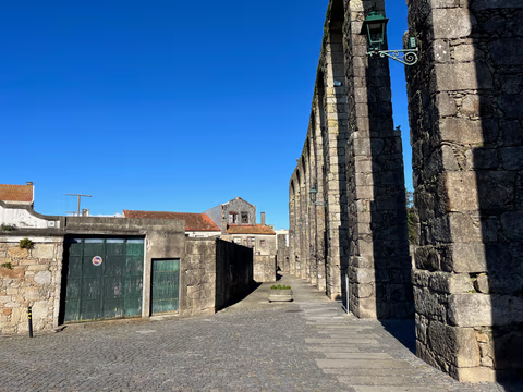
Aqueduct Trail – A path running along the Vila do Conde Aqueduct
From the Coastal Trail to the Camino Central: 12.9 km along the aqueduct from Vila do Conde to São Pedro de Rates. Route, stage, hostels, costs—explained honestly.
Read
