

Caminho do Médio Tejo – Rota de Tomar
The Rota de Tomar is the shortest of the Fátima routes on Camino Ninja: 30.8 kilometers from the Templar town of Tomar to the Cova da Iria, walkable in one long day or two short ones. It is not a Way of St. James but a pilgrimage route of the Caminhos de Fátima, with blue arrows and its own credencial. Its forerunner was laid out in 2015 expressly for Santiago pilgrims who leave the Central Portuguese Way in Tomar for a detour. Just before the finish it passes through Aljustrel, the village of the three shepherd children.
- 01At a Glance
- 02Overview
- 03Other Names
- 04Who It's Ideal For—and Who It's Not So Ideal For
- 05Route & Landscape
- 06Stages, Terrain, and Difficulty
- 07A Fátima Route Built for Santiago Pilgrims
- 08Highlights Along the Way
- 09How Pilgrims Find Their Way onto This Path
- 10Continue the pilgrimage?
- 11Preparation & Practical Information
- 12What the journey will cost you
- 13Getting Here
At a Glance
- Start / Finish: Tomar / Sanctuary of Fátima (Cova da Iria)
- Length: 30.8 km
- Duration: 1 long day or 2 short stages
- Elevation: ↗ 592 m / ↘ 314 m
- Highest point: 350 m at km 27.3, between Canhardo and Aljustrel
- Landscape: Rolling hills along the Nabão, olive slopes, and finally the limestone of the Serra de Aire
- Waymarking: Blue arrows
- Traces of St. James: none along the route; Tomar is a stage town on the Central Portuguese Way. Marian traces: Valinhos, Aljustrel, Capelinha
- Accommodation: Tomar, one small hostel in Fungalvaz, and in Fátima the sanctuary's pilgrim beds plus plenty of hotels
- Connecting routes: Central Portuguese Way in Tomar; for the last stretch, shared with Caminho do Médio Tejo – Rota de Abrantes and Caminho do Médio Tejo – Rota da Sertã
- Best time: Spring and fall; its own credencial, no Compostela
Overview
Tomar and Fátima are less than 25 kilometers apart as the crow flies. In Tomar, Gualdim Pais built the Templar castle around 1160; from 1319 it was the seat of the Order of Christ, and since 1983 it has been a World Heritage Site. In Fátima, three shepherd children saw the apparitions in 1917 that today draw around 6.5 million people a year to the Cova da Iria. The Rota de Tomar links the two over 30.8 kilometers, through hamlets like Fungalvaz and finally through Aljustrel, where the children grew up.
Let's be honest up front: this is not a Way of St. James. You follow blue arrows instead of yellow ones, and there's no Compostela at the end. Camino Ninja includes the route because many Santiago pilgrims on the Central spend the night in Tomar anyway. For them it's a one-day detour that trades Templars for shepherd children.
Other Names
At the Centro Nacional de Cultura the route is officially called Caminho do Médio Tejo – Rota de Tomar, in English Tomar Route; since 2024 it has been one of three branches of the Caminho do Médio Tejo. Older maps and forums call the same connection Caminho Nascente, the "Sunrise Way," because it comes from the east. Not to be confused with the Via Portugal Nascente, a Way of St. James from the Algarve to Trancoso.
Who It's Ideal For—and Who It's Not So Ideal For
The route is ideal if you're walking the Central and want to take in Fátima without investing a whole week. It's also ideal as a weekend pilgrimage from Lisbon: train to Tomar, one day on foot, evening in the Cova da Iria.
Honestly, though, it's not for you if you don't want to walk 30 kilometers in one go and the single hostel in Fungalvaz doesn't suit you: there are hardly any beds in between. Not for you if you're collecting Compostelas. And not for asphalt-haters: the operator describes the surface as "earth and asphalt."
Route & Landscape
The route starts in Tomar below the Convento de Cristo and, according to the operator, first follows the Aqueduto dos Pegões out of town. Then it turns rural: gardens, fields and olive slopes around Uchas and Brasões, a valley floor at Fagulhos (93 m), and the chapel of Fungalvaz.
From Lagoa do Furadouro (km 16.2) the route climbs noticeably. Via Outeiro das Matas and Canhardo you reach the edge of the Serra de Aire, the limestone massif of Estremadura: dry-stone walls, holm oaks, karst ground. After the high point at km 27.3 the route drops gently to Aljustrel and the sanctuary. From km 24.2 you share the trail with the route from Abrantes, and from km 27.1 also with those from the Sertã and from the north.
Stages, Terrain, and Difficulty
Most people walk the Rota de Tomar in a single day, as the operator intends: around seven hours. If you prefer a gentler pace, split it in Fungalvaz. Distances come from the Camino Ninja map, calibrated exactly to 30.8 km.
- Tomar → Fungalvaz (9.3 km) — short opener past the aqueduct; hostel by the chapel.
- Fungalvaz → Fátima (21.5 km) — climb into the Serra de Aire, then Aljustrel and the Cova da Iria.
Nothing is technically difficult, yet the operator rates the route "difícil" because of its length and terrain and quotes 1,260 meters of elevation; our map measures 592 meters of ascent. Water and coffee are available only in the villages.
A Fátima Route Built for Santiago Pilgrims
Most Fátima routes were created for Portuguese pilgrims who were heading to Fátima anyway. Not this one: in April 2015 the Associação de Amigos dos Caminhos de Fátima, a volunteer association founded in 2008, waymarked 29.4 kilometers from Tomar to Fátima, according to Portuguese Wikipedia mainly for Santiago pilgrims passing through Tomar. In May of that same year, Portugal was debating pilgrims on national highways after a series of fatal accidents. In 2019 a hiking blogger praised the routes as "delineados e excelentemente marcados pela Associação de Amigos dos Caminhos de Fátima" – exemplary in layout and waymarking.
Then the authorities stepped in. In 2021 the Comunidade Intermunicipal do Médio Tejo, with 13 municipalities and EU funding, launched a project for safe footpaths to Fátima under the funding line "Turismo Religioso: Fátima | Tomar"; the same body had previously waymarked the Way of St. James between Vila Nova da Barquinha and Ferreira do Zêzere. On August 1, 2024, the Centro Nacional de Cultura presented the result: three branches, from Tomar, the Sertã and Abrantes. Ever since, two arrow colors in Tomar point in two directions: yellow north to the Apostle, blue west to the Mother of God.
Highlights Along the Way
- Convento de Cristo, Tomar (km 0) — Templar castle and convent of the Order of Christ, a World Heritage Site.
- Aqueduto dos Pegões — approved in 1593, first section completed in 1614; commissioned by Philip II of Spain as Grand Master of the Order of Christ. A national monument since 1910.
- Fungalvaz (km 9.3) — a plain village chapel and the only hostel along the way.
- Valinhos and Loca do Cabeço — next to Aljustrel: the angel in 1916, and on August 19, 1917, the fourth apparition, because the children had been held in Ourém on the 13th. The monument was paid for by Hungarian Catholics.
- Aljustrel (km 28.8) — birthplaces of Lúcia (1907) and the Marto siblings; the Marto house has belonged to the sanctuary since 1996.
- Santuário de Fátima (km 30.8) — Capelinha das Aparições, Basilica of the Rosary, Church of the Most Holy Trinity.
- Nossa Senhora da Ortiga — not on our trail, but on the operator's main variant: a place of pilgrimage since around 1758, granted an indulgence by Pius VII in 1801, long before 1917.
How Pilgrims Find Their Way onto This Path
Almost everyone arrives via the Central Portuguese Way: Tomar lies at km 155.0 from Lisbon, between Golegã and Alvaiázere. Others come straight in by train. All the Fátima routes converge in Fátima:
- Caminho do Médio Tejo – Rota de Abrantes — Médio Tejo branch, on the same trail from km 24.2
- Caminho do Médio Tejo – Rota da Sertã — Médio Tejo branch, shared from km 27.1
- Caminho do Tejo — from Lisbon, on the Central as far as Santarém
- Caminho da Nazaré — from the Atlantic
- Caminho dos Candeeiros — from Rio Maior
- Caminho do Norte (Valença – Fátima) — from the Spanish border, long stretches on the Central
Continue the pilgrimage?
The Rota de Tomar ends in Fátima, not in Santiago. The easiest option is to take the bus back to Tomar in about 40 minutes and continue north on the Central Portuguese Way.
On foot, you take the Caminho do Norte in reverse: via Ourém and Caxarias to Venda do Negro between Alvaiázere and Ansião, where it meets the Central after about 57 kilometers. The blue arrows will point against your direction of travel, which is no problem with the track in the app; from Venda do Negro you follow yellow again.
Preparation & Practical Information
Credencial and app. Instead of the Compostela there is a separate credencial from the Centro Nacional de Cultura for a 2 € donation, available at the CNC in Lisbon, by mail, in cathedrals and at some hostels; the CNC certificate costs a 7 € donation and requires stamps from the start and the finish. Since October 13, 2026, the sanctuary has also been selling a credencial, "Via Pacis," for 2 €; its certificate will be available from November 29, 2026, and requires at least 13 kilometers on foot. Rector Carlos Cabecinhas: "Aquilo que distingue a peregrinação de uma outra deslocação é a sua motivação." – What sets a pilgrimage apart from any other journey is its motivation. The easiest way to plan is in the Camino Ninja App, where you can put together your stages and line up suitable accommodation at the same time.
Season and accommodation. In summer, set off early, or the climb will land in the midday heat. Avoid May 12–13 and October if you want a quiet room. Year-round, the sanctuary takes in walking pilgrims at the Casa de Retiros de Nossa Senhora das Dores: no reservation, up to three nights, with at least two stamps, one of them from outside the municipality of Ourém – the one from Tomar will do.
What the journey will cost you
A pilgrim bed at the sanctuary costs 10 €, the hostel in Fungalvaz 5 € according to our database, and a dorm bed in Tomar around 26 € (as of October 2026). Simple hotels in Fátima start at about 28 to 45 €, guesthouses in Tomar at 40 to 55 €. Food included, you'll get by on 40 to 70 € for the whole route; add the admission to the Convento de Cristo.
Getting Here
There and back. You can reach Tomar from Lisbon on a CP train in about two hours; the Ramal de Tomar branch line opened in 1928. The station called Fátima is about 20 kilometers from the sanctuary, so for the return trip take a long-distance bus to Lisbon, Porto or Tomar.
- Portuguese railways: cp.pt — Lisbon–Tomar
- Long-distance buses: rede-expressos.pt — from Fátima
- Operator and credencial: caminhosdefatima.org
Partners
Partner for Caminho do Médio Tejo – Rota de Tomar
Camino Ninja is cooperating with official partners. For this camino the partner is:

Popular towns on the Caminho do Médio Tejo – Rota de Tomar
Picked by our team, in walking order.

Get your pilgrim credential and shell
Everything you need for the Caminho do Médio Tejo – Rota de Tomar, shipped to your door.
Visit Camino Shop
Other Caminos
Ansbacher Jakobsweg
Ansbacher Jakobsweg
From Weihenzell via Ansbach, Feuchtwangen, Dinkelsbühl, Ellwangen and the Ostalb to Ulm and Oberdischingen: 9 stages, monasteries, imperial cities and the watershed between the Kocher and the Brenz.
ReadAppenzeller Weg
Appenzeller Weg
52.6 km from Rankweil across the Rhine to St. Peterzell: St. James Chapel (1464), 163 Years of the Wedding Trail, connection to the Via Jacobi. Stages, costs, how to get there.
Read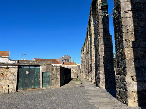
Aqueduct Trail – A path running along the Vila do Conde Aqueduct
From the Coastal Trail to the Camino Central: 12.9 km along the aqueduct from Vila do Conde to São Pedro de Rates. Route, stage, hostels, costs—explained honestly.
Read
