

Caminho do Norte
The Caminho do Norte is the longest of the Fátima routes: 368.7 kilometers from the border bridge in Valença to the Capelinha das Aparições in Fátima. For the first 311 kilometers you walk almost entirely on the route of the Central Portuguese Way – only heading south, with blue arrows ahead of you and the yellow arrows of the Santiago pilgrims at your back. Along the way lie Ponte de Lima, Barcelos, Porto, Coimbra and the limestone hills of Sicó; only beyond Ansião does the route strike out on its own paths via Freixianda and Ourém into the Cova da Iria.
- 01At a Glance
- 02Overview
- 03Other Names
- 04Who It's Ideal For—and Who It's Not So Ideal For
- 05Route & Landscape
- 06Stages, Terrain, and Difficulty
- 07Walking the Camino Backwards – on Purpose
- 08Highlights Along the Way
- 09How Pilgrims Find Their Way onto This Path
- 10Continue the pilgrimage?
- 11Preparation & Practical Information
- 12What the journey will cost you
- 13Getting Here
At a Glance
- Start / Finish: Valença, at the foot of the fortress by the bridge to Tui / Capelinha das Aparições in the Santuário de Fátima
- Length: 368.7 km
- Duration: 16 stages; the operator plans for 17 days
- Elevation: ↗ 4,664 m / ↘ 4,352 m
- Highest point: 391 m at km 22.9, on the Portela Grande above Labruja
- Landscape: Vine pergolas and cornfields in the Minho, the suburbs around Porto, the Bairrada wine country, and finally limestone hills, olives and oak woods
- Waymarking: Blue arrows and the holm-oak emblem, on the same route as the yellow Santiago arrows as far as Venda do Negro – just in the opposite direction
- Traces of Mary and St. James: São Pedro de Rates, consecrated by St. James himself according to legend; the tomb of the pilgrim queen Isabel in Coimbra, where Lúcia, the eldest of the seer children, also lived in the Carmel for 57 years; at the end Valinhos, Aljustrel and the Capelinha
- Accommodation: as far as Ansião, the Camino's hostel network with pilgrim hostels from 5 €; after that, all the way to Fátima, only guest rooms, country houses and hotels
- Connecting routes: Central Portuguese Way (shared as far as Venda do Negro), Portuguese Coastal Way (in Valença and before Porto), Caminho do Médio Tejo – Rota da Sertã (shared from km 342.9)
- Best time / Pilgrim passport: April to June and September to October; a separate credencial of the Caminhos de Fátima, no Compostela
Overview
Anyone looking across the bridge from Valença to Tui usually sees a beginning: for tens of thousands of Santiago pilgrims, Galicia starts on the far side of the Minho. The Caminho do Norte turns that around. It starts at the foot of the fortress of Valença and runs 368.7 kilometers south, through the Minho region, through Porto and Coimbra all the way to Fátima. For the first 311 kilometers it is almost entirely the Camino Portugués Central, just walked against the flow. You walk Portugal's most popular Camino backwards – and every morning you meet pilgrims heading exactly where you came from.
Let's be honest up front: it is not a Way of St. James but one of the Caminhos de Fátima, a network the Centro Nacional de Cultura has been building since 1996. At the end there is no Compostela, but a stamp from the Cova da Iria, where three shepherd children experienced the apparitions in 1917. It was built to get walking pilgrims off the national highways – onto a path pilgrims have known since the Middle Ages.
Other Names
On the guidebook that the Centro Nacional de Cultura presented at the sanctuary in 2019, it is simply called Caminho do Norte, the Northern Way. The operator's website lists it in English as From Northern to Center Route, and its Portuguese web address calls it "Caminho do Norte ao Centro."
It comes with a built-in mix-up: the Spanish edition of the guidebook is titled Camino del Norte – exactly like the Camino del Norte, the Way of St. James along Spain's north coast. This route has nothing to do with that one.
Who It's Ideal For—and Who It's Not So Ideal For
It's ideal for you if you want to cross Portugal from north to south in one go and still want infrastructure: as far as Ansião there is a Camino pilgrim hostel on the route almost every day, every village has a café, and in Porto and Coimbra you have two cities worth a rest day. Ideal, too, if you already know the Camino Portugués and want to see it once more from the other side.
Honestly, though, it's not for you if you like to follow arrows blindly: the blue markers are not everywhere as dense as the yellow ones, and the yellow ones point the other way. Not for you if you hate asphalt – between Vilarinho and Porto and from Gaia to Oliveira de Azeméis you spend a long time walking through suburbs and industrial zones. And not for you if you're hoping to find beds on the spur of the moment in the final days: between Ansião and Ourém there is no pilgrim hostel, and around May 12 and 13 the rooms are gone weeks in advance.
Route & Landscape
Valença to Porto (km 0–127.8): From the river you climb into the fortress of Valença and leave it heading south, through cornfields and vine pergolas to Rubiães (km 18.1). Beyond lies the only real mountain, the Portela Grande (391 m), then the trail descends through woods to Ponte de Lima (km 35.9). Via Vitorino dos Piães and Balugães you reach Barcelos (km 69.3), then Romanesque São Pedro de Rates (km 86.1) and the monastery of Vairão (km 99.7). Then it turns urban; the last 6 kilometers or so to Porto (km 127.8) you walk on the route of the Coastal Way.
Porto to Fátima (km 127.8–368.7): Across the Ponte Luís I to Gaia, on old Roman roads to the monastery of Grijó (km 143.1) and via São João da Madeira to Oliveira de Azeméis (km 171.1). Via Albergaria-a-Velha and the Vouga you reach Águeda (km 208.2) and the Bairrada wine country around Anadia and Mealhada. At Coimbra you cross the Mondego, then the route continues via Condeixa and the Roman town of Conímbriga into the limestone hills of the Serra de Sicó, via Rabaçal (km 286.1) and Alvorge to Ansião (km 305.4). At Venda do Negro (km 311.4) the blue route turns off: through pines and olives via Pelmá to Freixianda (km 329.2), via Caxarias and Seiça (km 345.1), past Ourém and up onto the plateau of Fátima.
Stages, Terrain, and Difficulty
We show the route in 16 stages. Kilometers from the Camino Ninja map, calibrated exactly to 368.7 km. The operator divides it into 17 days with stage towns such as Tamel, Vairão, Lourosa and Bofinho; we put the stage ends where the beds are, as far as Ansião mostly at Camino hostels.
- Valença → Rubiães (18.1 km) — Fortress, cornfields, hamlets; pilgrim hostel in the old school.
- Rubiães → Ponte de Lima (17.8 km) — Over the Portela Grande (391 m) and down through the woods to the Lima.
- Ponte de Lima → Barcelos (33.4 km) — Long but gentle; can be split at Aborim (20.8 + 12.6 km).
- Barcelos → Vilarinho (28.7 km) — Via São Pedro de Rates; shorter to Rates (16.8 km).
- Vilarinho → Porto (29.8 km) — Vairão monastery, then suburbs; the final kilometers on the route of the Coastal Way.
- Porto → Grijó (15.3 km) — Across the Ponte Luís I and on Roman paving to the monastery.
- Grijó → Vila de Cucujães (22.3 km) — Via Lourosa and São João da Madeira to the pilgrim hostel in the former railway halt.
- Vila de Cucujães → Albergaria-a-Velha (26.7 km) — Oliveira de Azeméis, Bemposta, hills and villages.
- Albergaria-a-Velha → Águeda (16.1 km) — Short, across the Vouga at Lamas do Vouga.
- Águeda → Mealhada (25.5 km) — Flat through the Bairrada via Anadia.
- Mealhada → Coimbra (23.8 km) — Chapels and hamlets, then down to the Mondego.
- Coimbra → Rabaçal (28.6 km) — Cernache, Condeixa, Conímbriga, the first limestone hills.
- Rabaçal → Ansião (19.3 km) — Sicó uplands via Alvorge; the operator rates this day as "difícil."
- Ansião → Freixianda (23.8 km) — Farewell to the Camino at Venda do Negro, then a lonely descent into the valley.
- Freixianda → Ourém (26.5 km) — Via Caxarias and Seiça; the town lies 0.8 km off the route.
- Ourém → Fátima (13.0 km) — Up onto the plateau, via Valinhos and Aljustrel to the Capelinha.
Nothing here is technically difficult. What wears you out are the long days 3 to 5, the cobblestones in the north and the summer heat in the Bairrada. The elevation comes in small waves; it only gets steep on the Portela Grande and on the last kilometers before Fátima, where the route climbs from a good 160 to around 345 meters.
Walking the Camino Backwards – on Purpose
By Rubiães at the latest you notice it: the yellow arrows are the wrong way around. They were painted for people heading north, and mostly show you only their backs or come at you head-on at junctions. Your signs are the blue ones, often on the same posts, house walls and stones. One pilgrim portal sums it up in a sentence: you see "setas azuis em direção ao sul, opostas às amarelas que, em direção ao norte, nos levam a Santiago" – blue arrows pointing south, opposite the yellow ones that lead north to Santiago. The network's signs show a white holm oak with a cross on blue; a small "x" tells you the wrong direction. The operator's guidebook puts it matter-of-factly: the route follows the Caminho de Santiago, "que corre em sentido contrário."
Backwards mostly means oncoming traffic. In 2025, 51,572 pilgrims set off for Santiago from Porto alone, and between Porto and Valença many of them come toward you in spring, often in groups, often with the same question written on their faces: are you going the wrong way? You're going the right way. You see the route the way only someone who turns around sees it – and you hear more "Bom Caminho" than anyone else.
The reason for this route lies on the road. Walking pilgrimages to Fátima have existed since the 1920s, and for a long time pilgrims from the north walked along the IC2 and National Road 1. On May 2, 2015, at four in the morning, a car plowed into a group of around 80 pilgrims from Mortágua near Cernache, south of Coimbra; five people died. The mayor of Santa Maria da Feira later said: "Todos os anos há atropelamentos de pessoas no caminho até ao santuário" – every year people are hit by cars on the way to the sanctuary. You pass through Cernache at km 267.5 – away from the expressway.
The answer had begun a year earlier: in 2014 an agreement for the first official pilgrim route between Porto and Fátima was signed at the sanctuary. In April 2015 the study was ready – 96 percent away from the national highways, at the price of 8 percent, or 16 kilometers, more distance. The rector of the sanctuary, Carlos Cabecinhas, summed up the goal: "interessa ao Santuário o bem-estar dos peregrinos, interessa-nos a sua segurança" – the sanctuary cares about the pilgrims' well-being, about their safety. Later in 2015 the municipalities involved resolved to found the Associação Caminhos de Fátima; 2017 brought the new emblem with the cross, 2019 the guidebook for the entire Caminho do Norte from Valença. That it uses the Camino de Santiago for this is no coincidence but pragmatism: the safest route through northern Portugal was already there – it was just yellow.
Highlights Along the Way
- Valença (km 0) — Fortress from the 12th and 13th centuries, expanded in the 17th and 18th; the rail and road bridge to Tui opened in 1886.
- Ponte de Lima (km 35.9) — Town charter from Queen Teresa dating from 1125, and the Roman-medieval bridge over the Lima.
- Barcelos (km 69.3) — Cávado bridge built from 1325 to 1328 and the cross of the rooster that saved an innocent Santiago pilgrim from the gallows.
- São Pedro de Rates (km 86.1) — Romanesque church; its patron saint is said to have been consecrated first bishop of Braga by St. James himself.
- Mosteiro de Vairão (km 99.7) — In 1141 Afonso Henriques placed the convent under his protection; the last nun died in 1891, and today pilgrims sleep here.
- Porto (km 127.8) — Cathedral and old town, a World Heritage Site since 1996; the Ponte Luís I of 1886 takes you across to Gaia.
- Vila de Cucujães (km 165.4) — In December 2024 the derelict railway halt became a 12-bed pilgrim hostel, run by the Red Cross.
- Coimbra (around km 257.5) — Tomb of Queen Isabel, who made the pilgrimage to Santiago in 1325, in the Santa Clara-a-Nova monastery; Lúcia lived in the city's Carmel from 1948 until her death in 2005.
- Conímbriga (near Condeixa) — Roman town with mosaics, one of the largest in Portugal; in Rabaçal (km 286.1), the remains of a Roman villa from the 4th and 5th centuries.
- Ponte da Cal (before Ansião) — 17th-century bridge; in 1669 Cosimo III de' Medici, later Grand Duke of Tuscany, passed through here on a journey that took him via Caminha into Galicia in March.
- Seiça (km 345.1) — The church of Santa Maria, goal of a pilgrimage by the military commander Nuno Álvares Pereira in 1385; from here you walk together with the Rota da Sertã.
- Santuário de Fátima (km 368.7) — Capelinha das Aparições from 1919, Basilica of the Rosary, Church of the Most Holy Trinity from 2007; Francisco and Jacinta were canonized in 2017.
How Pilgrims Find Their Way onto This Path
Most start in Valença, others in Porto or Coimbra. Several routes meet the Caminho do Norte along the way:
- Central Portuguese Way — the same route as far as Venda do Negro, just in the opposite direction
- Portuguese Coastal Way — officially ends in Valença; for the last 6 kilometers or so before Porto Cathedral both share the same route
- Senda Litoral and Porto – Braga — start at Porto Cathedral, which the Caminho do Norte passes at km 127.8
- Lima Trail and Camino Torres — meet the route in Ponte de Lima (km 35.9)
- Aqueduct Trail and Ave Trail — links from the Coastal Way that join at São Pedro de Rates and Arcos
On the final kilometers the sibling routes join in: from km 342.9 at Seiça you walk with the Caminho do Médio Tejo – Rota da Sertã, from km 364.2 also with the Caminho do Médio Tejo – Rota de Tomar and the Caminho do Médio Tejo – Rota de Abrantes; on the last 600 meters the Caminho do Tejo and the Caminho da Nazaré arrive.
Continue the pilgrimage?
The route ends in Fátima, and you don't need to go any further – you've reached your goal. If you still want to go to Santiago, the solution is simple: you walk the same route back, from Venda do Negro on with the yellow arrows. From Fátima to Venda do Negro it's around 57 kilometers against the blue waymarking; there you're on the Central Portuguese Way with just under 426 kilometers still ahead of you to Santiago. You'll reach the Central faster via the Caminho do Médio Tejo – Rota de Tomar: after 30.8 kilometers you're in the Templar town of Tomar, a stage town on the Central. All the way to Santiago, this detour is around 13 kilometers longer overall.
If you want to stay within the Caminhos de Fátima network, you can walk two sibling routes against their arrows:
- Caminho da Nazaré — from Fátima through the Serras de Aire e Candeeiros to the Atlantic
- Caminho do Tejo — to Lisbon; together with the Caminho do Norte it links the border on the Minho via Fátima with the capital
Preparation & Practical Information
Pilgrim passport and app. The Caminho do Norte is not a Way of St. James, so there is no Compostela at the end. You need the credencial of the Caminhos de Fátima: the Centro Nacional de Cultura on Rua António Maria Cardoso in Lisbon issues it for a 2 € donation, also by mail, as do some cathedrals and pilgrim hostels. It's best to order it in advance so it reaches you in time for the start. Since March 2026 the center has issued a completion certificate for a 7 € donation, provided the start and finish stamps are clearly visible. Since October 13, 2026, the sanctuary itself has also been selling its own credencial, "Via Pacis," for 2 € (in its shops and online); the matching certificate will be available from November 29, 2026, and requires at least 13 kilometers on foot. For the pilgrim lodging in Fátima you need at least two stamps. The easiest way to plan is directly in the Camino Ninja App, where you put together your stages and line up suitable accommodation at the same time – especially worthwhile after Ansião, where the hostels end.
Season and accommodation. The route is at its most beautiful from April to June and in September and October. In July and August the Bairrada is hot, and in winter it rains a lot in the Minho. Around May 12 and 13 and October 12 and 13 there are many walking pilgrims on the final stages and in Fátima, and rooms are scarce. As far as Ansião you use the Camino's pilgrim hostels, which the operator itself recommends; if in doubt, just ask whether a Fátima credencial is enough. Between Ansião and Fátima there is no pilgrim hostel: you sleep in guest rooms and country houses booked in advance, and in Ourém in a hotel. The sanctuary runs lodging for walking pilgrims in the Casa de Retiros de Nossa Senhora das Dores, without reservation. During the major pilgrimages in May, August and October it takes in walking pilgrims free of charge at the Centro de Acolhimento São Bento Labre.
What the journey will cost you
As far as Ansião the route stays cheap because you use the Camino's hostels: budget 30 to 50 € a day (as of October 2026). The municipal hostel in Ponte de Lima costs 5 €, as does the Misericórdia's pilgrim lodging in São João da Madeira; Valença 8 €, Albergaria-a-Velha 8 €, Rubiães, Grijó and Coimbra 10 € each, Águeda and Ansião 15 € each, Rabaçal 20 € (as of October 2026). In Barcelos there is a donation-based hostel.
From Ansião on there are no dormitories: guest rooms in Ourém mostly cost 60 to 80 € (as of October 2026), around Freixianda there are only a few country houses, and if you're on your own you pay almost all of it yourself. In Fátima a bed in the sanctuary's pilgrim lodging costs 10 €. Budget 60 to 90 € a day for the last three days.
Getting Here
Getting there and back. The most convenient option is to fly to Porto; from there CP regional trains run along the Linha do Minho to Valença in just over two hours. Barcelos, Porto, Coimbra and Caxarias have train stations. Fátima has no station in town; to get back to Porto or Lisbon, your best bet is the long-distance bus from the Fátima bus station.
- Portuguese railways: cp.pt — Porto–Valença and stops along the route
- Long-distance bus: rede-expressos.pt — Fátima–Porto and Fátima–Lisbon
- Operator: caminhosdefatima.org — map, GPX and credencial
Partners
Partner for Caminho do Norte
Camino Ninja is cooperating with official partners. For this camino the partner is:

Popular towns on the Caminho do Norte
Picked by our team, in walking order.
- ValençaValença is your last evening in Portugal: a fortress town with twelve bastions high above the Minho, facing the cathedral of Tui. By day, linen shops and day-trippers fill the lanes; in the evening the walls belong to the pilgrims. Tomorrow you cross the bridge of 1886 into Spain and lose an hour.Read the town guide
- RubiãesRubiães is the village behind the mountain: after the climb over the Serra da Labruja, at 391 meters the highest point between Porto and Santiago, you come down on old paving into a scattered village with a Romanesque church and a bridge over the Coura. The municipal albergue is due to be rebuilt in winter 2026/27. One evening is enough.Read the town guide
- Ponte de LimaPonte de Lima is the place where you are not supposed to forget: at this bridge over the Lima, which the Romans took for the river of forgetting, a general is said to have called his soldiers by name. The town received its charter in 1125. The pilgrim hostel costs €5, and tomorrow the climb over the Labruja awaits.Read the town guide
- Vitorino dos PiãesVitorino dos Piães is the village where pilgrims split the 33 kilometres from Barcelos to Ponte de Lima, and it is famous for its table: at the Casa da Fernanda everyone eats together in the evening, with wine and guitar. There is little to see, but all the more to experience. Tomorrow morning it is still 11.7 kilometres to Ponte de Lima.Read the town guide
- BalugãesBalugães is the halfway point between Barcelos and Ponte de Lima: 15.3 kilometres are behind you, 17.7 still ahead. Just before the village you cross the old Ponte das Tábuas down to the Rio Neiva, then climb to the church of São Martinho, with its rest area and fountain. A break is enough, then it's on into the Lima valley.Read the town guide
- BarcelosBarcelos is the town of the rooster that crowed for a pilgrim: over a fourteenth-century bridge you enter the old seat of the counts, where the stone cross of the legend stands in the palace ruins. Every Thursday since 1412 the market has filled the Campo da Feira. An afternoon is enough, because tomorrow brings 33 kilometres.Read the town guide

Get your pilgrim credential and shell
Everything you need for the Caminho do Norte, shipped to your door.
Visit Camino Shop
Other Caminos
Ansbacher Jakobsweg
Ansbacher Jakobsweg
From Weihenzell via Ansbach, Feuchtwangen, Dinkelsbühl, Ellwangen and the Ostalb to Ulm and Oberdischingen: 9 stages, monasteries, imperial cities and the watershed between the Kocher and the Brenz.
ReadAppenzeller Weg
Appenzeller Weg
52.6 km from Rankweil across the Rhine to St. Peterzell: St. James Chapel (1464), 163 Years of the Wedding Trail, connection to the Via Jacobi. Stages, costs, how to get there.
Read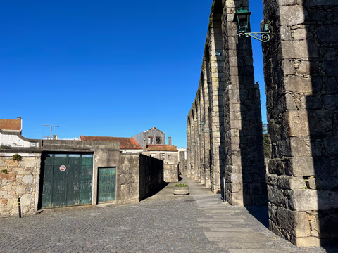
Aqueduct Trail – A path running along the Vila do Conde Aqueduct
From the Coastal Trail to the Camino Central: 12.9 km along the aqueduct from Vila do Conde to São Pedro de Rates. Route, stage, hostels, costs—explained honestly.
Read
