

Town on the Camino
Vila Praia de Âncora
Distrito de Viana do Castelo, Região do Norte, Portugal
- places to stay
- 18
- Caminos
- 2
- Elevation
- 17 m
Vila Praia de Âncora is a fishing and beach town at the mouth of the Âncora, and legend says the river takes its name from an anchor with which a king drowned his queen. A hundred metres off the trail lies a Neolithic dolmen, and by the harbour stands a fort. Caminha is only about nine kilometres away.
Right now in Vila Praia de Âncora (as of October 2026)
- No public albergue: In town you sleep in private hostels. Quinta da Quinhas above the town takes a winter break from mid-December to mid-February.
- Keep an eye on Caminha: According to Gronze, the municipal albergue in the next stage town is temporarily closed for maintenance. If you were planning to sleep there, call ahead or simply stay here.
How long to stay?
An afternoon is enough. The dolmen, the fort, the fishing harbour and the beach are close together, and there is little else to see. But the town is a good anchorage if the full stage from Viana do Castelo to Caminha, about 27 kilometres, is too long for you. You get an evening by the sea here, and the next morning only about nine flat kilometres to the border.
Vila Praia de Âncora in Ninja numbers
- About 179 kilometres to Santiago from here if you take the boat across to A Guarda and follow the coast. Via Valença and Tui it is about 160.
- 89,512 pilgrims reached Santiago on the Portuguese Coastal Way in 2025. Even so, this town has no public albergue.
- 100 metres off the trail lies a Neolithic grave. It has been a national monument since 1910.
- Since 1825 people have fished here. Before that, Gontinhães, as the place was then called, was a farming village. From the same year, many families from Galicia also settled here.
Arriving: across the Âncora and past the dolmen
From Viana do Castelo there are two routes of roughly the same length. The official one runs through the hinterland; it is fairly strenuous but has fine views. On the way you pass the former Benedictine monastery of São João de Cabanas and go through the village of Barreiros, with an old wash house and a wayside cross from 1779. Then you cross the Rio Âncora, the river of the legend, on a stone slab. Along Rua da Barrosa, past the school and the indoor pool and through an underpass beneath the N-13, you reach Praça da Revolução in the centre. After that you cross the railway and stand by the sea at the Forte da Lagarteira.
The coastal variant runs along beaches and boardwalks. It has no arrows, but you can hardly get lost: keep the sea on your left. It also ends at the fort.
In brief: from farming village to seaside vila
For centuries the place was called Gontinhães and lived from farming. Only from 1825 did fishing families arrive, along with many newcomers from Galicia, and the town grew towards the coast. In the nineteenth century bathers discovered the beach too, and with the halt on the Minho railway line from 1878 the name Praia d'Âncora spread. On 5 July 1924 Gontinhães was raised to the rank of vila and from then on was called Vila Praia de Âncora. With 4,623 inhabitants in 2021, it is today the largest town in the municipality of Caminha.
The anchor in the name
On the official route, shortly before town, you crossed a river named after a cruel story. According to legend, King Ramiro brought his queen back from the castle of a Moorish ruler in Gaia, tied her to an anchor and threw her into the water off the river mouth. Since then the river has been called Âncora, anchor. It is a legend, and it comes in several versions: in the medieval books of noble lineages where the story was first written down, it is not an anchor but a millstone. Some suspect anyway that the name is much older than the story. More on this in the long read below.
Along the sea: what to see
Everything important lies on the trail or a few steps away, between Rua da Barrosa and the harbour.
- Anta da Barrosa: The dolmen, also called Lapa dos Mouros, is a Neolithic grave and is considered the best-preserved funerary monument in the district of Viana do Castelo. Eight upright stones carry a capstone, and a passage about six metres long leads to the chamber. Serpentine lines and U-shaped marks are pecked into three of the slabs. It has been a national monument since 1910. It lies about 100 metres off the trail on Rua da Barrosa, with a shady rest area. For a pilgrim it is a good place for a break: people buried their dead here thousands of years before anyone walked to Santiago.
- Forte da Lagarteira: The small granite fort with four bastions and the Portuguese coat of arms above the gate stands on the right bank of the Âncora, next to the fishing harbour. It was built in the seventeenth century to protect the coast from Spanish attacks, in the period when Portugal had broken away from Spain again. Since 2017 it has been open to the public again, and the municipality uses it for concerts and exhibitions. We could not find opening hours. This is where the official route and the coastal variant meet again, and from here you continue along the sea tomorrow.
- The fishing harbour: Next to the fort lies the small harbour with its breakwater, the Portinho. The fish market sells what the boats land. More than 700 fishermen from the municipality of Caminha once sailed as far as Newfoundland to fish for cod.
- Capela de Nossa Senhora da Bonança: The neoclassical chapel with a bell tower and granite steps on Praça da República was built from 1890 on the remains of an eighteenth-century chapel. It is dedicated to Our Lady of Calm Seas, patroness of seafarers. We could not find opening or Mass times.
Food and drink
Here you eat what the harbour provides. The classic choice is grilled sardines with a glass of Vinho Verde. Usually in the second week of June the town celebrates the Festival of the Sea and the Sardine at the harbour. At lunchtime the cafés serve set menus that pilgrims praise for under €10.
Honestly
- There is no pilgrim albergue. In private hostels you pay €15 to €28 for a dorm bed. If you are budgeting for a public albergue, you should know this.
- The only albergue is up the hill. Quinta da Quinhas is lovely, but about 1.2 kilometres from the trail, and the way there is mostly uphill.
- The beach is no swimming pond. The beaches here are windy and the sea has a swell. Don't go swimming carelessly after a long day.
- The official route from Viana is no stroll. It runs through the hinterland with climbs and stony paths. If you prefer it easier, take the coast.
Where pilgrims sleep
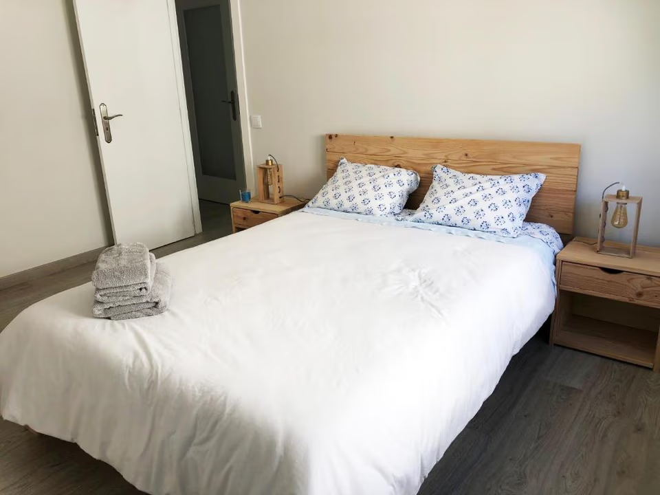
- Quinta da Quinhas: an albergue on a farm above the town, about 1.2 kilometres from the trail. Pilgrims praise the garden, the kitchen and the animals, donkeys among them. It is closed in winter (see box).
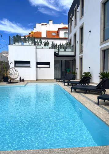
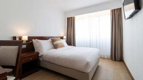
There is no public or church-run albergue. In the centre and on the beach promenade there are several private hostels with dorms for about €15 to €28, all bookable (as of October 2026). The newest opened in spring 2026.
Ninja tips
- Break at the dolmen: On Rua da Barrosa, turn off for the 100 metres to the Anta da Barrosa. There is shade and somewhere to sit, just before you reach town.
- The coast from Viana is unmarked but easy: Keep the sea on your left. By the Forte da Lagarteira at the latest you are back on the official route.
- Split the stage: Viana do Castelo to Caminha is about 27 kilometres. If you stay here, you walk about 18 today and only about 9 tomorrow.
- Plan your laundry: Not every hostel has a washing machine. Pilgrims report a laundromat in the centre, a few minutes from the hostels.
- Stay on the beach tomorrow: Shortly before Moledo the official route turns off under the railway and then runs monotonously beside a road. Better to carry straight on along Moledo beach and through the Mata do Camarido pine forest to the mouth of the Minho. It is only just over a kilometre longer.
- Sort out the boat today: If you want to cross from Caminha to A Guarda tomorrow, check the departure times this evening. From November to March the scheduled boat only runs early in the morning.
Practical tips for pilgrims
- Shopping: The town has supermarkets, cafés and restaurants. The stage to Caminha is short.
- Train: Vila Praia de Âncora has a stop on the Minho line between Viana do Castelo and Caminha.
- Stamps: Pilgrims report getting stamps at accommodation and eateries in town.
Onward: along the sea to the border
From the Forte da Lagarteira you walk on the flat along the sea and the railway, past the Capela de Santo Isidoro, to Moledo, 5 to 6 kilometres. To Caminha it is about 9 kilometres. There you decide: on the Senda Litoral you take the boat across to A Guarda, about 20 kilometres from here. On the Portuguese Coastal Way you walk upstream along the Minho to Valença.
What awaits you tomorrow
Most Camino Ninja pilgrims spend their next night in Caminha, the last town in Portugal at the mouth of the Minho. Through the clock tower, the last gate of the old town wall, you enter the old town. Across the water lies Galicia, from where many families came to Vila Praia de Âncora in the nineteenth century.
If you still have the energy and a boat is running, you can cross to A Guarda the same day and sleep in Spain, about 20 kilometres from here.
Deep dive: The river with the anchor
A long read, in case you want to learn more about Vila Praia de Âncora. About fifteen minutes' reading.
At the fort, where the routes meet
When you stand at the Forte da Lagarteira, you have a good spot for understanding this place. In front of you lies the Atlantic. Beside you lies the small fishing harbour with its breakwater. Nearby the Âncora flows into the sea and divides the long sandy beach in two. Here the two routes from Viana do Castelo meet, the one over the hills and the one along the coast. Whoever arrives here today, from either direction, has roughly eighteen kilometres behind them and about nine still ahead to the Spanish border.
Vila Praia de Âncora is not a big town, and it has no cathedral. But it has a Neolithic dolmen, a fort from the time when Portugal was fighting for its independence, a fishing community that only came into being two hundred years ago, and a legend so cruel you can hardly believe it. This text tells these stories, as far as they can be backed up.
A river called Anchor
Âncora is Portuguese for anchor. For a fishing town that is a fine name, and you might think seafarers had invented it. But the name belongs first to the river. The Âncora rises on the western slope of the Serra de Arga and after a short course flows into the Atlantic here. Already in Roman times gold and tin were extracted in its valley.
Where the name really comes from, nobody knows for sure. Some researchers suspect a very old Indo-European root connected with power, which also lies hidden in other place names in the Minho and in Galicia. If so, the name would be far older than any anchor. The town itself, by the way, long had a quite different name: Gontinhães. There are two explanations for that too: either the name goes back to a landowner called Guntinus, or to a Latin word, Quintilanes. Only in the twentieth century did the name under which you know the town today win out.
But the people here have never been content with a root from linguistics. They tell a story.
The queen in the river
The story is set in the tenth century, when Portugal did not yet exist. King Ramiro the Second of León, so one version goes, fell in love with the sister of a Moorish ruler named Alboazer, whose land stretched from Gaia to Santarém. Ramiro, however, was already married, to Queen Aldora. Alboazer refused; he would not give his sister to a Christian. Ramiro had an astrologer choose a favourable moment, abducted the princess and took her to León, where she was baptised.
Alboazer took revenge and abducted Ramiro's wife. Ramiro set out for Gaia with his son Ordonho and a few loyal men, disguised himself as a beggar and asked for water at a spring. Secretly he dropped half of a cameo into the vessel. The queen had the other half. She recognised the jewel, had the beggar brought to her and, in revenge for his unfaithfulness, handed him over to the Moorish king. Ramiro asked to be executed in public and so gained time to summon his son with a hunting horn. Ordonho stormed the castle, Alboazer fell, and Ramiro took his wife and her maids aboard his ship.
On the voyage home he tied a millstone around the queen's neck and threw her into the sea. The spot, so the tale goes, was afterwards called Foz de Âncora, mouth of the Âncora. Ramiro returned to León and married the baptised princess.
Millstone or anchor
This story appears in two medieval books of Portuguese noble lineages, the so-called Old Book from the late thirteenth century and the great book of lineages of Count Pedro of Barcelos from the fourteenth century. Among other things, it tells where the noble family of Maia came from. As an account of real events it is no use. The ancestor of this family, whom the legend makes Ramiro's son, had a quite different father according to present knowledge.
Here in the valley the story is told differently. In a version that the folklorist Álvaro Campelo published in 2002 in his collection of legends from the Minho valley, the queen is called Urraca. She herself falls in love with the Moorish nobleman Alboazar and flees with him to Gaia. Ramiro fetches her back by night and sails with her to Gontinhães, that is, to exactly this place. When he finds her weeping, she reproaches him for having killed Alboazar, who had been much better than he was. So he ties her to an anchor and throws her into the sea. And since that day the river has been called Âncora.
So which is true, millstone or anchor? Even the Portuguese reference work Infopédia cannot agree: in one article it attributes the anchor to Count Pedro, in the other the millstone. Honestly, the question is the wrong one. A millstone does not explain the name of a river, an anchor does. It is quite possible that the people on the Âncora kept retelling the old noble story until it fitted their river. The poet Almeida Garrett rewrote the story once more in 1844. In his version the queen is called Gaia, and the king beheads her before throwing her body into the river. Every age has made its own version. So when you walked across the stone slab over the Âncora, you crossed a river whose name carries a story that probably never happened and yet has been told for more than seven hundred years.
A grave from the New Stone Age
Long before anyone told tales of kings, people buried their dead here. The Anta da Barrosa, popularly also called Lapa dos Mouros, the Cave of the Moors, is a Neolithic dolmen. Sources differ on exactly when it was built: some say at the end of the fourth millennium before Christ, others in the third. Either way it is several thousand years older than anything else you see in this town.
Its design is typical of the passage graves of the northwest of the Iberian Peninsula, among which the archaeologist Vera Leisner counted it. Eight upright stone slabs form a polygonal chamber, and on top lies a large capstone. A passage about one and a half metres wide and six metres long leads inside. Originally the whole thing was hidden under an earth mound, of which nothing can be seen today. On three slabs the builders hammered marks into the stone, serpentine lines and shapes like a U. What they meant, we do not know.
The dolmen was excavated in 1879 by Francisco Martins Sarmento, one of the pioneers of Portuguese archaeology. In the middle of the twentieth century João de Castro Nunes examined it again. Later work also found traces from Roman times in the surroundings. So the place was visited again and again. As early as 1910 the anta was declared a national monument. It is considered the best-preserved funerary monument in the district of Viana do Castelo and the largest known megalith there.
For a long time it stood on private land, behind high walls. Only in 2016 did the municipality of Caminha settle a legal dispute over the plot, paying 240,000 euros in compensation. After that, plans were made to redesign the surroundings, with native trees instead of an old skate track. The idea came from the municipality's first participatory budget. A museum centre for megalithic culture has also been applied for, but whether it will ever be built was last unclear. Today the dolmen is a rest stop for pilgrims, a hundred metres off the trail.
The town on the hill
South of the town, on a hill 187 metres high above the mouth of the Âncora, lie the remains of another ancient settlement, the Cividade de Âncora. It is a castro, a fortified Iron Age settlement of the kind that existed by the hundreds in the northwest of the peninsula. Three rings of walls protected round and oval stone houses, often grouped around a small courtyard with a cistern. The hill may have been settled as early as the seventh century before Christ; the settlement was at its largest in the second and first centuries before Christ, and it lasted into Roman times. Together with smaller neighbouring places it controlled access to tin and gold in the mountains of Santa Luzia and Arga.
Its exploration has a little story of its own. Martins Sarmento visited the hill around 1880, but the archaeologist Abel Viana later made clear that he did not dig there. In 1959 a team from Oxford came under the archaeologist Hawkes, and in 1960 an international work camp of the students of Coimbra followed. They found a round house in whose centre an upturned Roman column base served as the footing for the roof post. Someone had recycled a piece of Rome. In the 1980s Armando Coelho Ferreira da Silva carried out the most extensive excavations. In 2018 the heritage authority opened proceedings to place the Cividade under protection.
A farming village called Gontinhães
For many centuries Gontinhães, as the town was called, was a village of farmers in the fertile valley between the Serra de Arga, the river and the sea. The parish was dedicated to Saint Marina, Santa Marinha, and still is today. In 1828 there were 208 households, 180 of them inhabited, with an average of almost five people in each.
The historian Aurora Botão Rego studied the lives of these families between 1828 and 1919, and she found something remarkable. The men were often away, working as builders or emigrated, to Brazil among other places. At home, the women held everything together. A good six out of ten wills in the village were made by women, and inheritance went preferably to daughters. After the wedding, in more than half the cases the couple lived in the house of the wife's family, not the other way round. More than one woman in three never married, and between 1900 and 1919 almost one in two. Rego speaks of a society with a matriarchal tendency. When you walk through the lanes, you walk through a place that for generations was carried above all by women.
Fishermen and neighbours from Galicia
And the sea? Until 1825, according to Rego, there was no fishing as a livelihood in Gontinhães. Then the first fishing families arrived, and at the same time many new residents came from the other side of the Minho, from Galicia. Whether the first fishermen were themselves Galicians, our sources do not say. The border on the river had never really separated the people of the two banks. Boats for fishing and trade had always gone back and forth, and Galicians lived in many border villages on the Portuguese side. In Gontinhães their settlement led to an extraordinary growth in population. Rego sees this as a major reason why the place was raised to the rank of vila a century later.
So began the move to the sea. From the second quarter of the nineteenth century, life shifted from the fields in the valley to the coast, to the boats and soon to the bathers as well. Under the Estado Novo, the dictatorship of the twentieth century, a separate fishermen's quarter was built. And many men sailed much further out: more than 700 fishermen from the municipality of Caminha fished for cod off Newfoundland. In 2015 an exhibition in the fort was dedicated to them.
Today the small harbour, the Portinho, is still in use. The fish market sells what the boats land. In 2022 a photographer captured in a photobook how the catch travels from the boat owner's vessel and his crew to the fishmonger and her sister in the market hall. He calls the town a fishing village full of traditions. When you walk into Galicia tomorrow, you walk into the homeland of many of the families who made this town grow.
Cannons against Castile
The Forte da Lagarteira, also called Forte de Âncora, tells of another side of the border. In 1640 Portugal broke away from Spain again after sixty years under Spanish kings, and almost three decades of war followed, until 1668. To protect the coast from Spanish attacks a chain of fortifications was built, to which this fort belongs, modelled on other fortresses in the Alto Minho. Exactly when is not entirely clear. Probably during the war, according to another view only around 1690 under King Pedro the Second.
The fort is small but complete: four bastions, a gun battery, battlements and little watchtowers at the corners. Above the gate is the coat of arms of Portugal. Inside lies a small square with three buildings, from which ramps lead up to the wall walk. Further south, the Forte do Cão was a second fort in this chain.
In 1939 the fort passed to the navy. Later it was stabilised and placed under heritage protection, although a decree in 1967 at first mistakenly located it in Viana do Castelo, until the error was corrected a few weeks later. Mostly it stood closed and unused. Only now and then were there events, a concert in 2014, a fado evening in 2015. In 2017 the navy and the municipality concluded an agreement, and from 1 June 2017 the fort was to be open again to the people of the town, with panels on its history. Today it is open to the public, and the municipality uses it for cultural events. Where cannons were once aimed at Spain, pilgrims heading for Spain now meet.
Railway, bathers and a new name
In the nineteenth century a new kind of visitor arrived: bathers. Alongside fishing, seaside tourism brought life to the coast. The regional newspapers wrote sometimes Gontinhães, sometimes Praia d'Âncora. In 1878 a halt opened on the railway line along the Minho, and with it the name Praia d'Âncora became known throughout the country.
The authorities stuck with the old name for a while; the censuses from 1864 to 1930 record Gontinhães. But on 5 July 1924 the place was raised by law to the rank of vila and from then on was officially called Vila Praia de Âncora. In 2024 the town celebrated a hundred years as a vila with a collection of essays. It remembers the doctor Luís Ramos Pereira, who cared especially for the poor, including during the Spanish flu, and a Senator Ramos Pereira, who stood for republican, democratic and secular values.
A chapel for the seafarers
A fishing town needs a saint for its fishermen. In Vila Praia de Âncora that is Nossa Senhora da Bonança, Our Lady of Calm Seas, patroness of seafarers. Her chapel on Praça da República was built from 1890 in neoclassical style, with a bell tower and granite steps, on the site of an older chapel from the eighteenth century. Bonança means calm weather at sea. On the way to Moledo tomorrow you will pass a second, small chapel, the Capela de Santo Isidoro on the coastal path.
Pilgrims on the coast
The coastal route to Santiago is not the oldest of the Portuguese ways. According to current knowledge it only became significant from the fifteenth century, used by people who lived on the coast or had come ashore in one of the ports. We have found no traces of medieval pilgrims in Vila Praia de Âncora, neither a hospital nor a figure of Saint James.
Today's pilgrims, on the other hand, you see everywhere. In 2025, 89,512 people reached Santiago on the Portuguese Coastal Way. Even so, the town has no public albergue. Pilgrims sleep in private hostels on the beach promenade and in the centre, and a new one opened in spring 2026. Many simply walk on to Caminha. Those who stay get an evening by the sea, with no cathedral and no compulsory sightseeing.
A town that likes to lean back
With 4,623 inhabitants in 2021, Vila Praia de Âncora is today the largest town in the municipality of Caminha. The number of people over sixty-five has risen since 2001 from 767 to 1,231. The town has grown older. In summer, families fill the beach promenade. The town's best-known son is the singer Quim Barreiros, born in 1947, a star of popular pimba music.
In June the town celebrates the Festival of the Sea and the Sardine at the harbour, with grilled sardines and Vinho Verde.
What Vila Praia de Âncora gives you
Perhaps the most beautiful thing about this place is its name. An anchor is what holds a ship in place when it does not want to, or cannot, sail on. It is not a destination but a pause. For many pilgrims, Vila Praia de Âncora is exactly that: a place where you tie up for one night before crossing the border.
Today you crossed a river named after a cruel legend, and you passed a grave that people built more than four thousand years ago. You are sleeping in a town that fishermen and newcomers from Galicia made grow and that women held together for generations. Tomorrow you walk in the direction many of them came from.
In the evening, walk back to the fort once more. Look at the sea that Our Lady of Calm Seas is meant to soothe, and at the small boats in the harbour. Then go to sleep. The anchor holds until morning.
Where to stay in Vila Praia de Âncora
The places pilgrims rate highest in Vila Praia de Âncora come first.
- Top #1
 OpenReservations accepted
Bombarda 51
- Top #2
 OpenReservations accepted
Guest House Pereira
- Top #3
 OpenReservations accepted
Quinta da Quinhas



Services in Vila Praia de Âncora
What you can find in town before the next stage.
- ATM
- Café
- Shop
- Medical clinic
- Pharmacy
- Fountain
- Train station
- Restaurant
Source: © OpenStreetMap contributors · updated April 2026
Town 13 of 31