

Caminho Central Via Atlântico
The detour to the sea in southern Portugal: 136 kilometres from Castro Verde through the steppe of the Campo Branco and the cork-oak montado to the coast at Porto Covo and Sines, then up to Santiago do Cacém. Seven stages, hardly any pilgrims, no albergues, but Portugal's founding myth at the start and a castle of the Order of Santiago at the finish.
- 01At a glance
- 02Overview
- 03Other names
- 04Who it's for – and who it isn't
- 05Route & landscape
- 06Stages, terrain & difficulty
- 07Two 25ths of July: a route between two feasts of St James
- 08Highlights along the way
- 09How pilgrims get onto this route
- 10Walking on?
- 11Preparation & practicalities
- 12What the route costs
- 13Getting there
At a glance
- Start / finish: Castro Verde / Santiago do Cacém
- Length: 136.0 km
- Duration: 7 stages, 15.8 to 26.6 km
- Elevation: ↗ 1,175 m / ↘ 1,195 m
- Lowest / highest point: about 1 m on the coast before Porto Covo (km 91.7) / 254 m in the Campo Branco beyond Castro Verde (km 9.9)
- Landscape: the open grain steppe of the Campo Branco, cork-oak montado and pastures around Ourique and Colos, the hills around Cercal, cliffs and beaches between the Ilha do Pessegueiro, Porto Covo and Sines
- Waymarking: yellow shell on a blue background and yellow arrows, in places on Rota Vicentina posts; only marked in the direction Castro Verde → Santiago do Cacém
- Accommodation: no pilgrim albergues; guesthouses, hostels and country houses, reliably only in Castro Verde, Porto Covo, Sines and Santiago do Cacém
- Connecting routes: the Camino de Faro in Castro Verde and Santiago do Cacém; sections of the Rota Vicentina between Cercal and Sines
- Managed by: Turismo do Alentejo e Ribatejo
- Best time: March to May, October and November
Overview
If you walk the Caminho de Faro north from the Algarve, you won't see the sea again until Lisbon. The Via Atlântico changes that. In Castro Verde it turns west, crosses the steppe of the Campo Branco and the cork-oak woods around Ourique and Colos, and reaches the Atlantic at the Ilha do Pessegueiro. Via Porto Covo and Sines it then climbs to Santiago do Cacém, where after 136 kilometres it rejoins the Caminho de Faro. The direct route between the two towns is 96.6 kilometres. So the Via Atlântico is a detour of around 40 kilometres, and a deliberate one.
The Alentejo e Ribatejo tourism region opened it on 12 December 2023 in the Basílica Real of Castro Verde; the municipality of Ourique had set the first waymarker stone a year earlier. It belongs to the network of Caminhos de Santiago in the Alentejo and Ribatejo, which according to the region covers around 1,400 kilometres. At the launch, the route was described as one meant to bring together "muitos dos quilómetros da malha dos Caminhos de Santiago". For you that means a week with almost no other pilgrims, with the sea as the destination rather than the backdrop.
Other names
Officially the route is called the Caminho Central Via Atlântico, because it is a variant of the Caminho Português Central, to which the Caminho de Faro also belongs. At the opening, the region and the press mostly spoke of the Caminho de Santiago Via Atlântico or simply the Via Atlântico; in English it is the Central Way via Atlantic. Then there is a nickname that says more about it than all the others: "Finisterra Alentejana", the Finisterre of the Alentejo. The colloquium held in Porto Covo for the opening bore the title "Caminho de Santiago – Via Atlântico ‚A Finisterra' do Alentejo".
Who it's for – and who it isn't
The Via Atlântico is ideal for you if, on your way through southern Portugal, you want to reach the sea for once. In a week you walk from the steppe around Castro Verde, where great bustards fly over the fields, to the cliffs of Porto Covo and Sines. It suits you if you like silence, enjoy planning for yourself and appreciate history along the way: Portugal's founding myth in Castro Verde, a 2,200-year-old sanctuary in Garvão, Vasco da Gama's birthplace in Sines and a castle of the Order of Santiago at the finish. The stages are mostly flat, the elevation gain modest.
To be honest, though, it's not for you if you expect albergues, a pilgrim community or a shop every few kilometres. You'll hardly meet other pilgrims, there are no pilgrim albergues, and beds are scarce between Castro Verde and Porto Covo. In summer the interior gets very hot and shadeless. The route is only waymarked in one direction, and if you're short on time, you're better off staying on the Caminho de Faro.
Route & landscape
The route starts in Castro Verde at the Basílica Real and leaves the Caminho de Faro heading west after about two kilometres. Then the Campo Branco opens up, a wide, almost treeless landscape of grain fields and pasture that has been a UNESCO Biosphere Reserve since 2017. Already at km 9.9 you reach the highest point at 254 metres, then continue via Grandaços to Ourique. After that it gets greener: through cork-oak montado and pastures you pass Chada Nova to Garvão, go past Funcheira station to Santa Luzia and, just off the route, Vale de Santiago, then on to Colos.
The longest stage leads through small hamlets such as Aldeia do Cano and Marmeleiro into the hill country around Cercal do Alentejo. From there you follow the Caminho Histórico of the Rota Vicentina to the coast, which you reach almost at sea level at the Ilha do Pessegueiro. Via Porto Covo and along the Fishermen's Trail past the beaches of São Torpes you come to Sines and its harbour. The final stage turns inland: via Ribeira de Moinhos and Relvas Verdes up to Santiago do Cacém, where the castle stands above the town.
Stages, terrain & difficulty
The Via Atlântico has seven stages, most of them between 16 and 18 kilometres. Two are longer: Colos–Cercal at 26.6 and Sines–Santiago do Cacém at 25.4 kilometres. You walk mainly on farm and service tracks, and on the coast on sandy paths that are more tiring over time than the elevation figures suggest. Nowhere does it get steep; the only longer climb comes right at the end, up to Santiago do Cacém. Distances and elevation come from the Camino Ninja map, calibrated exactly to 136.0 km.
- Castro Verde → Ourique (16.5 km) — Through the steppe of the Campo Branco and over the highest point (254 m), ↗ 116 m / ↘ 157 m.
- Ourique → Garvão (16.5 km) — Via Chada Nova through pastures and montado, ↗ 82 m / ↘ 175 m; only a few beds in Garvão.
- Garvão → Colos (17.2 km) — Past Funcheira station and via Santa Luzia, ↗ 207 m / ↘ 167 m; only country houses around Colos.
- Colos → Cercal do Alentejo (26.6 km) — The longest stage, through small hamlets with no reliable supplies, ↗ 263 m / ↘ 259 m.
- Cercal do Alentejo → Porto Covo (18.0 km) — On the Caminho Histórico to the sea at the Ilha do Pessegueiro, ↗ 151 m / ↘ 281 m.
- Porto Covo → Sines (15.8 km) — The coastal stage on the Fishermen's Trail, ↗ 49 m / ↘ 71 m.
- Sines → Santiago do Cacém (25.4 km) — Back inland and finally up to the castle, ↗ 307 m / ↘ 85 m.
Two 25ths of July: a route between two feasts of St James
The start and the finish of this route hang on the same date. In Castro Verde, the Basílica Real commemorates the Battle of Ourique, which tradition dates to 25 July 1139: Afonso Henriques defeated the Moorish armies and then became king, and the five defeated Moorish kings found their way into Portugal's coat of arms as five shields. The miracle with which legend embellishes the battle first appears in a chronicle from 1419, and nobody knows exactly where the fighting took place. Castro Verde still celebrates the day every year with a Mass in front of the basilica, and in the church's choir a cycle of azulejos tells the story of Santiago.
The second story awaits at the finish. Under the Moors, Santiago do Cacém was simply called Kassen. Legend has it that Princess Vataça Lascaris defeated the Moorish governor on a 25th of July, hence "Santiago de Kassen". What is documented is that in 1217 the town passed to the knights of the Order of Santiago, who built the parish church against the castle wall and set the fighting apostle in stone above the faithful. Vataça did later hold the castle, and in Sines around 1320 she founded the church of Nossa Senhora das Salas. After his voyage to India, Vasco da Gama had it rebuilt three times as large. Yet he was not allowed to keep his home town: the king had promised it to him, but the Order of Santiago, which owned Sines, prevailed and Gama had to leave. On this route, the Order of St James is not a chapter of history, it is the landlord.
Highlights along the way
- Castro Verde: the Basílica Real of 1718, whose walls are covered with azulejos of the Battle of Ourique, with a tile cycle on Santiago in the choir.
- Campo Branco: great bustards, little bustards and lesser kestrels in the steppe of the Castro Verde Biosphere Reserve, best in spring.
- Garvão: the Cerro do Castelo, where in 1982 the digging of a trench uncovered a sanctuary from the 3rd century BC, with votive eye plaques of gold and silver. Ten kilometres on lies Santa Luzia, the village of the saint who looks after the eyes.
- Funcheira: a small railway station right on the route, where trains between Lisbon and the Algarve stop.
- Ilha do Pessegueiro: the island 300 metres off the coast with Roman fish-salting tanks and a fortress begun in 1590 that was never quite finished.
- Porto Covo: the white fishing village around the Largo Marquês de Pombal with its late-18th-century church.
- Sines: the castle where Vasco da Gama was probably born around 1470, now a museum, and the church of Nossa Senhora das Salas.
- Santiago do Cacém: the castle of the Order of Santiago, the parish church of Santiago with its relief of the fighting apostle and, a kilometre outside town, the Roman city of Miróbriga with its baths and hippodrome.
How pilgrims get onto this route
Most come via the Camino de Faro, which leads from the Algarve via Almodôvar to Castro Verde. That's where the Via Atlântico branches off, so at the end of the stage from Almodôvar you decide whether to take the direct route north or the detour to the sea. If you only want to walk this one week, start directly in Castro Verde or join at Funcheira station.
Walking on?
The Via Atlântico ends in Santiago do Cacém, but the way to Santiago de Compostela doesn't. Here it flows back into the Camino de Faro, which runs through the Alentejo to Santarém on the Tagus. From there you continue north on the Camino Portugués Central. From Santiago do Cacém to Santiago de Compostela it's around 760 kilometres on these routes.
Preparation & practicalities
Download the track to your phone before you set off. The yellow arrows and the yellow shell on a blue background only point from Castro Verde to Santiago do Cacém; if you walk the other way, you depend on the track. Between Cercal and Sines the route shares its posts with the Rota Vicentina, so pay attention at junctions to which sign you're following. Since there are no pilgrim albergues, book every night in advance, especially in Ourique, Garvão, Colos and Cercal. For the stage from Colos to Cercal, carry water and food for the whole day.
As on all Portuguese routes, you need a pilgrim passport (credencial) to collect your stamps and receive the Compostela in Santiago de Compostela at the end. It's best to order it online in advance. You can get stamps at tourist offices, churches and cafés along the way.
Avoid high summer: in Beja, not far from Castro Verde, the average daily maximum in July is 33.5 degrees, on an average of twelve July days it exceeds 35 degrees, and there is hardly any shade in the Campo Branco. The route is at its most beautiful from March to May, when the steppe is green and the bustards are displaying, and in October and November. The easiest way to plan your stages and the few places to stay is in the Camino Ninja App.
What the route costs
There are no pilgrim prices on the Via Atlântico. In Porto Covo a bed in a hostel dorm costs from around €22 to €26 (as of November 2026); otherwise you sleep in guesthouses, B&Bs and country houses at normal room rates, considerably more on the coast in season. Plan for a higher daily budget than on the Portuguese routes from Porto. You'll find restaurants and shops mainly in Castro Verde, Ourique, Cercal, Porto Covo, Sines and Santiago do Cacém.
Getting there
The easiest way to reach Castro Verde is by bus from Lisbon; the journey takes just under three hours. By train you reach the route at Funcheira, which lies right on the route beyond Garvão and is just under two hours from Lisbon on the Intercidades. If you want to start at the very beginning, take a taxi from there to Castro Verde, about 30 kilometres.
Getting back from Santiago do Cacém is easy: buses to Lisbon run several times a day, and the journey takes about two hours. Sines also has direct buses to Lisbon.
- Outbound: bus Lisbon–Castro Verde (Rede Expressos) or train Lisbon–Funcheira (CP)
- Return: bus Santiago do Cacém–Lisbon
- Walking on: from Santiago do Cacém north on the Camino de Faro
Partners
Partner for Caminho Central Via Atlântico
Camino Ninja is cooperating with official partners. For this camino the partner is:

Popular towns on the Caminho Central Via Atlântico
Picked by our team, in walking order.
- Castro VerdeCastro Verde is where Portugal celebrates St James's Day: the Battle of Ourique on 25 July 1139 is seen as the birth of the kingdom, and in the Basílica Real azulejos tell the story of it and of the apostle's life. All around lies the Campo Branco, wide, shadeless and home to the great bustard.Read the town guide
- OuriqueOurique gave its name to Portugal's most famous battle, yet nobody knows whether the fighting really happened here on 25 July 1139. The town itself is small: a hill with a view over the Campo de Ourique, a castle of which almost nothing is left, and a reputation as the capital of the Alentejo pig.Read the town guide
- GarvãoIn 1982, construction workers in Garvão stumbled on a sanctuary from the 3rd century BC: hundreds of vessels, a skull and thin plaques of gold and silver stamped with eyes, offerings to a deity who helped people see. All that's left to see in the village is the hill, but ten kilometres on, Santa Luzia is waiting for you.Read the town guide
- ColosColos is the last breather before the longest stage of the Via Atlântico: a quiet village among cork oaks and pastures, once the seat of its own municipality, with the cross of the Order of Santiago on its coat of arms. There is no pilgrim bed in the village, and tomorrow 26.3 kilometres to Cercal lie ahead of you.Read the town guide
- Cercal do AlentejoAfter the longest stage, Cercal do Alentejo welcomes you with a legend about thirst: at the Bica Santa, Mary is said to have fetched water from a stone for shepherd children. In the parish church an old St James waits at the high altar, and tomorrow you walk to the sea on the Caminho Histórico.Read the town guide
- Porto CovoIn Porto Covo you stand beside the Atlantic for the first time, after 94.7 kilometres of Alentejo. The village was laid out in the late 18th century on the drawing board of a merchant who had grown rich in Lisbon; in 1780 it had four houses. Out in front lies the Ilha do Pessegueiro with its fortress. An afternoon is enough, but do give it the afternoon.Read the town guide

Get your pilgrim credential and shell
Everything you need for the Caminho Central Via Atlântico, shipped to your door.
Visit Camino Shop
Other Caminos
Ansbacher Jakobsweg
Ansbacher Jakobsweg
From Weihenzell via Ansbach, Feuchtwangen, Dinkelsbühl, Ellwangen and the Ostalb to Ulm and Oberdischingen: 9 stages, monasteries, imperial cities and the watershed between the Kocher and the Brenz.
ReadAppenzeller Weg
Appenzeller Weg
52.6 km from Rankweil across the Rhine to St. Peterzell: St. James Chapel (1464), 163 Years of the Wedding Trail, connection to the Via Jacobi. Stages, costs, how to get there.
Read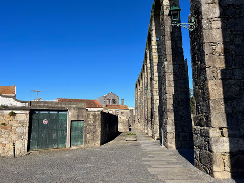
Aqueduct Trail – A path running along the Vila do Conde Aqueduct
From the Coastal Trail to the Camino Central: 12.9 km along the aqueduct from Vila do Conde to São Pedro de Rates. Route, stage, hostels, costs—explained honestly.
Read
