

Caminho Leon de Rosmithal
A young Camino through the backcountry of northern Portugal: 261.2 kilometres from the Spanish border on the Douro near Freixo de Espada à Cinta across the uplands of Trás-os-Montes and the serra to Braga. It follows the route the Bohemian knight Jaroslav Lev of Rožmitál took on his way to Santiago in 1466. Lonely, hilly, hardly any pilgrim hostels.
- 01At a glance
- 02Overview
- 03Other names
- 04Who it's ideal for – and who it isn't
- 05Route & landscape
- 06Stages, terrain & difficulty
- 07A chronicle for a guidebook
- 08Highlights along the way
- 09How pilgrims reach this route
- 10Continuing on?
- 11Preparation & practicalities
- 12What the route will cost you
- 13Getting there
At a glance
- Start / finish: Ponte Almirante Sarmento Rodrigues over the Douro, on the side of the municipality of Freixo de Espada à Cinta, near the Spanish border / Braga
- Length: 261.2 km
- Duration: 12 stages, 13.1 to 31.3 km
- Elevation: ↗ 6,059 m / ↘ 6,001 m
- Lowest / highest point: 112 m in the Vilariça valley (km 59.9) / 1,057 m between Alfarela de Jales and Parada de Aguiar (km 148.3)
- Landscape: steep slopes of the Douro, almond and olive groves, the wide Vilariça valley, uplands and heath of the serra, chestnut and oak woods in the Tâmega valley, the green Minho
- Waymarking: yellow arrows and scallop shells, information boards, steles with QR codes at the municipal boundaries; finished in only a few municipalities so far, planned in all of them by March/April 2027 (as of November 2026); until then GPS track essential
- Accommodation: only one pilgrim hostel along the way, the municipal hostel in Parada de Aguiar (donation-based), with another announced in Abreiro; at the finish the pilgrim hostel in Braga; otherwise guesthouses and country houses in the district towns
- Connecting routes: in Braga the Camino Torres towards Ponte de Lima and Santiago, plus Porto–Braga and the Caminho da Geira e dos Arrieiros; at Parada de Aguiar the Camino Portugués Interior crosses the route
- Best time: March to June, September and October
Overview
In the summer of 1466 a travelling party from Bohemia crossed the Douro by boat: 40 companions, 52 horses, and at their head Jaroslav Lev of Rožmitál, brother-in-law of the Bohemian king. They had been on the road since November 1465, had put Germany, Flanders, England, France and Spain behind them, and were heading for the Apostle's tomb in Santiago. Two of the companions kept records, and because their accounts name the places the party passed through, you can still walk the route today: from the border at Freixo de Espada à Cinta via Torre de Moncorvo, Abreiro and Vila Pouca de Aguiar to Braga, where King Afonso V entertained his guests for eight days.
Out of that came a Camino that has only existed since 2024. Twelve municipalities between the Douro and the Minho launched it together, the waymarking is going up right now, and the certification process is due to start in mid-2027. For you that means 261.2 kilometres through one of the loneliest corners of Portugal, with granite villages, Manueline churches, medieval bridges and almost 6,000 metres of climbing. You'll barely meet other pilgrims, and hardly ever a pilgrim hostel.
Other names
The official name is Caminho Português de Santiago de Leon de Rosmithal, often without the "de": Caminho Português de Santiago Leon de Rosmithal. In English: Portuguese Way of Saint James Leon de Rosmithal. "Leon de Rosmithal" is the Portuguese form, going back to the Latin chronicle. The man's name was Jaroslav Lev z Rožmitálu; "Lev", the lion, is the family name, and in Portugal it turned into the first name Leon. Don't confuse him with his son Zdeněk Lev of Rožmitál, who later became Supreme Burgrave of Bohemia.
Who it's ideal for – and who it isn't
The Caminho Leon de Rosmithal is ideal for you if you already know one of the big Portuguese routes and are now looking for the opposite: silence, wide open space and a Portugal that hardly any tourist sees. It suits you if you like to plan for yourself, enjoy a climb and love history along the way, from the castle tower in Freixo to the castle of Lanhoso, where Portugal's first king locked up his own mother.
Honestly, though, it's not for you if you expect a network of hostels, unbroken arrows or company. As of November 2026 the route is only partly waymarked, there is only one pilgrim hostel along the way, in Parada de Aguiar (hostels in Abreiro and Póvoa de Lanhoso are due to open in 2027), and between the district towns lie villages without a shop. The stage over the serra is long and high, and in summer the Douro valley gets very hot. Don't set off without a GPS track and rooms booked in advance.
Route & landscape
The route starts down on the Douro on the Ponte Almirante Sarmento Rodrigues, to be precise on its half in the municipality of Freixo de Espada à Cinta, near the Spanish border. Right away you climb steeply out of the river valley, via Poiares to Freixo de Espada à Cinta. Then you walk across the upland to Mós with its medieval paved path and down to Torre de Moncorvo. Beyond it lies the lowest point of the route in the fertile Vilariça valley; via Horta da Vilariça and Nabo you climb to Vila Flor, the town of olive oil, and on via Samões and Freixiel down to the Tua at Abreiro.
From Murça on it gets rougher. Via Pópulo and Carva you reach Alfarela de Jales in the old gold-mining area and shortly afterwards the high point at 1,057 metres. Via Parada de Aguiar, Soutelo de Aguiar and the mountain village of Gouvães da Serra it's a long descent to Cerva and into the Tâmega valley. At the Ponte de Cavez you cross the river, pass through Arco de Baúlhe to Cabeceiras de Basto and continue via Cumieira and Bucos to Guilhofrei. The last stretch is green and more densely settled: via Travassos and Fonte Arcada to Póvoa de Lanhoso and via Gualtar into the old town of Braga.
Stages, terrain & difficulty
The distances come from the Camino Ninja map and add up to 261.2 km in total; we calculated the elevation gain from the heights of the map points. The stages end in places where you're most likely to find a bed; where there isn't one, we say so. The municipalities themselves divide the route into twelve sections with some different stage towns, such as Carvalhal instead of Torre de Moncorvo or the Castelo de Aguiar instead of Parada de Aguiar.
- Ponte Almirante Sarmento Rodrigues → Freixo de Espada à Cinta (19.7 km) — Steeply out of the Douro valley onto the upland, ↗ 618 m / ↘ 293 m.
- Freixo de Espada à Cinta → Torre de Moncorvo (31.3 km) — Longest stage, via Mós and its paved path, ↗ 726 m / ↘ 789 m.
- Torre de Moncorvo → Vila Flor (24.7 km) — Through the Vilariça valley to the lowest point and back up again, ↗ 582 m / ↘ 435 m.
- Vila Flor → Abreiro (21.5 km) — Via Samões and Freixiel down to the Tua, ↗ 553 m / ↘ 794 m; the hostel in Abreiro is due to open in early 2027.
- Abreiro → Murça (20.0 km) — From the Tua bridge to the small town with the Porca, ↗ 517 m / ↘ 334 m.
- Murça → Alfarela de Jales (23.0 km) — Via Pópulo up onto the upland, ↗ 737 m / ↘ 392 m; accommodation in Alfarela unconfirmed.
- Alfarela de Jales → Parada de Aguiar (13.1 km) — Short, but over the high point (1,057 m), ↗ 271 m / ↘ 383 m; in Parada de Aguiar the only pilgrim hostel along the way, donation-based.
- Parada de Aguiar → Cerva (29.9 km) — Mountain stage via Gouvães da Serra, almost no supplies, ↗ 513 m / ↘ 920 m.
- Cerva → Cabeceiras de Basto (24.3 km) — Via the Ponte de Cavez and Arco de Baúlhe, ↗ 566 m / ↘ 587 m.
- Cabeceiras de Basto → Guilhofrei (20.6 km) — Via Cumieira and Bucos into the Minho, ↗ 470 m / ↘ 390 m; rooms in a hostel and country houses by the Ermal reservoir.
- Guilhofrei → Póvoa de Lanhoso (16.9 km) — Via Travassos and Fonte Arcada, ↗ 220 m / ↘ 405 m; a hostel is due to open in Póvoa de Lanhoso by the end of April 2027.
- Póvoa de Lanhoso → Braga (16.2 km) — Via Gualtar into the old town, ↗ 285 m / ↘ 278 m.
A chronicle for a guidebook
Hardly any Camino can be traced back so precisely to a single journey. King George of Poděbrady, a Hussite in poor standing with the Pope, sent his Catholic brother-in-law on a tour of Europe in 1465: he was to win support for Bohemia at the royal courts, and at the end of the journey lay the Apostle's tomb. Two men wrote down what they saw: the knight Václav Šašek of Bířkov in Czech and the Nuremberg patrician Gabriel Tetzel in German. Šašek's original is lost; what survives is a Latin translation printed in Olomouc in 1577. It is the source of the odd place names researchers in Portugal have worked with: "Alebra" is Abreiro, "Villa Panca" Vila Pouca de Aguiar, "Barcodevonde" Arco de Baúlhe.
The road behind it is far older than the journey. The Bohemians rode along a link between Trás-os-Montes and the Minho that goes back to Roman roads, among them the routes to the gold mines of Tresminas and Jales. In the 18th century it was called the Estrada Real; later, parts of it became national roads 103, 205 and 206. On the Tâmega the riders crossed a "puente de piedra", a stone bridge – very probably the Ponte de Cavez, which you still walk over today. In Braga King Afonso V received the delegation, had them entertained for eight days and gave the baron two horses. Then they moved on via Ponte de Lima and Valença to Tui. By April 1467 they were back home, after some 8,600 kilometres, as the municipalities reckon today.
Highlights along the way
- Freixo de Espada à Cinta: the seven-sided castle tower Torre do Galo and the Manueline hall church with 16 panel paintings from the 16th century, a national monument since 1910.
- Mós: a stretch of medieval paved road, the remains of the castle, the pillory (pelourinho), the old town hall and jail (Casa da Câmara e Cadeia) and a Romanesque fountain.
- Torre de Moncorvo: the Renaissance church of Nossa Senhora da Assunção, a basilica since 2022, the amêndoa coberta (the town's sugar-coated almond), the iron ore of the Serra do Reboredo, and the castle with its medieval walls.
- Vila Flor: named by King Dinis in 1286 after its beautiful landscape, today a centre of olive oil.
- Abreiro: the bridge over the Tua; the place Šašek describes in detail.
- Murça: the Porca de Murça, a pre-Roman granite wild boar, and the Manueline pillory. You can get a stamp at the Turismo.
- Alfarela de Jales: a municipality in its own right until 1853, namesake of the Jales gold mine, which produced gold until 1992.
- Ponte de Cavez: 13th-century bridge over the Tâmega, a national monument; legend has it that its builder lies buried beneath it.
- Arco de Baúlhe: the railway museum at the terminus of the Tâmega line, with King Carlos I's saloon car.
- Cabeceiras de Basto: the Benedictine monastery of São Miguel de Refojos with its Baroque dome, now the town hall.
- Fonte Arcada: the Romanesque church where the twelve municipalities founded the route in 2024; the Maria da Fonte uprising began here in 1846.
- Póvoa de Lanhoso: the castle of Lanhoso, where Afonso Henriques imprisoned his mother Teresa in 1128.
- Braga: the cathedral, where the municipalities' stage-by-stage pilgrimage ends with a Mass in April 2027, and the sanctuary of Bom Jesus do Monte.
How pilgrims reach this route
The route begins at the Spanish border, and that's exactly how Rožmitál arrived: from Salamanca via Hinojosa de Duero to the Douro. If you're coming from Spain, you join right at the border on the Douro. The Camino Ninja map doesn't yet have a feeder route from Salamanca to the Douro. The Camino Torres also starts in Salamanca, but it crosses the border further south and follows its own line to Braga. You can join midway at Parada de Aguiar, where the Camino Portugués Interior from Vila Real to Chaves crosses the route.
Most people come by train and taxi to the Douro at the border, or straight to Freixo de Espada à Cinta, and start walking there. If you'd like to walk the route in stages, you can join the pilgrimage organised by the municipality of Póvoa de Lanhoso, which walks one stage on a Saturday each month from April 2026 to April 2027, with a bus from Póvoa de Lanhoso.
Continuing on?
Braga isn't the end of the pilgrimage but the hand-over. On the Camino Ninja map you carry on along the Camino Torres: 36.1 kilometres from Braga to Ponte de Lima, then onto the Camino Portugués Central and 155.8 kilometres via Valença and Tui to Santiago. That's exactly the direction Rožmitál took in 1466. All told, it's 453.2 kilometres from the Douro to the cathedral in Santiago.
For the Compostela only the final stretch counts anyway: the kilometres from Braga are well over the required 100. Braga is also the start of the Caminho da Geira e dos Arrieiros, which follows the Roman Geira over the Serra do Gerês to Santiago.
Preparation & practicalities
Load the track onto your phone before you set off. So far there are yellow arrows, shells and information boards in Freixo de Espada à Cinta, Mirandela, Ribeira de Pena and Póvoa de Lanhoso; in the other municipalities the waymarking is due to be in place by March/April 2027 (as of November 2026). You can get a stamp at the Turismo in Murça, for example. Since for now there's only one pilgrim hostel before Braga, in Parada de Aguiar (Abreiro and Póvoa de Lanhoso follow in 2027), book the other nights in advance; even in the district towns the choice is small.
Plan the mountain stage from Parada de Aguiar to Cerva with water and food for the whole day: over 30 kilometres there are only small villages, and Gouvães da Serra has barely a hundred inhabitants. In high summer you're better off avoiding the first stages in the Douro valley; in winter it can get cold and foggy up in the serra at over 1,000 metres. The route is at its most beautiful in spring, when the almond trees blossom around Freixo de Espada à Cinta and Torre de Moncorvo, and in autumn.
What the route will cost you
There are hardly any pilgrim rates on this route: the municipal hostel in Parada de Aguiar takes a donation, and at the finish in Braga there's a pilgrim hostel. Otherwise you'll sleep in guesthouses, B&Bs and country houses, and we haven't found reliable 2026 prices for them. So budget for a double room in the countryside rather than a hostel bunk, and ask whether there's a pilgrim rate. You'll find shops and restaurants mainly in the district towns; in many of the villages in between there's a café at most.
Getting there
You can't reach the start on the Douro by train: the Douro line ends at Pocinho, the section to the border has been closed since 1988, and while there are studies on reopening it, there's no date (as of October 2026). From Pocinho you continue by taxi; we haven't found a reliable bus connection. From Spain, the start lies just across the border from La Fregeneda; the nearest larger destination is Salamanca.
Getting back from Braga is easy, by train to Porto and on to the airport.
- Getting there: train on the Douro line to Pocinho, then taxi to the start on the Douro or to Freixo de Espada à Cinta; via Spain, travel through Salamanca
- Getting back: train from Braga to Porto, Porto airport
- Continuing on: from Braga on the Camino Torres and the Camino Portugués Central to Santiago
Partners
Partner for Caminho Leon de Rosmithal
Camino Ninja is cooperating with official partners. For this camino the partner is:

Route guide for the Caminho Leon de Rosmithal
Stage-by-stage guide with the best places to stay.
Printable PDF · free with a Camino Ninja account
Popular towns on the Caminho Leon de Rosmithal
Picked by our team, in walking order.
- Freixo de Espada à CintaFreixo de Espada à Cinta is the first stage town of the Caminho Leon de Rosmithal, 19.7 kilometres after the start on the Douro at the Spanish border: a border town above the Douro with a seven-sided castle tower, a 16th-century hall church and carved granite windows. Here the Bohemian pilgrims entered Portugal in 1466.Read the town guide
- MósMós is the stop in the middle of the longest stage of the Caminho Leon de Rosmithal, 15.6 kilometres after Freixo de Espada à Cinta. A village granted a charter in 1162, with remains of an oval schist castle, and a pillory and church in front of the castle gate. Nowhere to sleep, ideal for a break.Read the town guide
- Torre de MoncorvoTorre de Moncorvo is the town of iron and almonds on the Caminho Leon de Rosmithal: 51.0 kilometres beyond the Douro, with a Renaissance church that looks far too big for a place of 2,600 people and a museum about the iron ore of the Serra do Reboredo. After the longest stage of the route, a good place to rest.Read the town guide
- Vila FlorVila Flor is the town King Dinis named in 1286 for its beautiful setting: a place of olives above the Vilariça valley, 75.7 kilometres beyond the start on the Douro on the Caminho Leon de Rosmithal. One gate of the medieval ring wall survives, along with an idiosyncratic museum. A quiet place for the evening after the climb out of the valley.Read the town guide
- AbreiroAbreiro is the village at the bridge over the Tua: once a vila of its own with a charter from 1225, today a quiet place with a pillory and granite houses. In the summer of 1466 the Bohemian knight after whom the Caminho Leon de Rosmithal is named passed through here. A hostel is due to open in early 2027; until then there is none.Read the town guide
- MurçaMurça is the small town of the Porca: in the middle of town stands a granite wild boar from pre-Roman times, the town's landmark, which also lends its name to local wines. Add a Manueline pillory, the Misericórdia chapel of 1692 and a stamp at the Turismo. An afternoon is enough for all of it.Read the town guide

Get your pilgrim credential and shell
Everything you need for the Caminho Leon de Rosmithal, shipped to your door.
Visit Camino Shop
Other Caminos
Ansbacher Jakobsweg
Ansbacher Jakobsweg
From Weihenzell via Ansbach, Feuchtwangen, Dinkelsbühl, Ellwangen and the Ostalb to Ulm and Oberdischingen: 9 stages, monasteries, imperial cities and the watershed between the Kocher and the Brenz.
ReadAppenzeller Weg
Appenzeller Weg
52.6 km from Rankweil across the Rhine to St. Peterzell: St. James Chapel (1464), 163 Years of the Wedding Trail, connection to the Via Jacobi. Stages, costs, how to get there.
Read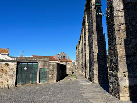
Aqueduct Trail – A path running along the Vila do Conde Aqueduct
From the Coastal Trail to the Camino Central: 12.9 km along the aqueduct from Vila do Conde to São Pedro de Rates. Route, stage, hostels, costs—explained honestly.
Read
